Old Maps of Harmon, North Dakota for Hiking & Exploration
Hike through history with 12 historic maps of Harmon. Explore old trails, ghost towns, and forgotten backroads — perfect for outdoor adventurers and local explorers.
- Rediscover forgotten places: Map out old mining camps, roads, and footpaths that no longer exist on modern maps.
- Layer with modern tools: Combine with LiDAR or satellite views to plan hikes through historical terrain.
- Made for exploration: Popular among hikers, overlanders, and local history lovers.
Use these maps to find adventure and explore the hidden past of Harmon.
Harmon, ND maps
(12)- 1907 Map of Bismarck
 1907 Bismarck1907 Print · USGSThe Missouri River corridor at the turn of the century shows North Dakota's capital and rail hubs in their formative years. Researchers can trace early land divisions and transport routes like the Fort Yates Stage Road and landmarks such as Fort Lincoln or St Anthony.2 unique versions available
 - 1951 Map of Bismarck
 1951 Bismarck1951 Print · USGSBismarck and Mandan sit at the heart of the Missouri River valley at mid-century, just as the post-war era began to reshape the North Dakota capital. Genealogists and local historians can trace legacy landmarks like St Marys Cem, the Great Plains Experiment Station, and numerous rural schoolhouses such as Sunny Sch.
 - 1954 Map of Bismarck, 1967 Print
 1954 Bismarck1967 Print · USGSBismarck and the Missouri River basin are shown in the mid-1960s as the Oahe Reservoir reshaped the valley. Genealogists can trace family-named landmarks like Dog Tooth Buttes and small prairie settlements such as Fort Yates, Selfridge, and Brisbane.2 unique versions available
 - 1958 Map of Bismarck
 1958 Bismarck1958 Print · USGSCentral North Dakota in the late fifties is defined by the Missouri River and the sprawling Standing Rock Indian Reservation. Genealogists and historians can trace rail-line outposts like Sedalia Siding or explore local landmarks like Saint Anthony and Fort Lincoln State Park/Museum.
 - 1962 Map of Harmon, 1964 Print
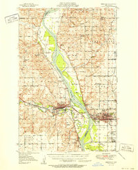
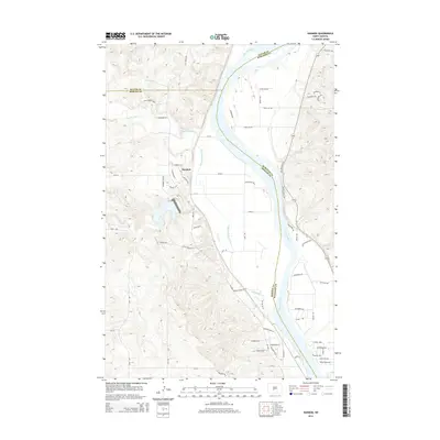
 1962 Harmon1964 Print · USGSThe Missouri River valley north of Bismarck comes alive in the early sixties, showing a landscape of riverside settlements and active rail lines. Genealogists and historians can trace the Northern Pacific tracks through Harmon or locate Square Butte School No 1 and the Double Ditch Indian Village.2 unique versions available
 - 1976 Map of Harmon, 1977 Print
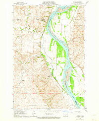
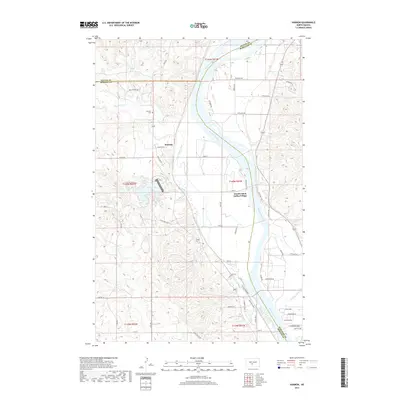
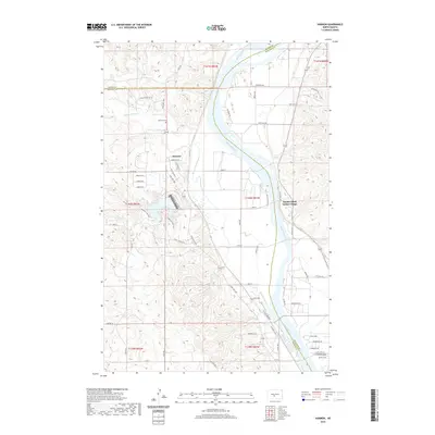
 1976 Harmon1977 Print · USGSThe Missouri River valley north of Bismarck reveals a landscape of ancient settlements and early rail corridors in the mid-seventies. Trace the historic Double Ditch Indian Village and find remote rural landmarks like Square Butte School No 1 and Harmon.
 - 1979 Map of Bismarck, 1980 Print
 1979 Bismarck1980 Print · USGSBismarck and Mandan sit at the heart of this late-century North Dakota survey, where the Missouri River flows past historic frontier outposts. Trace the old Soo Line rail corridors or locate family landmarks near St Anthony, Fort Rice, and Custer Flats.
 - 2011 Map of Harmon, 2011 Print
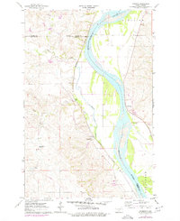
 2011 Harmon2011 Print · USGSCovers Harmon, including Double Ditch Indian Village, Burleigh County, and other nearby areas
 - 2014 Map of Harmon, 2014 Print
 2014 Harmon2014 Print · USGSCovers Harmon, including Double Ditch Indian Village, Burleigh County, and other nearby areas
 - 2017 Map of Harmon, 2017 Print
 2017 Harmon2017 Print · USGSCovers Harmon, including Double Ditch Indian Village, Burleigh County, and other nearby areas
 - 2020 Map of Harmon, 2020 Print
 2020 Harmon2020 Print · USGSCovers Harmon, including Double Ditch Indian Village, Burleigh County, and other nearby areas
 - 2024 Map of Harmon, 2024 Print
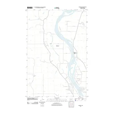
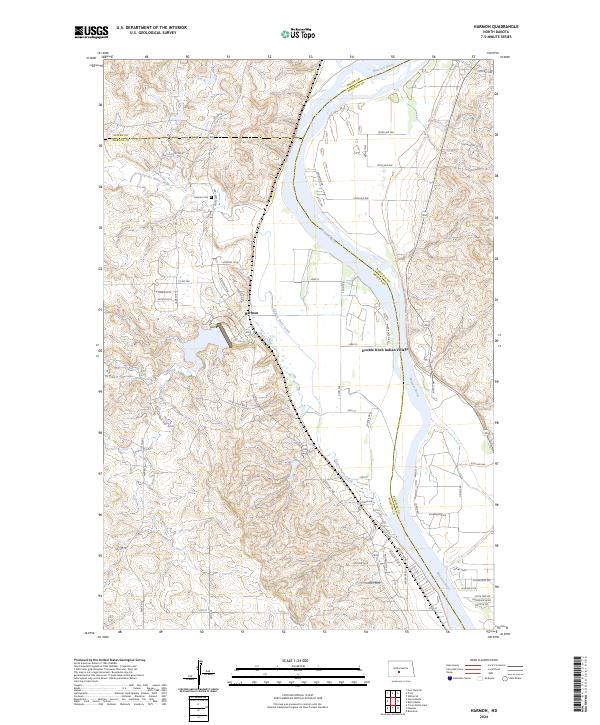 2024 Harmon2024 Print · USGSModern-day Morton and Burleigh Counties meet along the Missouri River in this recent survey. Researchers can trace the layout of the Harmon settlement and locate significant sites like the Double Ditch Indian Village and Harmon Cem.
End of results
Showing maps 1-12 of 12
Top cities near Harmon
Frequently asked questions
- What are the different types of historical maps available for Harmon?
- What is the oldest map of Harmon?
- Where can I purchase historical maps of Harmon for my home or office?
- Where can I download high-res historical maps of Harmon?
- Are there historical topographic maps available for Harmon?
- Is there historical aerial imagery available for Harmon?
- Where are historical maps of Harmon sourced from?