Old Maps of Sargent County, North Dakota for Genealogy
Trace your family roots with 195 historic maps of Sargent County. These high-res maps reveal old neighborhoods, homesites, landmarks, and streets — helping you uncover where your ancestors lived and how the area evolved over time.
- Explore historic neighborhoods: Identify where your relatives may have lived in the 1800s or 1900s.
- Compare maps over time: Trace the changes in streets, buildings, and landmarks for multi-generational research.
- Perfect for genealogy & ancestry research: Used by family historians and researchers to map out lineage and migration.
These maps are an incredible resource for exploring your personal connection to Sargent County's past.
Sargent County, ND maps
(195)- 1894 Map of Hecla
 1894 Hecla1894 Print · USGSThe northern Dakota plains are captured here in the 1890s as the rail and river determined the pulse of new settlements. Genealogists and historians can trace the early township grids and rail stops like Hecla, Houghton, and the frontier hamlet of Detroit.4 unique versions available
 - 1894 Map of Oakes
 1894 Oakes1894 Print · USGSSoutheast North Dakota at the close of the nineteenth century is revealed as a burgeoning rail hub centered on the James River Valley. Genealogists can locate early homesteading era settlements like Port Emma, Glover, and the bustling junction at Oakes.2 unique versions available
 - 1895 Map of Lamoure
 1895 Lamoure1895 Print · USGSSoutheastern North Dakota was a landscape of rapid rail expansion and river-based settlement in the mid-1890s. Genealogists and historians can trace the early foundations of towns like Lamoure, Oakes, and Grand Rapids along the winding James River.2 unique versions available
 - 1896 Map of Columbia
 1896 Columbia1896 Print · USGSSettlement along the upper James River valley flourished in the 1890s as railroads expanded through the Dakota Territory. Trace the rail-fed growth of Columbia and Hecla alongside the waters of Sand Lake and Lake Columbia.3 unique versions available
 - 1907 Map of Wyndmere
 1907 Wyndmere1907 Print · USGSRichland and Sargent counties are seen here in the early 1900s during the height of the prairie railroad boom. Genealogists and historians can trace the paths of five different rail lines serving early towns like Milnor, Wyndmere, and Sandoun Mc Leod P O.2 unique versions available
 - 1918 Map of La Moure
 1918 La Moure1918 Print · USGSSoutheastern North Dakota was a thriving rail and agricultural hub during the early twentieth century, as seen in this detailed 1918 survey. Researchers can trace the development of the James River corridor and locate early settlements like Grand Rapids, Oakes, and Port Emma.2 unique versions available
 - 1952 Map of Oakes, 1954 Print
 1952 Oakes1954 Print · USGSIn the early fifties, this Dickey County hub sat at a critical rail junction. Trace the path of three major railroads through Oakes, locate local landmarks like Oakes View Cemetery, and identify rural prairie infrastructure including School No 4 and various flowing wells.
 - 1952 Map of Crete, 1954 Print
 1952 Crete1954 Print · USGSSargent County prairie life in the early fifties was centered on remote rail stops and township schoolhouses. Researchers can trace family ties to Emmanuel Ch and locate rural landmarks like Crete, Hample, and the distinct waters of Bruns Slough.2 unique versions available
 - 1953 Map of Jamestown
 1953 Jamestown1953 Print · USGSSoutheastern North Dakota was a thriving rail and agricultural corridor in the early fifties, anchored by the James River. Researchers can trace the footprints of institutional landmarks like the North Dakota State Hospital and historic sites such as Whitestone Hill Battlefield Park.3 unique versions available
 - 1953 Map of Kidder, 1955 Print
 1953 Kidder1955 Print · USGSKidder and the surrounding townships sat at a critical railroad juncture in the early fifties along the North Dakota and South Dakota border. Genealogists and local historians can trace the foundations of this prairie community through landmarks like Pleasant Valley Ch and Holy Sepulcher Cem.2 unique versions available
 - 1953 Map of Newark, 1955 Print
 1953 Newark1955 Print · USGSThe North Dakota and South Dakota borderlands come alive in this mid-century survey of the Newark vicinity. Genealogists and local historians can trace the tracks of the Milwaukee Road past the Chadwick Sch and Brampton Cem.2 unique versions available
 - 1953 Map of Milbank, 1958 Print
 1953 Milbank1958 Print · USGSThe tri-state border region of South Dakota, North Dakota, and Minnesota is shown here during the early fifties, a landscape defined by glacial lakes and the Sisseton Indian Reservation. Researchers can trace the legacy of the western railroads, locating old stops along the Great Northern and settlements like Milbank, Webster, and Sisseton.3 unique versions available
 - 1953 Map of Fargo, 1965 Print
 1953 Fargo1965 Print · USGSThe Red River Valley in the mid-fifties was a bustling rail and agricultural corridor during a period of steady prairie growth. Genealogists and historians can trace the intricate rail networks of the Great Northern and Soo Line connecting local hubs like Casselton and Wahpeton.2 unique versions available
 - 1954 Map of Aberdeen, 1964 Print
 1954 Aberdeen1964 Print · USGSNortheastern South Dakota in the mid-fifties remains a world of rail-dependent prairie towns and sweeping waterfowl refuges. Genealogists can trace family roots through settlements like Eureka and Ipswich or locate rural landmarks near Richmond Lake.2 unique versions available
 - 1955 Map of Oakes SE, 1956 Print
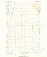 1955 Oakes SE1956 Print · USGSThe rail-driven landscape of Dickey County is captured in the mid-fifties, featuring the strategic junction at Ludden. Researchers can trace the paths of the Great Northern and Riverdale Sch alongside the winding James River.
 - 1956 Map of Fargo
 1956 Fargo1956 Print · USGSThe Red River Valley's agricultural heartland is documented here in the mid-fifties as the rail-and-road network expanded across the plains. Genealogists can trace family roots through numerous small railroad towns and local landmarks like Casselton, Sheyenne Valley Church, and Sisseton Indian Res.
 - 1956 Map of Aberdeen
 1956 Aberdeen1956 Print · USGSUpper South Dakota during the mid-fifties remains a landscape of rail-connected farming towns and expansive glacial lake basins. Genealogists and historians can trace the paths of the Minneapolis and St Louis railroad through Gettysburg or locate vanished stops near Elm Lake and Richmond Lake.
 - 1956 Map of Jamestown
 1956 Jamestown1956 Print · USGSThe James River valley and the vast alkali lake country of south-central North Dakota are captured here in the mid-fifties. Genealogists can trace family farms across several counties, locating small rail stops like Medberry and monuments like Whitestone Hill Battlefield Park.
 - 1956 Map of Straubville, 1957 Print
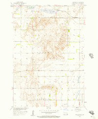 1956 Straubville1957 Print · USGSSargent County agriculture and rail transport intersect in the mid-1950s, centered on the village of Straubville. Researchers can trace old township schools like School No 2 and the paths of the Great Northern and Soo Line railroads.
 - 1956 Map of Havana, 1957 Print
 1956 Havana1957 Print · USGSHavana and the surrounding farm country are captured here in the mid-1950s, bridging the borderlands between North Dakota and South Dakota. Researchers can trace the Great Northern rail line and locate rural landmarks like School No 4 and Trondhjem Cem.
 - 1956 Map of Newark NW, 1957 Print
 1956 Newark NW1957 Print · USGSThe North Dakota and South Dakota borderlands remained a quiet agricultural frontier in the mid-fifties, dominated by isolated farmsteads and township grids. Genealogists can trace the shift in rural education through sites like School No 1 and several others marked School No 4 (Abandoned) or School No 2 (Abandoned).2 unique versions available
 - 1956 Map of Hecla NE, 1957 Print
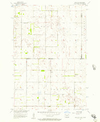 1956 Hecla NE1957 Print · USGSThe Dakota state line in the mid-1950s reveals a sprawling agricultural landscape defined by its rural school districts and township boundaries. Genealogists can trace family homesteads near landmarks like Eaton Sch No 2, Tiry Sch, and the Flowing Well.3 unique versions available
 - 1957 Map of Elliott SW, 1958 Print
 1957 Elliott SW1958 Print · USGSRansom and Sargent Counties are captured here in the late fifties, showcasing a prairie landscape defined by township grids and glacial sloughs. Genealogists can trace the locations of rural schoolhouses like Cleveland Sch and School No 2 or the drainage of Englevale Slough.
 - 1957 Map of Stirum, 1958 Print
 1957 Stirum1958 Print · USGSSargent County prairie life in the mid-fifties is captured here, centered on the rail-side settlement of Stirum. Genealogists can trace local roots through the locations of Township Cem, Harlem Cem, and two numbered country schools.
 - 1957 Map of Cogswell, 1958 Print
 1957 Cogswell1958 Print · USGSSargent County at the height of the post-war era shows a landscape defined by the prairie rail network and the winding Wild Rice River. Trace the old corridors of the Great Northern and find local history at Mt Calvary Cem or the Town Hall.
Showing maps 1-25 of 195
Top cities of Sargent County
- Gwinner historical maps
- Milnor historical maps
- Forman historical maps
- Rutland historical maps
- Cogswell historical maps
- Havana historical maps
See more
Frequently asked questions
- What are the different types of historical maps available for Sargent County?
- What is the oldest map of Sargent County?
- Where can I purchase historical maps of Sargent County for my home or office?
- Where can I download high-res historical maps of Sargent County?
- Are there historical topographic maps available for Sargent County?
- Is there historical aerial imagery available for Sargent County?
- Where are historical maps of Sargent County sourced from?