Old Maps of Wamsley, Ohio for Academic Research
Study the evolution of Wamsley with 12 high-resolution historic maps. Whether you're teaching, researching, or modeling changes in land use, these maps provide essential visual documentation of urban, environmental, and geographic change.
- Analyze long-term change: Track patterns in development, transportation, and natural features.
- Ideal for environmental or urban studies: Support academic projects with primary historical map data.
- Use in the classroom or lab: Educators and researchers rely on these maps to bring historical context to life.
These maps are a powerful tool for teaching, research, and visualizing how Wamsley has changed over the decades.
Wamsley, OH maps
(12)- 1916 Map of Peebles, 1962 Print
 1916 Peebles1962 Print · USGSIn the early twentieth century, the rural landscape of Adams County was defined by its winding creeks and a dense network of one-room schoolhouses. Researchers can trace the Norfolk and Western RR corridor through Peebles or find ancestral locations like Marble Furnace and Bacon Flat School.
 - 1918 Map of Peebles, 1941 Print
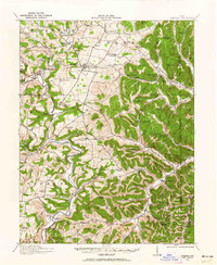
 1918 Peebles1941 Print · USGSIn the hills of southern Ohio during the Great War era, the landscape is a network of small schoolhouses and creek-side settlements. Genealogists can trace family footprints near Peebles or Locust Grove through dozens of sites like Marble Furnace and Mt Zion School.2 unique versions available
 - 1957 Map of Huntington, 1966 Print
 1957 Huntington1966 Print · USGSThe industrial heart of the Ohio River valley is captured here in the mid-sixties, showing the growth of Huntington and Ashland. Researchers can trace the extensive rail networks of the Chesapeake and Ohio RR and locate sites like the Chief Cornstalk Hunting Ground.3 unique versions available
 - 1960 Map of Huntington
 1960 Huntington1960 Print · USGSThe tri-state river valley thrived in the late fifties as a hub of heavy industry and Appalachian rail transit. Genealogists and historians can trace the connection between river towns like Ashland and Portsmouth or locate family homesteads near Coleman Ridge.
 - 1961 Map of Blue Creek, 1962 Print
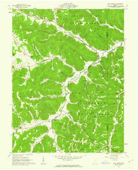 1961 Blue Creek1962 Print · USGSSouthern Ohio in the early sixties remains a landscape of remote mountain peaks and deep hollows within the Shawnee State Forest. Researchers can trace old family sites and rural landmarks like the Township High Sch, Copas Cem, and Jones Corner.3 unique versions available
 - 1986 Map of Maysville
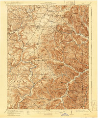
 1986 Maysville1986 Print · USGSThe Ohio River valley in the mid-eighties reveals a landscape of industrial river towns and sprawling public lands spanning the Kentucky and Ohio border. Researchers can trace the rail corridors of the Chesapeake and Ohio Railway or locate landmarks like Confidence Cemetery and the Fleming-Mason Airport.
 - 1991 Map of Maysville
 1991 Maysville1991 Print · USGSThe Ohio River valley at the turn of the nineties reveals a landscape of river-bend towns and dense forest preserves. Trace local history through landmark sites like Confidence Cemetery, the small-town streets of Ripley, and the river reaches of Manchester Island No 1.
 - 2010 Map of Blue Creek, 2010 Print
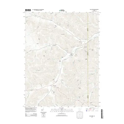
 2010 Blue Creek2010 Print · USGSCovers Wamsley, including Blue Creek, Scioto County, and other nearby areas
 - 2013 Map of Blue Creek, 2013 Print
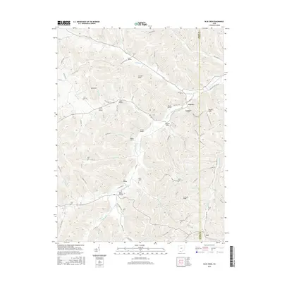
 2013 Blue Creek2013 Print · USGSCovers Wamsley, including Blue Creek, Scioto County, and other nearby areas
 - 2016 Map of Blue Creek, 2016 Print
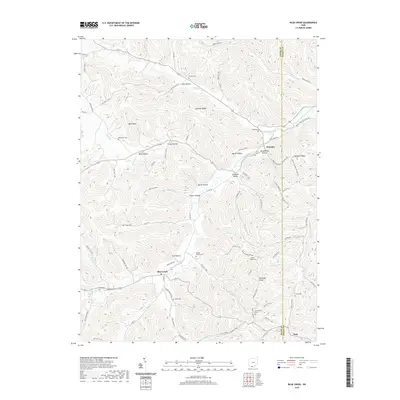
 2016 Blue Creek2016 Print · USGSCovers Wamsley, including Blue Creek, Scioto County, and other nearby areas
 - 2019 Map of Blue Creek, 2019 Print
 2019 Blue Creek2019 Print · USGSCovers Wamsley, including Blue Creek, Scioto County, and other nearby areas
 - 2023 Map of Blue Creek, 2023 Print
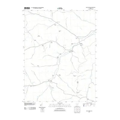
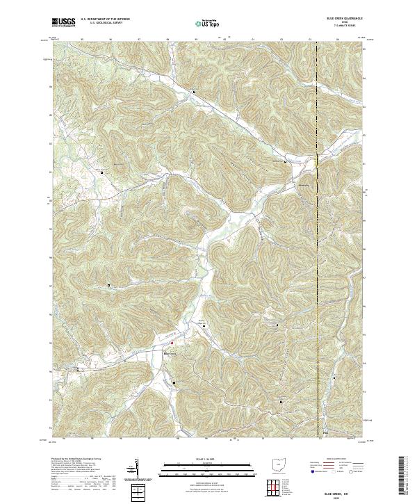 2023 Blue Creek2023 Print · USGSThe eastern hills of Adams County are shown here in the 2020s, highlighting a landscape of deep hollows and high ridges along the Scioto County line. Researchers can locate numerous local landmarks such as Moores Chapel Cem, Wamsley, and the headwaters of Turkey Creek.
End of results
Showing maps 1-12 of 12
Top cities near Wamsley
- Peebles historical maps
- Vanceburg historical maps
- Rarden historical maps
- Otway historical maps
- Concord historical maps
Frequently asked questions
- What are the different types of historical maps available for Wamsley?
- What is the oldest map of Wamsley?
- Where can I purchase historical maps of Wamsley for my home or office?
- Where can I download high-res historical maps of Wamsley?
- Are there historical topographic maps available for Wamsley?
- Is there historical aerial imagery available for Wamsley?
- Where are historical maps of Wamsley sourced from?