1940s Maps of Allen County, Ohio
Explore 3 historic maps of Allen County from the 1940s. These maps offer a rare glimpse into what life looked like during the 1940s — showing old roads, neighborhoods, homes, and landmarks that have changed or disappeared over time.
Whether you're researching your family's past, planning a metal detecting trip, or studying how Allen County's landscape evolved across the 1940s, these high-resolution maps are a powerful tool for exploring the history of this region.
- Focus on a specific era: All maps on this page are from the 1940s, giving you a focused view of this time period.
- See what’s changed: Compare century-old streets, trails, and buildings to today's modern landscape using overlays and satellite layers.
- Research with precision: Use these maps for genealogy, historical research, land use analysis, or educational projects.
- View, download, or print: Maps are fully viewable online in high resolution, and can be downloaded or printed for your own records.
Start exploring Allen County's history through authentic maps from the 1940s. This is your window into the past.
Allen County, OH maps
(3)- 1943 Map of Alger
 1943 Alger1943 Print · USGSDuring the early 1940s, this pocket of Ohio was a landscape of rail-fed villages and drainage ditches. Trace family roots across a grid of rural schools like Sugarfree Sch, follow the Erie RR through Alger, or explore the shores of Indian Lake.
 - 1944 Map of Delphos
 1944 Delphos1944 Print · USGSThe rail-and-river landscape of West-Central Ohio is captured here during the mid-forties, showing the intersection of three counties. Genealogists can locate family roots via dozen of named schools like Raabe Sch and churches such as Morris Chapel or the Mennonite Cem.
 - 1944 Map of Spencerville
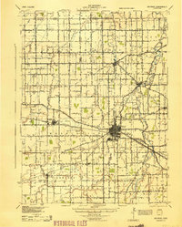
 1944 Spencerville1944 Print · USGSMid-century Western Ohio is shown here at the height of its rail and canal era. Genealogists can trace family roots through dozens of rural landmarks like Deep Cut Sch, Walnut Grove Church, and the Artesian Well at St Marys.
End of results
Showing maps 1-3 of 3
Top cities of Allen County
- Lima historical maps
- Fort Shawnee historical maps
- Spencerville historical maps
- Elida historical maps
- Cairo historical maps
- Harrod historical maps
See more
Frequently asked questions
- What are the different types of historical maps available for Allen County?
- What is the oldest map of Allen County?
- Where can I purchase historical maps of Allen County for my home or office?
- Where can I download high-res historical maps of Allen County?
- Are there historical topographic maps available for Allen County?
- Is there historical aerial imagery available for Allen County?
- Where are historical maps of Allen County sourced from?