2020s Maps of Kemp, Ohio
Explore 1 historic maps of Kemp from the 2020s. These maps offer a rare glimpse into what life looked like during the 2020s — showing old roads, neighborhoods, homes, and landmarks that have changed or disappeared over time.
Whether you're researching your family's past, planning a metal detecting trip, or studying how Kemp's landscape evolved across the 2020s, these high-resolution maps are a powerful tool for exploring the history of this region.
- Focus on a specific era: All maps on this page are from the 2020s, giving you a focused view of this time period.
- See what’s changed: Compare century-old streets, trails, and buildings to today's modern landscape using overlays and satellite layers.
- Research with precision: Use these maps for genealogy, historical research, land use analysis, or educational projects.
- View, download, or print: Maps are fully viewable online in high resolution, and can be downloaded or printed for your own records.
Start exploring Kemp's history through authentic maps from the 2020s. This is your window into the past.
Kemp, OH maps
(1)- 2023 Map of Cridersville, 2023 Print
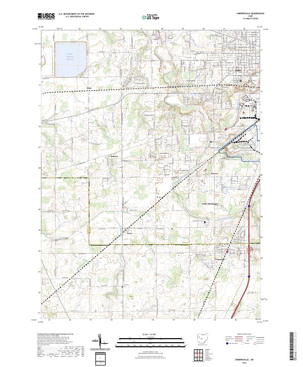 2023 Cridersville2023 Print · USGSModern-day Auglaize and Allen Counties are shown in meticulous detail as they appeared in 2023, documenting the communities south of Lima. Researchers can trace local lineage and land use through numerous sites like Saint Matthew Cem, Fort Shawnee, and the Bresler Upground Reservoir.
End of results
Showing maps 1-1 of 1
Top cities near Kemp
- Lima historical maps
- Wapakoneta historical maps
- Saint Marys historical maps
- Delphos historical maps
- Fort Shawnee historical maps
- Spencerville historical maps
See more
Frequently asked questions
- What are the different types of historical maps available for Kemp?
- What is the oldest map of Kemp?
- Where can I purchase historical maps of Kemp for my home or office?
- Where can I download high-res historical maps of Kemp?
- Are there historical topographic maps available for Kemp?
- Is there historical aerial imagery available for Kemp?
- Where are historical maps of Kemp sourced from?