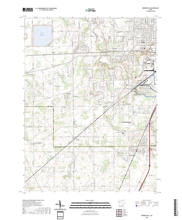
2023 Map of Cridersville
USGS Topo · Published 2023About this map
Cridersville and Fort Shawnee anchor this detailed study of the suburban and rural landscape south of Lima as it appeared in 2023. The terrain is defined by the winding course of the Ottawa River and the Little Ottawa River, alongside significant water management features like the Bresler Upground Reservoir and Witney Reservoir. The area maintains its historical roots through numerous burial grounds, including Saint Matthew Cem and the older Crawford Cem near the southern edge of the survey.
Find a feature on this map
171 named features on this map. Tap any name to fly to it.
Don’t see what you’re looking for? This feature index may not catch every label — zoom into the map to look around manually.
Map Details
Editions of this 2023 Cridersville Map
This is the sole edition of this map. No revisions or reprints were ever made.
Other maps of this area

1906 · Lima
USGS Topo · 1:62,500

1906 · Columbus Grove
USGS Topo · 1:62,500

1908 · Columbus Grove
USGS Topo · 1:62,500

1911 · Spencerville
USGS Topo · 1:62,500

1911 · Delphos
USGS Topo · 1:62,500

1944 · Delphos
USGS Topo · 1:62,500

1944 · Spencerville
USGS Topo · 1:62,500

1953 · Muncie
USGS Topo · 1:250,000

1956 · Muncie
USGS Topo · 1:250,000
1960 · Delphos
USGS Topo · 1:24,000