Old Maps of Ashland County, Ohio for Genealogy
Trace your family roots with 104 historic maps of Ashland County. These high-res maps reveal old neighborhoods, homesites, landmarks, and streets — helping you uncover where your ancestors lived and how the area evolved over time.
- Explore historic neighborhoods: Identify where your relatives may have lived in the 1800s or 1900s.
- Compare maps over time: Trace the changes in streets, buildings, and landmarks for multi-generational research.
- Perfect for genealogy & ancestry research: Used by family historians and researchers to map out lineage and migration.
These maps are an incredible resource for exploring your personal connection to Ashland County's past.
Ashland County, OH maps
(104)- 1904 Map of Wellington, 1958 Print
 1904 Wellington1958 Print · USGSNorth-central Ohio at the turn of the century is a network of growing rail towns and agricultural townships. Genealogists can trace family roots through settlements like Wellington, Homerville, and Lodi, while following the paths of the Wheeling and Lake Erie RR and Salt Creek.
 - 1906 Map of Wellington, 1942 Print
 1906 Wellington1942 Print · USGSNorth-central Ohio at the opening of the twentieth century was a landscape of thriving rail-junction towns and fertile creek bottoms. Genealogists and historians can trace the early footprints of Wellington, Sullivan, and Lodi as they were connected by the Baltimore and Ohio and several electric rail lines.
 - 1906 Map of West Salem, 1961 Print
 1906 West Salem1961 Print · USGSIn the early 1900s, this area of Northern Ohio was a web of small rail-side settlements and rural townships. Genealogists and historians can trace old homesteads and local landmarks like the Eight Square Ch, the village of Jeromesville, and the Mohicanville Reservoir.
 - 1908 Map of Ashland
 1908 Ashland1908 Print · USGSAshland and its surrounding townships are captured in 1908 at the height of the steam and electric rail era. Researchers can trace the path of the Erie Electric line or locate family-named landmarks like Anderson School and Dickey Church.4 unique versions available
 - 1908 Map of West Salem, 1946 Print
 1908 West Salem1946 Print · USGSNorth Central Ohio's rural landscape is captured here in the early twentieth century, showing the transition from early surveying reserves to a rail-connected farm economy. Researchers can locate early township centers and rail stops like Polk, Congress, and Eight Square Ch.
 - 1908 Map of New London, 1948 Print
 1908 New London1948 Print · USGSNorth-central Ohio at the turn of the century was a landscape of thriving rail junctions and rural school districts. Genealogists can trace family roots through numerous local landmarks like Barlams Store, Todd School, and the busy junction at New London.
 - 1912 Map of Loudonville, 1958 Print
 1912 Loudonville1958 Print · USGSBefore modern highways rearranged rural Ohio, this area thrived as a network of rail-side towns and country schoolhouses. Genealogists can trace family footprints at Germany School, the Greenville Treaty Line, and the village of Shreve.
 - 1912 Map of Perrysville, 1959 Print
 1912 Perrysville1959 Print · USGSRichland and Ashland counties were thriving agricultural and rail hubs during this era of rural development. Genealogists and local historians can trace the specific locations of many vanished schools and landmarks, from Black Swamp School to the prominent Gatton Rock.
 - 1914 Map of Loudonville, 1944 Print
 1914 Loudonville1944 Print · USGSNorth-central Ohio is captured here in the years before the Great War, showing a dense network of hill-country farms and railroad towns. Genealogists can trace family roots through dozens of local landmarks like Germany School, Miley Crossroads, and the historic Greenville Treaty Line.
 - 1915 Map of Perrysville, 1944 Print
 1915 Perrysville1944 Print · USGSAshland and Richland counties are captured here just before the First World War, when the landscape was a patchwork of small school districts and river-bottom farms. Genealogists can locate family landmarks such as St James School, the Treaty 1795 Line, and the rural village of Newville.
 - 1943 Map of Loudonville
 1943 Loudonville1943 Print · USGSAshland and Holmes counties during the early years of the war show a landscape defined by the PENNSYLVANIA rail line and the Mohican River. Genealogists can locate dozens of country schools like Ball Alley Sch and settlements such as Nashville or Big Prairie.
 - 1944 Map of Perrysville
 1944 Perrysville1944 Print · USGSThe Mohican River valley in the mid-1940s reveals a transition from traditional milling to modern water management with the Pleasant Hill Reservoir. Genealogists can trace family footprints across dozens of country school sites like Knotty Oak Sch and the vanished crossroads of Black Swamp.
 - 1950 Map of Marion
 1950 Marion1950 Print · USGSCentral Ohio was a powerhouse of rail and river industry at the mid-century point, serving as a vital corridor between the Great Lakes and the Ohio River valley. Genealogists and rail historians can trace the paths of the Erie RR and Nickel Plate Road through towns like Bucyrus, Galion, and Upper Sandusky.
 - 1956 Map of Toledo, 1968 Print
 1956 Toledo1968 Print · USGSNorthwest Ohio and the Lake Erie shoreline are shown in detail during the late fifties, showcasing a landscape of heavy industry, railroads, and island communities. Genealogists and historians can trace rail networks like the Chesapeake & Ohio RR or locate landmarks such as the Erie Proving Ground and Kelleys Island.4 unique versions available
 - 1960 Map of New London, 1961 Print
 1960 New London1961 Print · USGSNew London and the surrounding farm country are captured here in the early sixties, showing a vital crossroads of major Midwestern rail lines. Local researchers can locate specific burial sites like Day Cem, the old Township Sch, and the path of the Vermilion River.4 unique versions available
 - 1960 Map of Nova, 1961 Print
 1960 Nova1961 Print · USGSAs the mid-century agricultural landscape of Ashland County remained firmly tied to the rails, the villages of Nova and Rochester thrived. Genealogists can trace family plots at Universalist Cem or Rochester Cem and follow the historic Orphanage Gore boundary.3 unique versions available
 - 1960 Map of Pavonia, 1962 Print
 1960 Pavonia1962 Print · USGSRichland and Ashland counties are captured during a period of mid-century suburban growth and water management. Genealogists can trace family names at Smeltzer Cem and Pittenger Cem or locate old landmarks like Pavonia and Windsor.3 unique versions available
 - 1960 Map of Olivesburg, 1962 Print
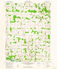 1960 Olivesburg1962 Print · USGSThe Richland and Ashland county borderlands in the early sixties reveal a settled agricultural landscape of crossroads hamlets and family farmsteads. Researchers can trace the layout of Adario, find the Amish Sch, and locate the Blooming Grove Cem.4 unique versions available
 - 1961 Map of Toledo
 1961 Toledo1961 Print · USGSThe western basin of Lake Erie and the industrial heart of Northern Ohio are captured here during the post-war era. Researchers can trace historical rail lines like the New York Central or locate landmarks like the Erie Ordnance Depot and Pelee Island.
 - 1961 Map of Greer, 1963 Print
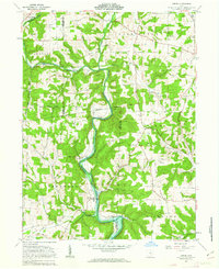 1961 Greer1963 Print · USGSHolmes County was a land of river valleys and treaty boundaries during the early sixties. Researchers can trace family history through sites like Ullman Cem, the settlement of Greer, and the historic Greenville Treaty Line.3 unique versions available
 - 1961 Map of Loudonville, 1963 Print
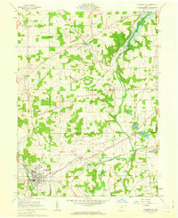 1961 Loudonville1963 Print · USGSIn the early sixties, the Mohican River valley around Loudonville remained a landscape of active rail transport and rural industry. Researchers can trace family sites at County Line Cem, the local impact of the Mohicanville Dam, and the early oil and gas fields near McZena.3 unique versions available
 - 1961 Map of Ashland South, 1963 Print
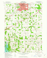 1961 Ashland South1963 Print · USGSThe city of Ashland and its southern environs are captured here in the early sixties as a center of education and industry. Researchers can trace family sites at the Ashland Cemetery, locate the old Hayesville-Vermillion Sch, or explore the shoreline of the Charles Mill Reservoir.4 unique versions available
 - 1961 Map of Jeromesville, 1963 Print
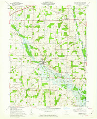 1961 Jeromesville1963 Print · USGSMid-century Ashland County comes into focus as the Erie Railroad winds through the river valleys of north-central Ohio. Genealogists and local historians can locate early burial sites like Old Rowsburg Cem, rural congregations at Trinity Ch, and the industrial footprint of numerous Oil Wells.2 unique versions available
 - 1961 Map of Sullivan, 1963 Print
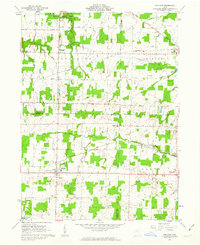 1961 Sullivan1963 Print · USGSThe rural borderlands of Ashland, Medina, and Lorain counties are captured here in the early sixties as small farming hamlets like Sullivan and Homerville thrived. Genealogists can trace family landmarks such as Hubler Cem and Gould Cem or locate early school sites like the Black River High Sch.3 unique versions available
 - 1961 Map of Perrysville, 1963 Print
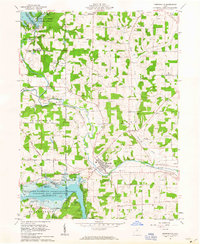 1961 Perrysville1963 Print · USGSAshland and Richland counties are captured here in the early sixties as industrial flood control and rural energy production shaped the valley. Genealogists and local historians can trace family plots at Green Lawn Cem or Shambaugh Cem and locate vanished landmarks like the Long Landing Strip and Widowville.3 unique versions available
Showing maps 1-25 of 104
Top cities of Ashland County
Frequently asked questions
- What are the different types of historical maps available for Ashland County?
- What is the oldest map of Ashland County?
- Where can I purchase historical maps of Ashland County for my home or office?
- Where can I download high-res historical maps of Ashland County?
- Are there historical topographic maps available for Ashland County?
- Is there historical aerial imagery available for Ashland County?
- Where are historical maps of Ashland County sourced from?