
Loading...
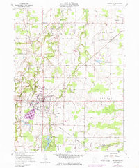
Loading map...1904 Map of Wellington
USGS Topo · Published 1958About this map
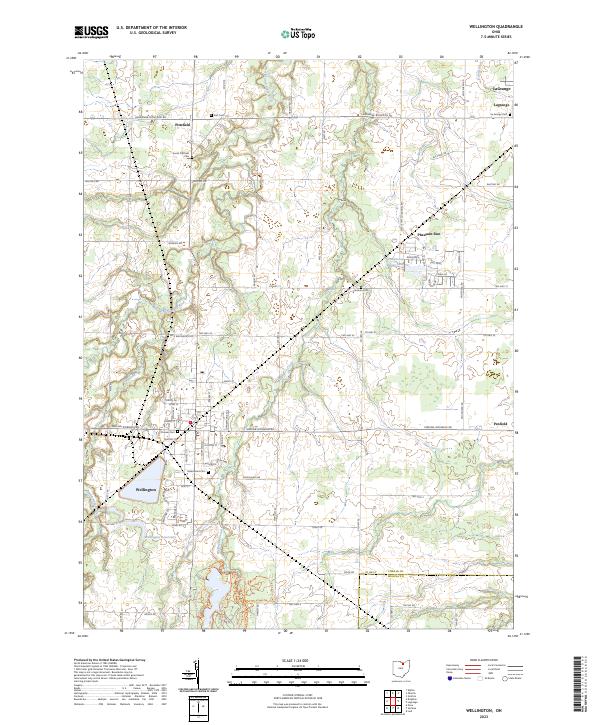
Wellington serves as a central hub in this early 20th-century landscape, defined by a dense intersection of rail lines including the Cleveland Cincinnati Chicago and St Louis RR and the Cleveland and Southwestern Electric RR. The map illustrates a rural economy transitioning through the arrival of several major transit corridors, such as the Wheeling and Lake Erie RR and the Baltimore and Ohio RR, which connected small agrarian centers like Spencer and Homerville.
Find a feature on this map
55 named features on this map. Tap any name to fly to it.
Don’t see what you’re looking for? This feature index may not catch every label — zoom into the map to look around manually.
Map Details
Date Portrayed1904
Date Published1958
PublisherU.S. Geological Survey
Map TypeTopographic
Scale1:62,500
Physical Dimensions17.1 x 20.8 inches
Editions of this 1904 Wellington Map
This is the sole edition of this map. No revisions or reprints were ever made.
Historical Maps of Wellington Through Time
8 maps found

Featured Locations
Source Details
SourceU.S. Geological Survey
CopyrightPublic Domain