1906 Map of Wellington
USGS Topo · Published 1942About this map
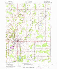
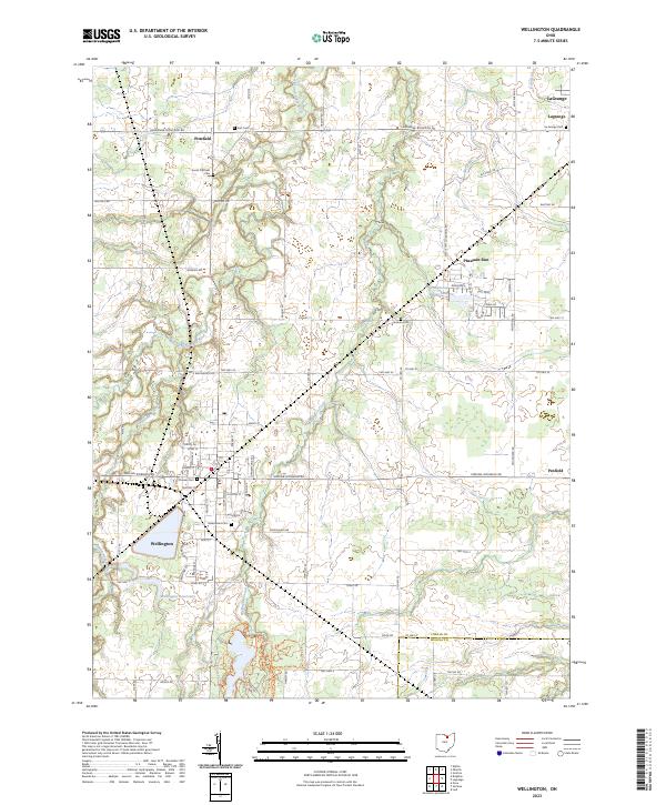
Wellington stands as a primary rail hub in this early twentieth-century landscape, where several major lines converge to move the region's agricultural and industrial output. The town layout shows a dense concentration of structures and a dedicated Cem near the crossing of the Cleveland Southwestern and Columbus (Electric) and the Cleveland Cincinnati Chicago and St Louis railroads. The topography is defined by the winding course of the East Branch Black River, which flows northward through Penfield and past River Corners. To the south and east, smaller settlements like Lodi and Spencer are linked by the Wheeling and Lake Erie and the Northern Ohio lines. The map captures a moment when rural crossroads like Garden Isle and Homerville remained distinct social centers, largely organized around the local drainage basins of the Little Killbuck Cr and the West Fork.
Find a feature on this map
51 named features on this map. Tap any name to fly to it.
Don’t see what you’re looking for? This feature index may not catch every label — zoom into the map to look around manually.
Map Details
Editions of this 1906 Wellington Map
This is the sole edition of this map. No revisions or reprints were ever made.
Historical Maps of Wellington Through Time
8 maps found