2020s Maps of Loudonville, Ohio
Explore 3 historic maps of Loudonville from the 2020s. These maps offer a rare glimpse into what life looked like during the 2020s — showing old roads, neighborhoods, homes, and landmarks that have changed or disappeared over time.
Whether you're researching your family's past, planning a metal detecting trip, or studying how Loudonville's landscape evolved across the 2020s, these high-resolution maps are a powerful tool for exploring the history of this region.
- Focus on a specific era: All maps on this page are from the 2020s, giving you a focused view of this time period.
- See what’s changed: Compare century-old streets, trails, and buildings to today's modern landscape using overlays and satellite layers.
- Research with precision: Use these maps for genealogy, historical research, land use analysis, or educational projects.
- View, download, or print: Maps are fully viewable online in high resolution, and can be downloaded or printed for your own records.
Start exploring Loudonville's history through authentic maps from the 2020s. This is your window into the past.
Loudonville, OH maps
(3)- 2023 Map of Jelloway, 2023 Print
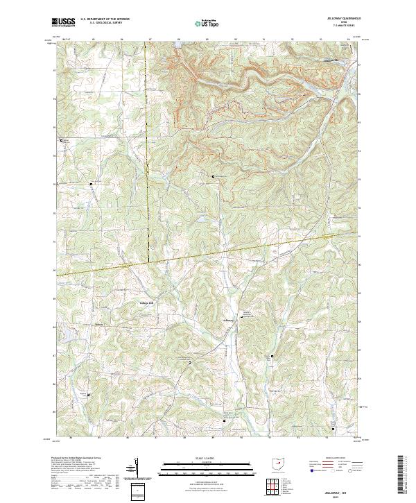 2023 Jelloway2023 Print · USGSCentral Ohio's hilly borderlands near the Knox and Ashland county lines come alive in this recent topographical study. Genealogists can locate several remote burial sites, such as Bigelow Cem and the Wesley Chapel Cem, while hikers can trace the paths through Hemlock Gorge.
 - 2023 Map of Greer, 2023 Print
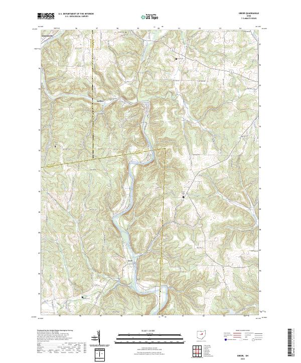 2023 Greer2023 Print · USGSThe Mohican River valley comes into sharp focus in this contemporary survey of the Ashland, Holmes, and Knox county borders. Family historians can trace rural burial grounds like Kaylor Ridge Cem and Ullman Cem near the settlements of Greer and Spellacy.
 - 2023 Map of Loudonville, 2023 Print
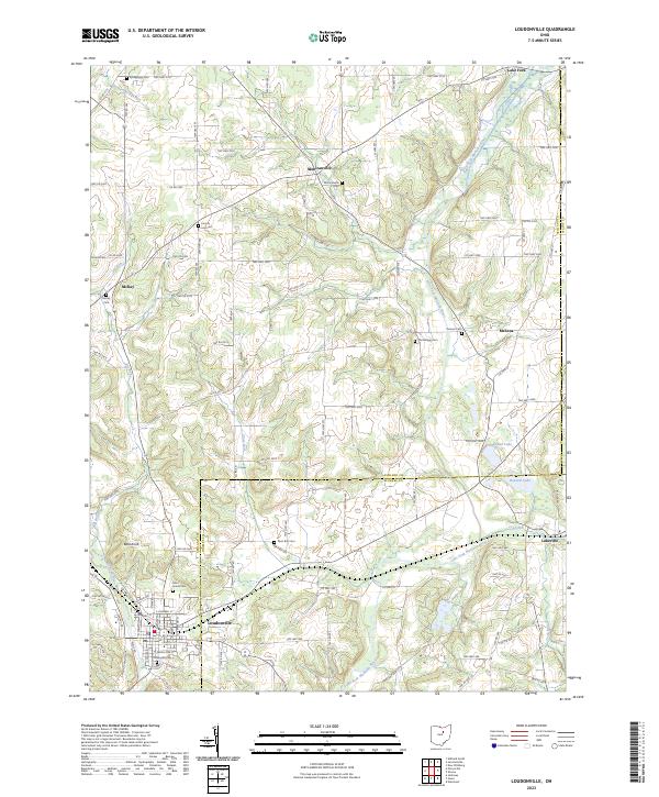 2023 Loudonville2023 Print · USGSLoudonville and the surrounding townships of Ashland and Holmes County are documented here in modern detail. Genealogists and local researchers can trace numerous rural burial sites like Old Sixteen Cem, McKay Cem, and the high ground at Bold Knob.
End of results
Showing maps 1-3 of 3
Top cities near Loudonville
- Mansfield historical maps
- Ashland historical maps
- Mount Vernon historical maps
- Howard historical maps
- Shreve historical maps
- Danville historical maps
See more
Frequently asked questions
- What are the different types of historical maps available for Loudonville?
- What is the oldest map of Loudonville?
- Where can I purchase historical maps of Loudonville for my home or office?
- Where can I download high-res historical maps of Loudonville?
- Are there historical topographic maps available for Loudonville?
- Is there historical aerial imagery available for Loudonville?
- Where are historical maps of Loudonville sourced from?