Old Maps of Ashtabula County, Ohio for Genealogy
Trace your family roots with 165 historic maps of Ashtabula County. These high-res maps reveal old neighborhoods, homesites, landmarks, and streets — helping you uncover where your ancestors lived and how the area evolved over time.
- Explore historic neighborhoods: Identify where your relatives may have lived in the 1800s or 1900s.
- Compare maps over time: Trace the changes in streets, buildings, and landmarks for multi-generational research.
- Perfect for genealogy & ancestry research: Used by family historians and researchers to map out lineage and migration.
These maps are an incredible resource for exploring your personal connection to Ashtabula County's past.
Ashtabula County, OH maps
(165)- 1904 Map of Chardon, 1962 Print
 1904 Chardon1962 Print · USGSGeauga and Lake Counties are shown here during the early twentieth century, just as the region's electric and steam rail networks were at their peak. Researchers can trace the routes of the Cleveland and Chardon Electric RR and find local landmarks like Indian Point or the Infirmary.
 - 1905 Map of Andover
 1905 Andover1905 Print · USGSAshtabula County and the Pennsylvania border are shown here at the height of the steam era, before modern highways transformed these rural townships. Genealogists and researchers can locate early congregations like South Denmark Church and trace the paths of the Cooperage Co RR or the Lake Shore and Michigan Southern Railroad.3 unique versions available
 - 1905 Map of Ashtabula
 1905 Ashtabula1905 Print · USGSAshtabula and its Lake Erie shoreline were a powerhouse of rail and maritime activity during the early twentieth century. Researchers can trace the complex harbor docks at Sweden, the industrial rail hubs in Geneva, and inland riverside hamlets like Mechanicsville or Austinburg.5 unique versions available
 - 1905 Map of Perry, 1943 Print
 1905 Perry1943 Print · USGSLake County’s shoreline at the opening of the twentieth century was a critical corridor of rail and road travel. Genealogists can trace family footprints through Painesville, Madison, and Unionville, or locate specific properties near North Ridge and Genung Corners.
 - 1905 Map of Jefferson, 1959 Print
 1905 Jefferson1959 Print · USGSAshtabula County at the start of the twentieth century shows a landscape of growing railroad towns and early pioneer settlements. Genealogists can trace family footprints through sites like the Amish Church, New England Schoolhouse, and vanished stops like Rock Creek Station.
 - 1906 Map of Chardon, 1940 Print
 1906 Chardon1940 Print · USGSGeauga and Lake Counties are mapped here during the era of steam and electric rail, showing the landscape between Chardon and Painesville. Researchers can trace old township boundaries and find landmarks like the Infirmary, Bass Lake, and the New York Chicago and St Louis RR.2 unique versions available
 - 1906 Map of Conneaut, 1943 Print
 1906 Conneaut1943 Print · USGSAshtabula County's industrial and rural landscape is caught at a pivotal moment as the rail network expanded toward the Lake Erie shoreline. Researchers can trace early township life in Monroe Center or follow the heavy rail traffic through Conneaut and Kingsville Station.2 unique versions available
 - 1907 Map of Andover
 1907 Andover1907 Print · USGSThe Ohio-Pennsylvania borderlands near Andover are captured here during a period of significant railway expansion. Local historians can trace early mail routes and church sites like the Williamsfield P O, South Denmark Church, and the vanished crossroads of Padanaram.4 unique versions available
 - 1907 Map of Kinsman, 1940 Print
 1907 Kinsman1940 Print · USGSEastern Trumbull County thrived at the start of the century as a vital crossroads of Ohio and Pennsylvania rail lines. Local historians can trace the foundations of Kinsman, Orangeville, and the remote State Line Church during the height of the steam rail era.2 unique versions available
 - 1907 Map of Jefferson, 1943 Print
 1907 Jefferson1943 Print · USGSAshtabula County at the start of the twentieth century is centered here on Jefferson and its surrounding agricultural townships. Genealogists can trace family footprints across old settlements like Windsor Mills, find the Amish Church, or locate the New England Schoolhouse.
 - 1950 Map of Cleveland
 1950 Cleveland1950 Print · USGSCovers Ashtabula County, including Cleveland, Akron, and other nearby areas
 - 1950 Map of Erie, 1953 Print
 1950 Erie1953 Print · USGSThe northern and southern shores of the Great Lakes meet in the mid-twentieth century, showcasing the vital shipping and rail corridors between Ontario and Pennsylvania. Trace the routes of the Michigan Central railroad or locate coastal landmarks like Presque Isle Light and the settlement of Iona Station.
 - 1956 Map of Cleveland, 1967 Print
 1956 Cleveland1967 Print · USGSNortheast Ohio and Western Pennsylvania are shown at their industrial height during the mid-fifties, from the steel mills to the lakeshore. Researchers can trace the massive Ravenna Arsenal, the Ohio Turnpike, and vanished rail sidings of the B & O RR.3 unique versions available
 - 1959 Map of Dorset, 1960 Print
 1959 Dorset1960 Print · USGSAshtabula County rural life in the late fifties centered on the railroad crossing at Dorset. Genealogists and local historians can trace small communities like Rowenton and Sentinel or locate the Dorset Cem and Williams Cem.4 unique versions available
 - 1959 Map of East Claridon, 1961 Print
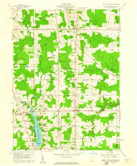 1959 East Claridon1961 Print · USGSGeauga County in the late fifties remains a rural landscape of headwater creeks and small crossroads settlements. Genealogists and historians can trace family locations along Chardon-Windsor Road or locate the old Huntsburg Cem and Culbertsons Corners.3 unique versions available
 - 1959 Map of Andover, 1961 Print
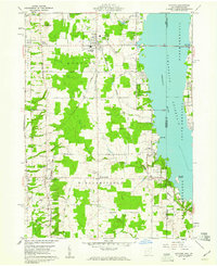 1959 Andover1961 Print · USGSAndover and Williamsfield sit at the edge of the Pymatuning Reservoir in the late fifties, where rural life meets a growing recreation industry. Researchers can trace family sites like Maple Grove Cem, the New York Central rail line, and the local Drive-in Theater.4 unique versions available
 - 1959 Map of Windsor, 1961 Print
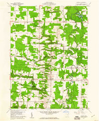 1959 Windsor1961 Print · USGSAshtabula County townships such as Hartsgrove and Windsor are seen here in the late fifties as a landscape of steady agricultural life. Genealogists and historians can trace family road names and locate old burial grounds like Pioneer Cemetery and Southeast Hartsgrove Cemetery.2 unique versions available
 - 1959 Map of Leon, 1961 Print
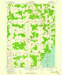 1959 Leon1961 Print · USGSThe Ohio-Pennsylvania borderlands come into focus in the late fifties as the Pymatuning Reservoir dominates the local landscape. Researchers can trace the heritage of rural Richmond and Pierpont through landmarks like Richmond Cem, Pennline Ch, and the New York Central railroad.6 unique versions available
 - 1959 Map of East Trumbull, 1961 Print
 1959 East Trumbull1961 Print · USGSAshtabula County townships maintained their traditional rural character in the late fifties, shaped by the winding Grand River. Genealogists can locate several small burial grounds and rural pulpits, including Cork Cem, Footville Cem, and Faith Ch.3 unique versions available
 - 1959 Map of Cherry Valley, 1961 Print
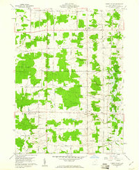 1959 Cherry Valley1961 Print · USGSAshtabula County's rural townships are documented here during the late fifties, showing a landscape of family farms and crossroads communities. Genealogists can locate family burial sites at Cherry Valley Cem or Hayes Cem and trace old routes like Sodom Road.3 unique versions available
 - 1959 Map of Erie, 1974 Print
 1959 Erie1974 Print · USGSCoastal communities and busy international rail lines define the North Shore and Pennsylvania lakefront during the late fifties and early seventies. Researchers can trace historic docklands and depot sites in Erie, Port Burwell, and Simcoe alongside the extensive reaches of Long Point.2 unique versions available
 - 1960 Map of North Kingsville, 1961 Print
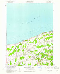 1960 North Kingsville1961 Print · USGSAshtabula County’s lakefront and rail corridors were undergoing steady development in the early sixties. Researchers can trace the path of the New York Central Line and locate landmarks like Gardner Airpark, the Drive-in Theater, and Lulu Falls Cem.3 unique versions available
 - 1960 Map of Gageville, 1961 Print
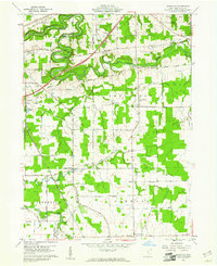 1960 Gageville1961 Print · USGSAshtabula County townships at the dawn of the 1960s reveal a landscape of winding river valleys and straight-line rail corridors. Genealogists and researchers can trace family-named routes like Lillie Road to find local landmarks such as the Gageville Cem and the Covered Bridge.3 unique versions available
 - 1960 Map of Ashtabula South, 1961 Print
 1960 Ashtabula South1961 Print · USGSAshtabula and its southern outskirts are captured here during the early sixties, showing the city's growth alongside its deep river valleys. Genealogists and local historians can trace family locations near the Grand River Academy High Sch, the Covered Bridge, and various landmarks like the Ridgeview Burial Park.3 unique versions available
 - 1960 Map of Ashtabula North, 1961 Print
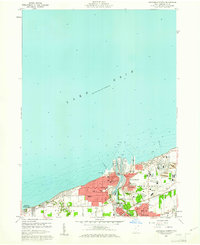 1960 Ashtabula North1961 Print · USGSAshtabula flourished as a major Lake Erie port and rail hub during the early sixties. Genealogists and local historians can trace neighborhood growth through landmarks like St Josephs Cem, Columbus Sch, and the Ashtabula Harbor.4 unique versions available
Showing maps 1-25 of 165
Top cities of Ashtabula County
- Ashtabula historical maps
- Conneaut historical maps
- Geneva historical maps
- Jefferson historical maps
- Jefferson Township historical maps
- North Kingsville historical maps
See more
Frequently asked questions
- What are the different types of historical maps available for Ashtabula County?
- What is the oldest map of Ashtabula County?
- Where can I purchase historical maps of Ashtabula County for my home or office?
- Where can I download high-res historical maps of Ashtabula County?
- Are there historical topographic maps available for Ashtabula County?
- Is there historical aerial imagery available for Ashtabula County?
- Where are historical maps of Ashtabula County sourced from?