Old Maps of Auglaize County, Ohio for Academic Research
Study the evolution of Auglaize County with 120 high-resolution historic maps. Whether you're teaching, researching, or modeling changes in land use, these maps provide essential visual documentation of urban, environmental, and geographic change.
- Analyze long-term change: Track patterns in development, transportation, and natural features.
- Ideal for environmental or urban studies: Support academic projects with primary historical map data.
- Use in the classroom or lab: Educators and researchers rely on these maps to bring historical context to life.
These maps are a powerful tool for teaching, research, and visualizing how Auglaize County has changed over the decades.
Auglaize County, OH maps
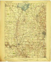
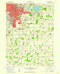
(120)- 1906 Map of Lima, 1943 Print
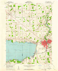
 1906 Lima1943 Print · USGSNorthwest Ohio’s industrial heart beats at the turn of the century, dominated by a dense rail network. Trace the early Buckeye oil era through the Oil Tanks near Lima or locate family roots in Cridersville, Uniopolis, and Wapakoneta.2 unique versions available
 - 1909 Map of Loramie, 1961 Print
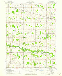
 1909 Loramie1961 Print · USGSWestern Ohio at the opening of the twentieth century was a landscape defined by the transition from canal transport to electric rail. Genealogists can trace family names across dozens of rural school districts like Walkup School and Diters School, or locate old parish centers such as Maria Stein and St John.
 - 1911 Map of Loramie, 1936 Print
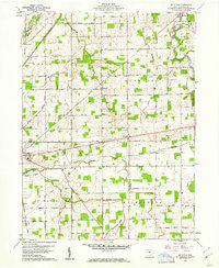
 1911 Loramie1936 Print · USGSWestern Ohio at the start of the twentieth century shows a landscape transitioning from the canal era to the age of electric rail. Researchers can trace the Miami and Erie Canal through Minster and New Bremen, or locate family sites near St Patricks Church and Schwaberow School.
 - 1911 Map of Spencerville, 1942 Print
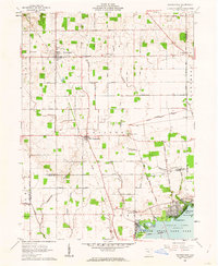
 1911 Spencerville1942 Print · USGSWestern Ohio in the early 1900s was a hub of canal and rail transport, anchored by the industrial and shipping activity in St Marys. Genealogists and historians can trace numerous rural schoolhouses like Hardscrabble School and the path of the Miami and Erie Canal.
 - 1913 Map of Alger
 1913 Alger1913 Print · USGSWestern Ohio's agricultural heartland is documented here just before the Great War, showing a landscape shaped by drainage ditches and rail lines. Locate family landmarks like the Bee Hive School, Mt Zion Church, and the vanished stops along the Chicago & Erie Railroad.2 unique versions available
 - 1913 Map of Bellefontaine
 1913 Bellefontaine1913 Print · USGSLogan County in the decade before the First World War shows a landscape connected by steam and electric rail. Genealogists can locate family landmarks from Santa Fe to Quincy, including the County Infirmary and old sites like Muchinippi Church.2 unique versions available
 - 1913 Map of Sidney, 1934 Print
 1913 Sidney1934 Print · USGSShelby County at the height of the steam and electric rail era features a landscape defined by the Miami and Erie Canal and the historic Greenville Treaty Line. Genealogists and historians can trace dozens of rural schoolhouses, including Poplar Knob School and Walnut Grove School, alongside the early streetcar route of the Western Ohio RR.2 unique versions available
 - 1915 Map of Alger
 1915 Alger1915 Print · USGSNorthwest Ohio's agricultural and rail heartland is captured here just before the First World War. Genealogists can locate family homesteads near dozens of early rural schoolhouses like Kingsley School and trace the paths of the ERIE RR and LAKEVIEW ELECTRIC ROAD.4 unique versions available
 - 1915 Map of Bellefontaine
 1915 Bellefontaine1915 Print · USGSLogan County at the start of the twentieth century shows a bustling landscape of rail hubs and lakeside settlements. Genealogists can trace family footprints at Richland New Richland PO or locate landmarks like the County Infirmary and Black Lake School.3 unique versions available
 - 1943 Map of Alger
 1943 Alger1943 Print · USGSDuring the early 1940s, this pocket of Ohio was a landscape of rail-fed villages and drainage ditches. Trace family roots across a grid of rural schools like Sugarfree Sch, follow the Erie RR through Alger, or explore the shores of Indian Lake.
 - 1944 Map of Sidney
 1944 Sidney1944 Print · USGSShelby County thrived as a rail and river hub in the mid-1940s, centered on the growing industrial town of Sidney. Researchers can trace old rural school districts and family-named landmarks such as Walnut Grove Sch, Poplar Knob, and the Childrens Home.
 - 1944 Map of Loramie
 1944 Loramie1944 Print · USGSWest-central Ohio farmland is captured here during the mid-forties, showing the intricate grid of rural school districts and turnpikes. Researchers can trace family-named sites like Fledderjohn Sch and St Patricks Ch near the Loramie Reservoir.
 - 1944 Map of Spencerville
 1944 Spencerville1944 Print · USGSMid-century Western Ohio is shown here at the height of its rail and canal era. Genealogists can trace family roots through dozens of rural landmarks like Deep Cut Sch, Walnut Grove Church, and the Artesian Well at St Marys.
 - 1944 Map of Bellefontaine
 1944 Bellefontaine1944 Print · USGSLogan County in the 1940s centers on the bustling rail junction of Bellefontaine and the recreational shores of Indian Lake. Genealogists and local historians can locate early landmarks like the County Infirmary and dozens of rural schoolhouses, including McKee Creek Sch and Miller Sch.
 - 1950 Map of Marion
 1950 Marion1950 Print · USGSCentral Ohio was a powerhouse of rail and river industry at the mid-century point, serving as a vital corridor between the Great Lakes and the Ohio River valley. Genealogists and rail historians can trace the paths of the Erie RR and Nickel Plate Road through towns like Bucyrus, Galion, and Upper Sandusky.
 - 1953 Map of Muncie, 1966 Print
 1953 Muncie1966 Print · USGSIndiana and Ohio borderlands thrive in the early fifties, showing a landscape defined by manufacturing cities and an intensive railroad network. Genealogists can trace family roots across the Indiana-Ohio line through Muncie, Celina, and Portland via the Pennsylvania railroad.5 unique versions available
 - 1956 Map of Muncie
 1956 Muncie1956 Print · USGSEastern Indiana and western Ohio are shown at a peak of rail-driven industry in the mid-fifties. Genealogists and rail historians can trace the paths of the Pennsylvania RR through Muncie or locate landmarks like Lake Saint Marys (Grand Lake Reservoir) and Frances Slocum State Forest.
 - 1960 Map of Spencerville, 1961 Print
 1960 Spencerville1961 Print · USGSSpencerville and the surrounding farm country are captured here in the early sixties as the landscape transition from canal-era roots to mid-century industry. Genealogists and historians can trace the Miami and Erie Canal, Fort Amanda State Park, and local sites like St Patricks Cem.3 unique versions available
 - 1960 Map of St. Marys, 1961 Print
 1960 St. Marys1961 Print · USGSSt. Marys and the shores of Grand Lake appear in the early sixties as a hub of water-borne history and mid-century industry. Trace the Miami and Erie Canal (Abandoned) past Forty Acre Pond and find old family sites near Neptune or Villa Nova.3 unique versions available
 - 1960 Map of Elgin, 1961 Print
 1960 Elgin1961 Print · USGSWestern Ohio farmland is captured here in the early sixties at the meeting point of four counties. Genealogists and historians can trace family-named landmarks like Fissel Lauth Cem and Hankin Cem or locate the village of Elgin along the Erie Lackawanna Railroad.
 - 1960 Map of Moulton, 1961 Print
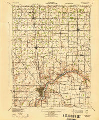
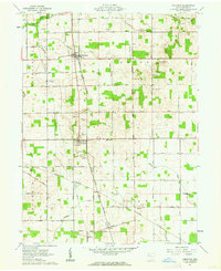
 1960 Moulton1961 Print · USGSAuglaize County is captured here in the early sixties, showing a landscape defined by industrial transitions and old survey lines. Genealogists can locate family landmarks like Zion Cem and trace the defunct Miami and Erie Canal (Abandoned) past Lock Fourteen.3 unique versions available
 - 1961 Map of Waynesfield, 1962 Print
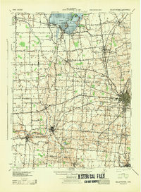
 1961 Waynesfield1962 Print · USGSAuglaize County farming life and the northern recreation shores of Indian Lake are captured here during the early sixties. Researchers can trace historic property divisions along the Old Indian Treaty Boundary and locate family burial sites like Willow Branch Cem or the village of New Hampshire.3 unique versions available
 - 1961 Map of Lima, 1962 Print
 1961 Lima1962 Print · USGSAllen and Auglaize counties were reaching their mid-century peak in this early 1960s survey of the local rail and water infrastructure. Researchers can trace the path of the Old Indian Treaty Boundary or locate family sites at Fletcher Cem and Victory Ch.4 unique versions available
 - 1961 Map of Uniopolis, 1962 Print
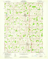
 1961 Uniopolis1962 Print · USGSAuglaize County at the start of the sixties is a landscape of established farmsteads and rail corridors still defined by the Old Indian Treaty Boundary. Genealogists and historians can trace old family sites near Uniopolis, St Johns, and Fairmount Cem.3 unique versions available
 - 1961 Map of Botkins, 1962 Print
 1961 Botkins1962 Print · USGSShelby and Auglaize counties are captured here in the early sixties, showing the complex intersection of early land surveys along the Greenville Treaty Line. Genealogists can trace family names across Old Loramie Valley Cem, Redman Cem, and the small community of Rumley.3 unique versions available
Showing maps 1-25 of 120
Top cities of Auglaize County
- Wapakoneta historical maps
- Saint Marys historical maps
- New Bremen historical maps
- Minster historical maps
- Cridersville historical maps
- Moulton historical maps
See more
Frequently asked questions
- What are the different types of historical maps available for Auglaize County?
- What is the oldest map of Auglaize County?
- Where can I purchase historical maps of Auglaize County for my home or office?
- Where can I download high-res historical maps of Auglaize County?
- Are there historical topographic maps available for Auglaize County?
- Is there historical aerial imagery available for Auglaize County?
- Where are historical maps of Auglaize County sourced from?