1900s (20th Century) Maps of New Knoxville, Ohio
Explore 11 historic maps of New Knoxville from the 1900s (20th Century). These maps offer a rare glimpse into what life looked like during the 1900s — showing old roads, neighborhoods, homes, and landmarks that have changed or disappeared over time.
Whether you're researching your family's past, planning a metal detecting trip, or studying how New Knoxville's landscape evolved across the 1900s, these high-resolution maps are a powerful tool for exploring the history of this region.
- Focus on a specific era: All maps on this page are from the 1900s, giving you a focused view of this time period.
- See what’s changed: Compare century-old streets, trails, and buildings to today's modern landscape using overlays and satellite layers.
- Research with precision: Use these maps for genealogy, historical research, land use analysis, or educational projects.
- View, download, or print: Maps are fully viewable online in high resolution, and can be downloaded or printed for your own records.
Start exploring New Knoxville's history through authentic maps from the 1900s. This is your window into the past.
New Knoxville, OH maps
(11)- 1909 Map of Loramie, 1961 Print
 1909 Loramie1961 Print · USGSWestern Ohio at the opening of the twentieth century was a landscape defined by the transition from canal transport to electric rail. Genealogists can trace family names across dozens of rural school districts like Walkup School and Diters School, or locate old parish centers such as Maria Stein and St John.
 - 1911 Map of Loramie, 1936 Print
 1911 Loramie1936 Print · USGSWestern Ohio at the start of the twentieth century shows a landscape transitioning from the canal era to the age of electric rail. Researchers can trace the Miami and Erie Canal through Minster and New Bremen, or locate family sites near St Patricks Church and Schwaberow School.
 - 1911 Map of Spencerville, 1942 Print
 1911 Spencerville1942 Print · USGSWestern Ohio in the early 1900s was a hub of canal and rail transport, anchored by the industrial and shipping activity in St Marys. Genealogists and historians can trace numerous rural schoolhouses like Hardscrabble School and the path of the Miami and Erie Canal.
 - 1944 Map of Loramie
 1944 Loramie1944 Print · USGSWest-central Ohio farmland is captured here during the mid-forties, showing the intricate grid of rural school districts and turnpikes. Researchers can trace family-named sites like Fledderjohn Sch and St Patricks Ch near the Loramie Reservoir.
 - 1944 Map of Spencerville
 1944 Spencerville1944 Print · USGSMid-century Western Ohio is shown here at the height of its rail and canal era. Genealogists can trace family roots through dozens of rural landmarks like Deep Cut Sch, Walnut Grove Church, and the Artesian Well at St Marys.
 - 1953 Map of Muncie, 1966 Print
 1953 Muncie1966 Print · USGSIndiana and Ohio borderlands thrive in the early fifties, showing a landscape defined by manufacturing cities and an intensive railroad network. Genealogists can trace family roots across the Indiana-Ohio line through Muncie, Celina, and Portland via the Pennsylvania railroad.5 unique versions available
 - 1956 Map of Muncie
 1956 Muncie1956 Print · USGSEastern Indiana and western Ohio are shown at a peak of rail-driven industry in the mid-fifties. Genealogists and rail historians can trace the paths of the Pennsylvania RR through Muncie or locate landmarks like Lake Saint Marys (Grand Lake Reservoir) and Frances Slocum State Forest.
 - 1960 Map of Moulton, 1961 Print
 1960 Moulton1961 Print · USGSAuglaize County is captured here in the early sixties, showing a landscape defined by industrial transitions and old survey lines. Genealogists can locate family landmarks like Zion Cem and trace the defunct Miami and Erie Canal (Abandoned) past Lock Fourteen.3 unique versions available
 - 1961 Map of New Knoxville, 1962 Print
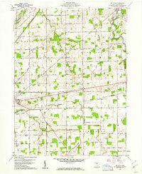
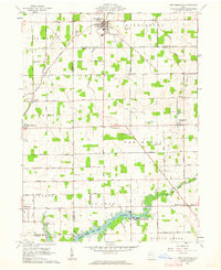 1961 New Knoxville1962 Print · USGSWestern Ohio farmland and the waters of Lake Loramie are frozen in time during the early sixties. Genealogists can locate family-named cemeteries like Pilger Ruhe Cem while historians trace legacy infrastructure at Lock Two and Lehmkuhl Landing.3 unique versions available
 - 1986 Map of Piqua
 1986 Piqua1986 Print · USGSThe western Ohio and eastern Indiana borderlands appear here in the mid-1980s, showcasing a landscape of river-valley industry and fertile plains. Researchers can trace historic rail lines like Conrail and Norfolk and Western through towns like Greenville and Winchester.3 unique versions available
 - 1986 Map of Lima
 1986 Lima1986 Print · USGSWest Ohio and East Indiana are captured here in the mid-1980s, showcasing a landscape of productive farmland and industrial transit hubs. Genealogists and historians can trace the development of Lima and Van Wert or locate landmarks like Woodland Chapel and the Lima Ordnance Modification Center.3 unique versions available
End of results
Showing maps 1-11 of 11
Top cities near New Knoxville
- Lima historical maps
- Sidney historical maps
- Celina historical maps
- Wapakoneta historical maps
- Saint Marys historical maps
- Fort Shawnee historical maps
See more
Frequently asked questions
- What are the different types of historical maps available for New Knoxville?
- What is the oldest map of New Knoxville?
- Where can I purchase historical maps of New Knoxville for my home or office?
- Where can I download high-res historical maps of New Knoxville?
- Are there historical topographic maps available for New Knoxville?
- Is there historical aerial imagery available for New Knoxville?
- Where are historical maps of New Knoxville sourced from?