Old Maps of Rosedale / The Oaks, Middletown for Academic Research
Study the evolution of Rosedale / The Oaks with 11 high-resolution historic maps. Whether you're teaching, researching, or modeling changes in land use, these maps provide essential visual documentation of urban, environmental, and geographic change.
- Analyze long-term change: Track patterns in development, transportation, and natural features.
- Ideal for environmental or urban studies: Support academic projects with primary historical map data.
- Use in the classroom or lab: Educators and researchers rely on these maps to bring historical context to life.
These maps are a powerful tool for teaching, research, and visualizing how Rosedale / The Oaks has changed over the decades.
Rosedale / The Oaks, Middletown maps
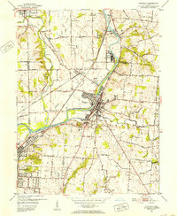
(11)- 1908 Map of Miamisburg, 1948 Print
 1908 Miamisburg1948 Print · USGSThe Miami Valley at the start of the twentieth century was a hub of electric traction lines and canal history. Genealogists and historians can trace the early layouts of Miamisburg and Franklin, or locate landmarks like Browns Chapel and the National Military Home.
 - 1951 Map of Franklin, 1953 Print
 1951 Franklin1953 Print · USGSThe industrial corridor of the Great Miami River valley thrives in the early 1950s as a major rail hub for the New York Central and Baltimore and Ohio. Genealogists can trace family landmarks like Swartzel Cem and Stettler Ch or locate the ancient Indian Mound overlooking the river.
 - 1953 Map of Cincinnati, 1965 Print
 1953 Cincinnati1965 Print · USGSThe Ohio River valley and the industrial heartland of Indiana and Ohio are captured here during the mid-century peak of rail and river commerce. Genealogists and historians can trace connections between Cincinnati and outlying military sites like Camp Atterbury and Bakalar AFB.3 unique versions available
 - 1957 Map of Cincinnati
 1957 Cincinnati1957 Print · USGSThe Ohio River valley and its surrounding highlands thrived during the mid-fifties industrial peak, centered on the bustling Cincinnati and Dayton metropolitan hubs. Researchers can trace the extensive rail networks and military sites like Wright-Patterson AFB and Camp Atterbury.
 - 1965 Map of Franklin, 1967 Print
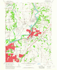 1965 Franklin1967 Print · USGSMiddletown and Franklin thrive along the river and rail corridors of the Miami Valley in the mid-1960s. Genealogists and researchers can trace local landmarks like Wood Hill Cemetery, Stettler Ch, and the sprawling Mound Laboratory (AEC) complex.5 unique versions available
 - 1986 Map of Dayton
 1986 Dayton1986 Print · USGSThe Miami Valley and the Indiana-Ohio borderlands reached a peak of suburban and industrial connectivity in the mid-eighties. Genealogists and historians can trace family burial sites at Miami Memorial Garden (Cem) and the development surrounding Wright-Patterson Air Force Base.2 unique versions available
 - 2010 Map of Franklin, 2010 Print
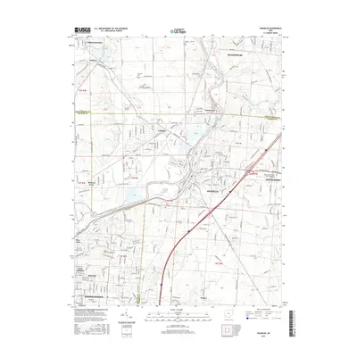
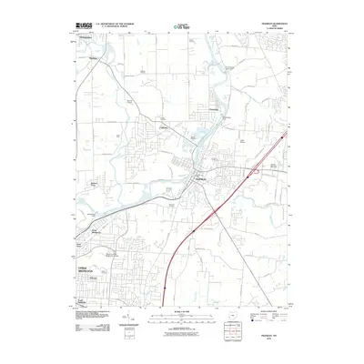 2010 Franklin2010 Print · USGSCovers Rosedale / The Oaks, including Middletown, Miamisburg, and other nearby areas
 - 2013 Map of Franklin, 2013 Print
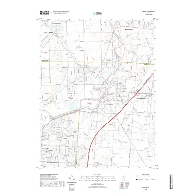
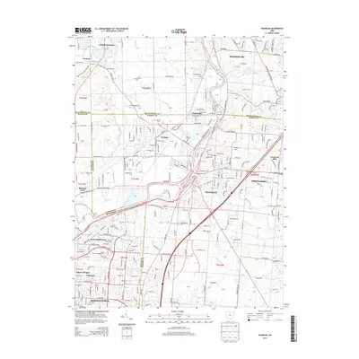 2013 Franklin2013 Print · USGSCovers Rosedale / The Oaks, including Middletown, Miamisburg, and other nearby areas
 - 2016 Map of Franklin, 2016 Print
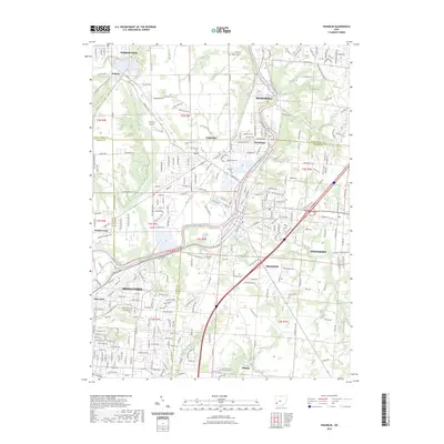
 2016 Franklin2016 Print · USGSCovers Rosedale / The Oaks, including Middletown, Miamisburg, and other nearby areas
 - 2019 Map of Franklin, 2019 Print
 2019 Franklin2019 Print · USGSCovers Rosedale / The Oaks, including Middletown, Miamisburg, and other nearby areas
 - 2023 Map of Franklin, 2023 Print
 2023 Franklin2023 Print · USGSSouthwestern Ohio's industrial and river corridor comes into focus in this contemporary survey of the Miami Valley. Genealogists and local historians can trace family roots at Swartzel Cem and Tapscott Cem, or locate landmarks like Hummel Airport and Chautauqua.
End of results
Showing maps 1-11 of 11
Frequently asked questions
- What are the different types of historical maps available for Rosedale / The Oaks?
- What is the oldest map of Rosedale / The Oaks?
- Where can I purchase historical maps of Rosedale / The Oaks for my home or office?
- Where can I download high-res historical maps of Rosedale / The Oaks?
- Are there historical topographic maps available for Rosedale / The Oaks?
- Is there historical aerial imagery available for Rosedale / The Oaks?
- Where are historical maps of Rosedale / The Oaks sourced from?