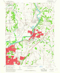
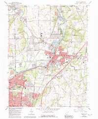
1965 Map of Franklin
USGS Topo · Published 1967About this map
The Great Miami River carves a deep valley through this industrial and agricultural landscape, serving as the corridor for the Baltimore and Ohio, New York Central, and Pennsylvania railroads. This mid-century survey captures the expanding residential footprints of Franklin and Middletown as they grew along the riverbanks and rail lines. Notable for researchers is the massive Mound Laboratory (AEC) complex on the northern edge, a Cold War-era facility that stands in contrast to the ancient Indian Mound nearby.
Find a feature on this map
49 named features on this map. Tap any name to fly to it.
Don’t see what you’re looking for? This feature index may not catch every label — zoom into the map to look around manually.
Map Details
Editions of this 1965 Franklin Map
5 editions found
Other maps of this area

1904 · Mason
USGS Topo · 1:62,500

1906 · Mason
USGS Topo · 1:62,500

1908 · Miamisburg
USGS Topo · 1:62,500

1913 · Waynesville
USGS Topo · 1:62,500

1914 · Morrow
USGS Topo · 1:62,500

1915 · Waynesville
USGS Topo · 1:62,500

1916 · Morrow
USGS Topo · 1:62,500

1951 · Franklin
USGS Topo · 1:24,000

1953 · Cincinnati
USGS Topo · 1:250,000

1955 · Monroe
USGS Topo · 1:24,000