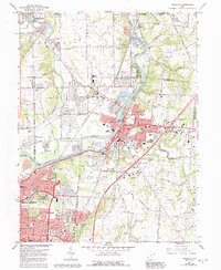
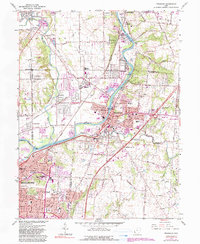
1965 Map of Franklin
USGS Topo · Published 1992About this map
The Great Miami River valley anchors this mid-century look at southwest Ohio, revealing a landscape defined by the industrial and Cold War infrastructure of Franklin and north Middletown. A notable feature of this era is the Mound Facility Dept of Energy, which stands near the northern edge of the map, while traces of much older history appear at the Indian Mound and the Stettler Ch cemetery area. The settlement pattern shows the growth of Springboro, Carlisle, and Germantown as suburban expansion began to connect formerly separate river towns. Significant local institutions are mapped in detail, from the Wood Hill Cemetery and Camp Hook to numerous neighborhood landmarks like the Schenck Sch and the Drive-in Theater. The presence of the Conrail lines and extensive Gravel Pits reflects the area's continued reliance on the river corridor for transportation and resource extraction during this period of development.
Find a feature on this map
83 named features on this map. Tap any name to fly to it.
Don’t see what you’re looking for? This feature index may not catch every label — zoom into the map to look around manually.
Map Details
Editions of this 1965 Franklin Map
5 editions found
Other maps of this area

1904 · Mason
USGS Topo · 1:62,500

1906 · Mason
USGS Topo · 1:62,500

1908 · Miamisburg
USGS Topo · 1:62,500

1913 · Waynesville
USGS Topo · 1:62,500

1914 · Morrow
USGS Topo · 1:62,500

1915 · Waynesville
USGS Topo · 1:62,500

1916 · Morrow
USGS Topo · 1:62,500

1951 · Franklin
USGS Topo · 1:24,000

1953 · Cincinnati
USGS Topo · 1:250,000

1955 · Monroe
USGS Topo · 1:24,000