Old Maps of South Highlands, Middletown for Genealogy
Trace your family roots with 10 historic maps of South Highlands. These high-res maps reveal old neighborhoods, homesites, landmarks, and streets — helping you uncover where your ancestors lived and how the area evolved over time.
- Explore historic neighborhoods: Identify where your relatives may have lived in the 1800s or 1900s.
- Compare maps over time: Trace the changes in streets, buildings, and landmarks for multi-generational research.
- Perfect for genealogy & ancestry research: Used by family historians and researchers to map out lineage and migration.
These maps are an incredible resource for exploring your personal connection to South Highlands's past.
South Highlands, Middletown maps
(10)- 1908 Map of Miamisburg, 1948 Print
 1908 Miamisburg1948 Print · USGSThe Miami Valley at the start of the twentieth century was a hub of electric traction lines and canal history. Genealogists and historians can trace the early layouts of Miamisburg and Franklin, or locate landmarks like Browns Chapel and the National Military Home.
 - 1953 Map of Cincinnati, 1965 Print
 1953 Cincinnati1965 Print · USGSThe Ohio River valley and the industrial heartland of Indiana and Ohio are captured here during the mid-century peak of rail and river commerce. Genealogists and historians can trace connections between Cincinnati and outlying military sites like Camp Atterbury and Bakalar AFB.3 unique versions available
 - 1957 Map of Cincinnati
 1957 Cincinnati1957 Print · USGSThe Ohio River valley and its surrounding highlands thrived during the mid-fifties industrial peak, centered on the bustling Cincinnati and Dayton metropolitan hubs. Researchers can trace the extensive rail networks and military sites like Wright-Patterson AFB and Camp Atterbury.
 - 1959 Map of Middletown, 1961 Print
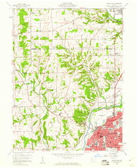 1959 Middletown1961 Print · USGSThe Miami Valley in the late fifties shows a region in transition between its river-and-rail origins and the modern industrial era. Genealogists can trace family names through the Elk Creek Cem, Astoria Cem, and local school locations like Madison High Sch.5 unique versions available
 - 1986 Map of Dayton
 1986 Dayton1986 Print · USGSThe Miami Valley and the Indiana-Ohio borderlands reached a peak of suburban and industrial connectivity in the mid-eighties. Genealogists and historians can trace family burial sites at Miami Memorial Garden (Cem) and the development surrounding Wright-Patterson Air Force Base.2 unique versions available
 - 2010 Map of Middletown, 2010 Print
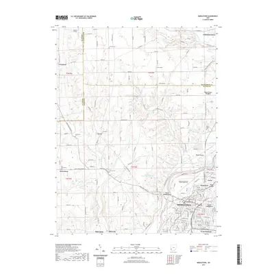
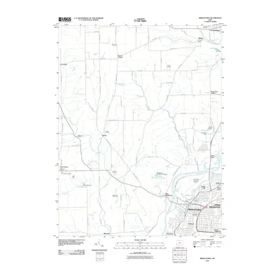 2010 Middletown2010 Print · USGSCovers South Highlands, including Middletown, Trenton, and other nearby areas
 - 2013 Map of Middletown, 2013 Print
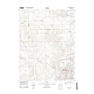 2013 Middletown2013 Print · USGSCovers South Highlands, including Middletown, Trenton, and other nearby areas
 - 2016 Map of Middletown, 2016 Print
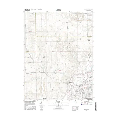 2016 Middletown2016 Print · USGSCovers South Highlands, including Middletown, Trenton, and other nearby areas
 - 2019 Map of Middletown, 2019 Print
 2019 Middletown2019 Print · USGSCovers South Highlands, including Middletown, Trenton, and other nearby areas
 - 2023 Map of Middletown, 2023 Print
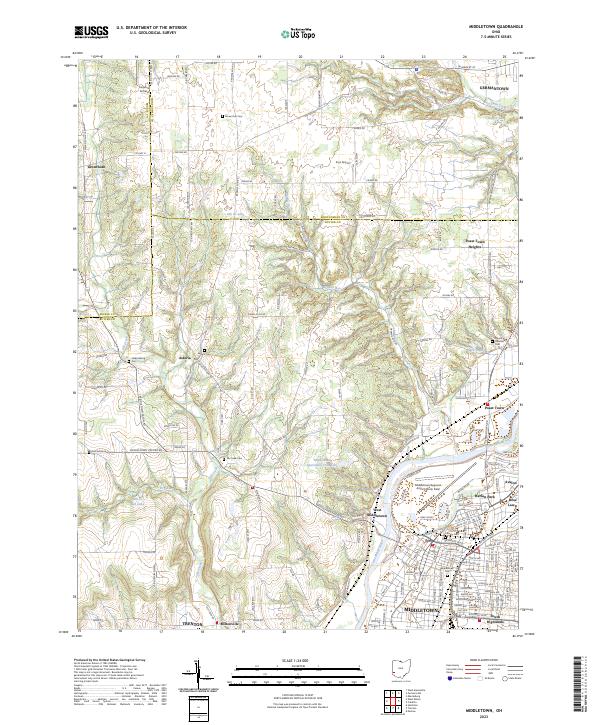 2023 Middletown2023 Print · USGSThe Great Miami River valley in the early twenty-first century reveals a landscape where the urban reach of Middletown meets the rural roots of Butler County. Researchers can pinpoint family history at Old Jacksonburg Cem or trace the development of small settlements like Poast Town and Miltonville.
End of results
Showing maps 1-10 of 10
Top cities near South Highlands
- Dayton historical maps
- Hamilton historical maps
- Kettering historical maps
- Middletown historical maps
- Fairfield historical maps
- Mason historical maps
See more
Frequently asked questions
- What are the different types of historical maps available for South Highlands?
- What is the oldest map of South Highlands?
- Where can I purchase historical maps of South Highlands for my home or office?
- Where can I download high-res historical maps of South Highlands?
- Are there historical topographic maps available for South Highlands?
- Is there historical aerial imagery available for South Highlands?
- Where are historical maps of South Highlands sourced from?