2020s Maps of Fox Township, Ohio
Explore 4 historic maps of Fox Township from the 2020s. These maps offer a rare glimpse into what life looked like during the 2020s — showing old roads, neighborhoods, homes, and landmarks that have changed or disappeared over time.
Whether you're researching your family's past, planning a metal detecting trip, or studying how Fox Township's landscape evolved across the 2020s, these high-resolution maps are a powerful tool for exploring the history of this region.
- Focus on a specific era: All maps on this page are from the 2020s, giving you a focused view of this time period.
- See what’s changed: Compare century-old streets, trails, and buildings to today's modern landscape using overlays and satellite layers.
- Research with precision: Use these maps for genealogy, historical research, land use analysis, or educational projects.
- View, download, or print: Maps are fully viewable online in high resolution, and can be downloaded or printed for your own records.
Start exploring Fox Township's history through authentic maps from the 2020s. This is your window into the past.
Fox Township, OH maps
(4)- 2023 Map of Bergholz, 2023 Print
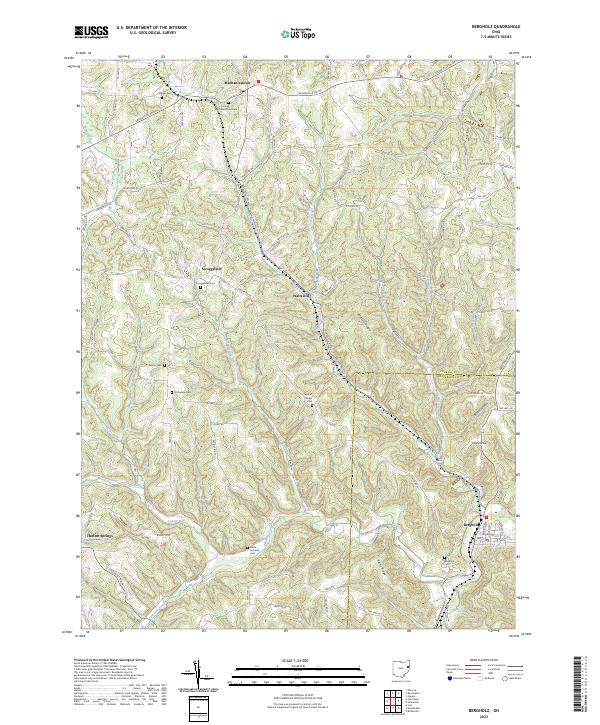 2023 Bergholz2023 Print · USGSThe rural borderlands of Carroll and Jefferson counties are captured here in the early 2020s, showing a landscape of scattered settlements and deep-rooted family history. Researchers can trace local heritage through numerous sites like Scroggsfield Cem, Kilgore, and Bergholz.
 - 2023 Map of Salineville, 2023 Print
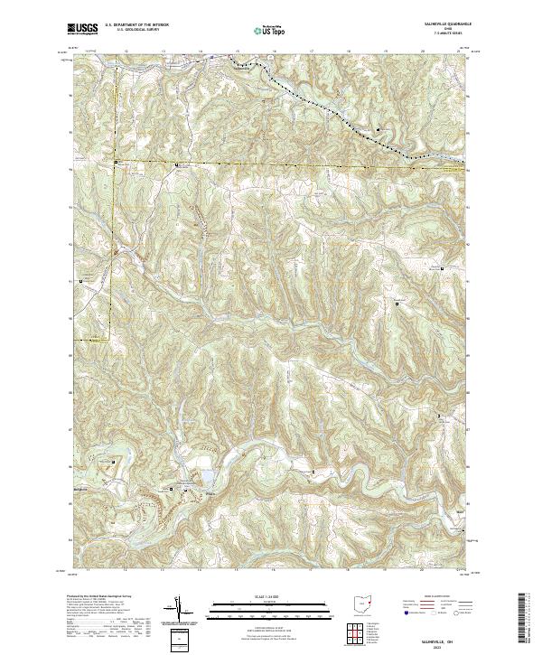 2023 Salineville2023 Print · USGSThe borderlands of Columbiana, Carroll, and Jefferson counties appear here in modern detail, centered on the historic hills around Salineville. Genealogists can trace family lines through numerous rural burial sites like West Grove Cem and Chestnut Grove Cem.
 - 2023 Map of Gavers, 2023 Print
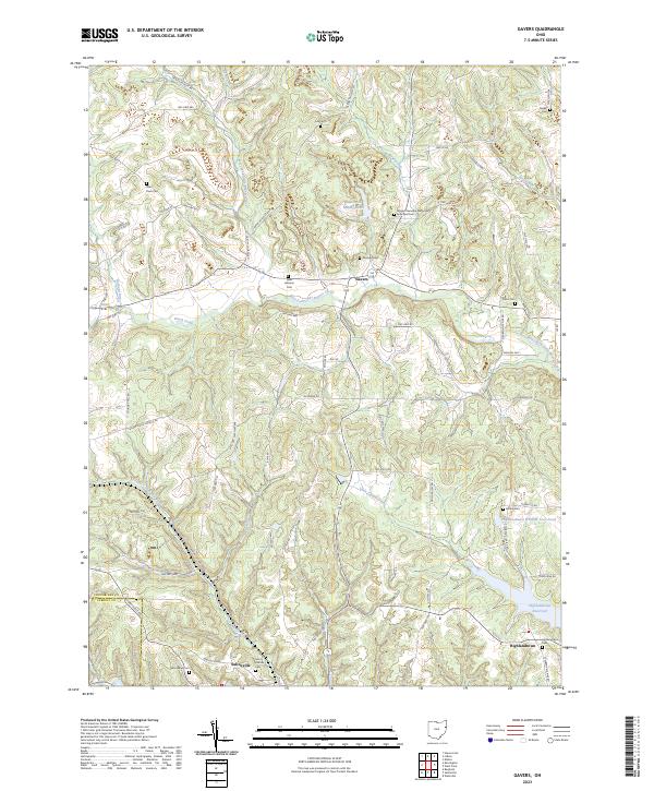 2023 Gavers2023 Print · USGSColumbiana County at the turn of the 21st century remains a landscape of high ridges and winding creek valleys. Researchers can trace ancestral roots at Saint Pauls Cem or Woodland Cem, while mapping the historical industry of Dobson Mill and Salineville.
 - 2023 Map of Kensington, 2023 Print
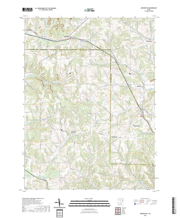 2023 Kensington2023 Print · USGSThe borderlands of Carroll and Columbiana counties are documented here in recent detail, showing a landscape of quiet crossroads and winding creeks. Trace family roots at Sandy Springs Cem or locate old community centers in Summitville, Millport, and Norristown.
End of results
Showing maps 1-4 of 4
Top cities near Fox Township
- Steubenville historical maps
- Wintersville historical maps
- Minerva historical maps
- Carrollton historical maps
- Lisbon historical maps
- Augusta historical maps
See more
Top neighborhoods of Fox Township
- Wattsville historical maps
- Scroggsfield historical maps
- Pine Hill historical maps
- Mechanicstown historical maps
Frequently asked questions
- What are the different types of historical maps available for Fox Township?
- What is the oldest map of Fox Township?
- Where can I purchase historical maps of Fox Township for my home or office?
- Where can I download high-res historical maps of Fox Township?
- Are there historical topographic maps available for Fox Township?
- Is there historical aerial imagery available for Fox Township?
- Where are historical maps of Fox Township sourced from?