1990s Maps of Orange Township, Ohio
Explore 5 historic maps of Orange Township from the 1990s. These maps offer a rare glimpse into what life looked like during the 1990s — showing old roads, neighborhoods, homes, and landmarks that have changed or disappeared over time.
Whether you're researching your family's past, planning a metal detecting trip, or studying how Orange Township's landscape evolved across the 1990s, these high-resolution maps are a powerful tool for exploring the history of this region.
- Focus on a specific era: All maps on this page are from the 1990s, giving you a focused view of this time period.
- See what’s changed: Compare century-old streets, trails, and buildings to today's modern landscape using overlays and satellite layers.
- Research with precision: Use these maps for genealogy, historical research, land use analysis, or educational projects.
- View, download, or print: Maps are fully viewable online in high resolution, and can be downloaded or printed for your own records.
Start exploring Orange Township's history through authentic maps from the 1990s. This is your window into the past.
Orange Township, OH maps
(5)- 1993 Map of Uhrichsville
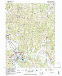
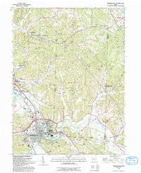 1993 Uhrichsville1993 Print · USGSUhrichsville and Dennison are captured in the early nineties, showing a landscape shaped by the rail and clay industries. Genealogists can trace family sites at Roswell Cem, St Marys Ch, and along the banks of Stillwater Creek.
 - 1994 Map of Mineral City, 1998 Print
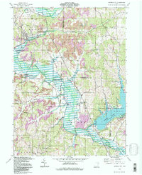 1994 Mineral City1998 Print · USGSIn the mid-1990s, the Tuscarawas and Carroll County line was a landscape defined by industry and water. Local historians can trace the United States Railroad through Mineral City or find rural landmarks like St Matthews Ch and Atwood Lake Park.
 - 1994 Map of Bowerston, 1998 Print
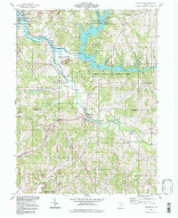 1994 Bowerston1998 Print · USGSThe rural border of Carroll and Harrison counties in the 1990s reflects a landscape shaped by water management and mineral wealth. Genealogists can locate family landmarks like Heller Cem, the Plum Run Ch, and the winding shores of Leesville Lake.
 - 1994 Map of Dellroy, 1998 Print
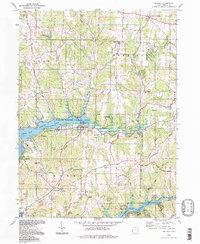 1994 Dellroy1998 Print · USGSThe rolling hills of Carroll County are defined by mid-century conservation and coal mining. Researchers can trace family history at Baxter Ridge Cem or locate former transit lines along the Old Railroad Grade near Dellroy.
 - 1994 Map of Uhrichsville, 1998 Print
 1994 Uhrichsville1998 Print · USGSThe twin cities of Uhrichsville and Dennison anchor this 1990s study of the Tuscarawas County coal and clay country. Trace the footprints of local industry and faith at the Roanoke Kilns, the Strip Mine, and St Elizabeth Ch.
End of results
Showing maps 1-5 of 5
Top cities near Orange Township
- New Philadelphia historical maps
- Uhrichsville historical maps
- Goshen historical maps
- Cadiz historical maps
- Carrollton historical maps
- Dennison historical maps
See more
Top neighborhoods of Orange Township
- Leesville Hills historical maps
- Leesville Lake Park historical maps
- New Hagerstown historical maps
- Thornhill historical maps
- Pines Cottage Area historical maps
- Hazelton historical maps
See more
Frequently asked questions
- What are the different types of historical maps available for Orange Township?
- What is the oldest map of Orange Township?
- Where can I purchase historical maps of Orange Township for my home or office?
- Where can I download high-res historical maps of Orange Township?
- Are there historical topographic maps available for Orange Township?
- Is there historical aerial imagery available for Orange Township?
- Where are historical maps of Orange Township sourced from?