Old Maps of Clark County, Ohio for Hiking & Exploration
Hike through history with 124 historic maps of Clark County. Explore old trails, ghost towns, and forgotten backroads — perfect for outdoor adventurers and local explorers.
- Rediscover forgotten places: Map out old mining camps, roads, and footpaths that no longer exist on modern maps.
- Layer with modern tools: Combine with LiDAR or satellite views to plan hikes through historical terrain.
- Made for exploration: Popular among hikers, overlanders, and local history lovers.
Use these maps to find adventure and explore the hidden past of Clark County.
Clark County, OH maps
(124)- 1904 Map of Springfield, 1952 Print
 1904 Springfield1952 Print · USGSWest-central Ohio was a bustling network of electric railways and turnpikes at the opening of the twentieth century. Researchers can trace the early industrial footprint of Springfield or locate family roots near Yellow Springs, Pitchin, and the Masonic Home.2 unique versions available
 - 1904 Map of Dayton, 1956 Print
 1904 Dayton1956 Print · USGSThe Miami Valley at the dawn of the 1900s shows a landscape transformed by the Miami and Erie Canal and a dense network of interurban electric railways. Researchers can trace historic river communities like Osborn and Tipp City or follow the early path of the National Road.
 - 1906 Map of Dayton, 1935 Print
 1906 Dayton1935 Print · USGSThe Dayton region in the early twentieth century shows a landscape transitioning from the canal era to the age of electric interurbans and railroads. Trace the original sites of Osborn and Fairfield or locate the path of the Miami and Erie Canal.2 unique versions available
 - 1906 Map of Springfield, 1942 Print
 1906 Springfield1942 Print · USGSSpringfield and the surrounding Clark and Greene County townships are shown here during the peak era of electric traction and steam rail. Genealogists can trace family footprints through Ferncliff Cemetery, the Masonic Home, and settlements like Yellow Springs and Enon.
 - 1907 Map of South Charleston, 1943 Print
 1907 South Charleston1943 Print · USGSThe Clark County countryside at the turn of the century shows a landscape dominated by rail travel and local school districts. Genealogists can locate family-named landmarks such as Yeazel School, Pancake Chapel, and the settlement of Dolly Varden.2 unique versions available
 - 1914 Map of Troy, 1931 Print
 1914 Troy1931 Print · USGSMiami County at the height of the interurban era shows a landscape defined by the Miami River and competing rail lines. Genealogists can locate family landmarks like the County Infirmary or schools such as Sheepskin School and Frogpond School.2 unique versions available
 - 1914 Map of St. Paris, 1954 Print
 1914 St. Paris1954 Print · USGSChampaign County at the height of the steam and electric rail era shows a landscape of thriving rural school districts and busy market towns. Trace the footprints of early education at Mt Jesse School or locate family roots near Millerstown and the County Infirmary.2 unique versions available
 - 1914 Map of Mechanicsburg, 1954 Print
 1914 Mechanicsburg1954 Print · USGSChampaign County at the start of the Great War was a thriving landscape of rail-connected villages and one-room schoolhouses. Genealogists can trace family footprints at Pretty Prairie School, the ancient Indian Mound, or along the busy tracks of the Erie RR in North Lewisburg.
 - 1916 Map of Mechanicsburg, 1936 Print
 1916 Mechanicsburg1936 Print · USGSChampaign County at the height of the rail era shows a landscape where small villages and rural schoolhouses thrived alongside major transit corridors. Genealogists and historians can trace family locations near landmarks like Indian Mound, Catawba Station, and Five Points School.
 - 1916 Map of St. Paris, 1936 Print
 1916 St. Paris1936 Print · USGSChampaign and Clark counties are shown here just before the first World War, revealing a landscape of rural schoolhouses and bustling rail junctions. Researchers can locate family landmarks like the Speece School or trace the path of the Ohio Electric Ry through Tremont City.
 - 1944 Map of Mechanicsburg
 1944 Mechanicsburg1944 Print · USGSChampaign County and its borders with Logan, Union, and Clark counties are shown here during the peak of the rail era in the 1940s. Genealogists and historians can locate numerous rural schools like Pretty Prairie Sch and landmarks such as the Indian Mound and White Cem.
 - 1944 Map of St. Paris
 1944 St. Paris1944 Print · USGSChampaign County at the height of the war years reveals a landscape of thriving rural schoolhouses and bustling rail junctions. Genealogists can trace family footprints through sites like Mt Zion Ch, Carysville, and the County Infirmary.
 - 1944 Map of Troy
 1944 Troy1944 Print · USGSMiami County during the mid-forties reveals a landscape of industrial river towns and an incredibly dense network of rural schools. Researchers can trace the path of the Miami and Erie Canal and locate family-named landmarks like Rhodhammel Sch and Staunton.
 - 1947 Map of Columbus, 1948 Print
 1947 Columbus1948 Print · USGSCentral Ohio in the late 1940s is captured in this survey, showing the post-war transition of its rail hubs and military airfield expansions. Genealogists and historians can trace the paths of the Ohio Canal, the Pennsylvania RR lines, and the Camp Sherman Military Reservation.
 - 1950 Map of Marion
 1950 Marion1950 Print · USGSCentral Ohio was a powerhouse of rail and river industry at the mid-century point, serving as a vital corridor between the Great Lakes and the Ohio River valley. Genealogists and rail historians can trace the paths of the Erie RR and Nickel Plate Road through towns like Bucyrus, Galion, and Upper Sandusky.
 - 1953 Map of Cincinnati, 1965 Print
 1953 Cincinnati1965 Print · USGSThe Ohio River valley and the industrial heartland of Indiana and Ohio are captured here during the mid-century peak of rail and river commerce. Genealogists and historians can trace connections between Cincinnati and outlying military sites like Camp Atterbury and Bakalar AFB.3 unique versions available
 - 1953 Map of Muncie, 1966 Print
 1953 Muncie1966 Print · USGSIndiana and Ohio borderlands thrive in the early fifties, showing a landscape defined by manufacturing cities and an intensive railroad network. Genealogists can trace family roots across the Indiana-Ohio line through Muncie, Celina, and Portland via the Pennsylvania railroad.5 unique versions available
 - 1954 Map of Clifton, 1956 Print
 1954 Clifton1956 Print · USGSSouth of Springfield in the mid-fifties, this area shows a landscape of river valleys and agricultural crossroads. Genealogists can trace family names through Bethel Cem, Emery Chapel, and old routes like Hustead Road or Pitchin Pike.
 - 1955 Map of Springfield, 1956 Print
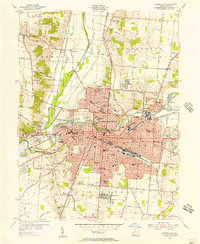 1955 Springfield1956 Print · USGSSpringfield and its Clark County surrounds are captured here during the mid-fifties industrial peak. Genealogists and historians can trace neighborhood growth through dozens of local landmarks, from Wittenberg College to the Masonic Home and Ferncliff Cemetery.
 - 1955 Map of Donnelsville, 1956 Print
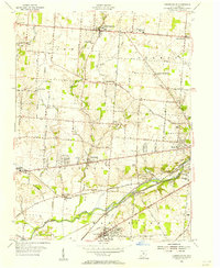 1955 Donnelsville1956 Print · USGSMid-century Clark County comes alive in this survey of the agricultural heartland between the Mad River and North Hampton. Researchers can trace the routes of the New York Central RR or locate family sites like the Old German Ch and Glen Haven Memorial Cem.
 - 1955 Map of Yellow Springs, 1956 Print
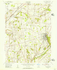 1955 Yellow Springs1956 Print · USGSMid-century Greene County centers on the academic and social landscape of Yellow Springs as it appeared in the mid-fifties. Local researchers can trace family landmarks and rural life at Antioch College, Pleasant Grove Ch, and the small settlement of Goes.2 unique versions available
 - 1955 Map of New Carlisle, 1956 Print
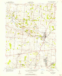 1955 New Carlisle1956 Print · USGSIn the mid-1950s, the rural borderlands between Miami and Clark Counties centered on the growing town of New Carlisle. Genealogists and researchers can trace family landmarks like Walnut Grove Cem, McKendree Ch, and the many schools and cemeteries dotting the Honey Creek valley.4 unique versions available
 - 1955 Map of Fairborn, 1957 Print
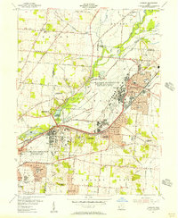 1955 Fairborn1957 Print · USGSGreene County is defined by the massive expansion of the Wright-Patterson Air Force Base during the mid-fifties. Researchers can trace the growth of Fairborn, locate the Wright Bros Memorial, and find family-named landmarks like the John Cox Cemetery.
 - 1956 Map of Muncie
 1956 Muncie1956 Print · USGSEastern Indiana and western Ohio are shown at a peak of rail-driven industry in the mid-fifties. Genealogists and rail historians can trace the paths of the Pennsylvania RR through Muncie or locate landmarks like Lake Saint Marys (Grand Lake Reservoir) and Frances Slocum State Forest.
 - 1957 Map of Cincinnati
 1957 Cincinnati1957 Print · USGSThe Ohio River valley and its surrounding highlands thrived during the mid-fifties industrial peak, centered on the bustling Cincinnati and Dayton metropolitan hubs. Researchers can trace the extensive rail networks and military sites like Wright-Patterson AFB and Camp Atterbury.
Showing maps 1-25 of 124
Top cities of Clark County
- Springfield historical maps
- Mad River historical maps
- New Carlisle historical maps
- Harmony historical maps
- Enon historical maps
- South Charleston historical maps
See more
Frequently asked questions
- What are the different types of historical maps available for Clark County?
- What is the oldest map of Clark County?
- Where can I purchase historical maps of Clark County for my home or office?
- Where can I download high-res historical maps of Clark County?
- Are there historical topographic maps available for Clark County?
- Is there historical aerial imagery available for Clark County?
- Where are historical maps of Clark County sourced from?