1960s Maps of Coshocton County, Ohio
Explore 20 historic maps of Coshocton County from the 1960s. These maps offer a rare glimpse into what life looked like during the 1960s — showing old roads, neighborhoods, homes, and landmarks that have changed or disappeared over time.
Whether you're researching your family's past, planning a metal detecting trip, or studying how Coshocton County's landscape evolved across the 1960s, these high-resolution maps are a powerful tool for exploring the history of this region.
- Focus on a specific era: All maps on this page are from the 1960s, giving you a focused view of this time period.
- See what’s changed: Compare century-old streets, trails, and buildings to today's modern landscape using overlays and satellite layers.
- Research with precision: Use these maps for genealogy, historical research, land use analysis, or educational projects.
- View, download, or print: Maps are fully viewable online in high resolution, and can be downloaded or printed for your own records.
Start exploring Coshocton County's history through authentic maps from the 1960s. This is your window into the past.
Coshocton County, OH maps
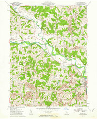
(20)- 1961 Map of Walhonding, 1963 Print
 1961 Walhonding1963 Print · USGSKnox and Coshocton counties are captured in the early sixties as the landscape's industrial and spiritual roots remained clearly visible. Genealogists and historians can trace family locations near Butler Ch, Newcastle Cem, and the old oil wells of Rabbit Ridge.4 unique versions available
 - 1961 Map of Baltic, 1963 Print
 1961 Baltic1963 Print · USGSThe tri-county border area of Tuscarawas, Holmes, and Coshocton comes into focus in the early sixties. Genealogists and local historians can locate rural landmarks like Mt Zion Cem, Union Valley Sch, and the Clay Pit Kilns near Baltic.2 unique versions available
 - 1961 Map of Newcomerstown, 1963 Print
 1961 Newcomerstown1963 Print · USGSThe Tuscarawas River valley in the early 1960s reveals a landscape shaped by coal extraction and old transit corridors. Researchers can trace the legacy of the Canal (Abandoned) and locate landmarks like the Cy Young Memorial Park and Stark Patent.2 unique versions available
 - 1961 Map of Fresno, 1963 Print
 1961 Fresno1963 Print · USGSIn the early sixties, the Tuscarawas River valley was a busy corridor for the Pennsylvania railroad and the expanding brick and mining industries. Genealogists can trace family names at Woods College Cem and Fairview Cem, or locate the Old Stone Fort near Orange.4 unique versions available
 - 1961 Map of Brinkhaven, 1963 Print
 1961 Brinkhaven1963 Print · USGSIn the early sixties, the Mohican River valley supported a mix of rail transit and active drilling near Brinkhaven. Researchers can trace old family burial sites like Borden Cem and rural landmarks such as Tiverton Ch and Riley Chapel.4 unique versions available
 - 1961 Map of Coshocton, 1963 Print
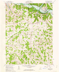
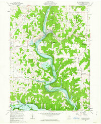
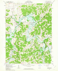
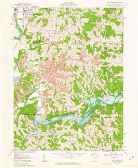
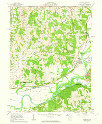
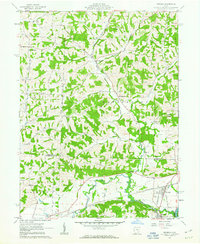
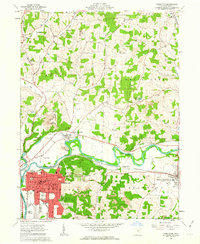 1961 Coshocton1963 Print · USGSCoshocton and its surrounding river forks are captured here in the early sixties, showing the industrial and agricultural heart of the county. Genealogists and historians can trace the locations of Sacred Heart Ch, Oak Grove Cem, and the specialized U S Hydrologic Experiment Station.4 unique versions available
 - 1961 Map of New Bedford, 1963 Print
 1961 New Bedford1963 Print · USGSThe rural borderlands of Holmes and Coshocton counties are captured here in the early sixties as a landscape of ridge-top farms and valley industry. Genealogists can locate family landmarks like Oak Hill Ch, Knob Cem, and the historic Becks Mills settlement.2 unique versions available
 - 1962 Map of Marion
 1962 Marion1962 Print · USGSCentral Ohio during the post-war era showcases a dense network of railroad towns and emerging interstate highways. Genealogists can trace family roots in smaller settlements like Houcktown and Marseilles or locate landmarks near Indian Lake.
 - 1962 Map of Canton
 1962 Canton1962 Print · USGSThe industrial heartland of Eastern Ohio and Western Pennsylvania thrives in the early sixties as steel mills and rail lines dominate the river valleys. Genealogists and historians can trace local landmarks like McKinley National Memorial, Malone College, and industrial sites such as Republic Steel Corp.2 unique versions available
 - 1962 Map of Perryton, 1963 Print
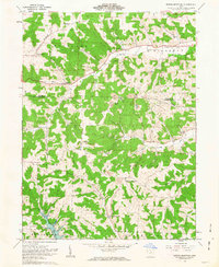
 1962 Perryton1963 Print · USGSLicking and Coshocton counties are shown in the early sixties as a rural landscape of winding creek valleys and dispersed hamlets. Researchers can trace family history at Perry Chapel, locate the Union Sch, or find the old Covered Bridge and Ashcraft Ford.3 unique versions available
 - 1962 Map of Randle, 1963 Print
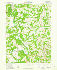
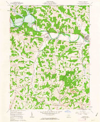
 1962 Randle1963 Print · USGSCoshocton County in the early sixties shows a landscape of river-valley agriculture and growing energy extraction. Researchers can trace the old railroad grade, locate family sites near Antioch Cem, or find industrial roots at strip mines and Sixmile Dam.4 unique versions available
 - 1962 Map of Spring Mountain, 1963 Print
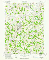
 1962 Spring Mountain1963 Print · USGSThe rolling hills of Coshocton County come into focus in the early sixties as a landscape of gas wells, strip mines, and remote hilltop cemeteries. Genealogists can trace family roots through sites like Union Grove Ch Cem, Fort Fizzle, and Dutch Run Ch.2 unique versions available
 - 1962 Map of Plainfield, 1963 Print
 1962 Plainfield1963 Print · USGSCoshocton and Guernsey counties are shown here in the early 1960s as the Wills Creek Reservoir reshaped the valley. Genealogists and local historians can trace small settlements like Linton Mills and Birds Run alongside numerous family cemeteries.4 unique versions available
 - 1962 Map of Killbuck, 1963 Print
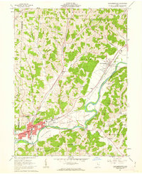
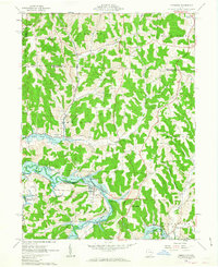
 1962 Killbuck1963 Print · USGSThe rural valleys of Holmes and Coshocton Counties are captured here in the early 1960s as a landscape of small rail-side hamlets and family farmsteads. Local historians can trace the PENNSYLVANIA line through Helmick or locate local landmarks like the Covered Bridge and Salem Cem.5 unique versions available
 - 1962 Map of Wills Creek, 1963 Print
 1962 Wills Creek1963 Print · USGSCoshocton and Muskingum counties are shown in the early 1960s as the regional economy shifted between river valley agriculture and heavy industrial mining. Researchers can trace rural life through Marquand Mills, the Wills Creek Dam, and numerous sites like Zion Ch Cem.4 unique versions available
 - 1962 Map of Conesville, 1963 Print
 1962 Conesville1963 Print · USGSThe Muskingum River valley comes to life in this early 1960s survey, showing the intensive coal mining and rail activity of central Ohio. Genealogists can locate family landmarks like McGee Cem, Titus Cem, and the rural community at New Moscow.4 unique versions available
 - 1962 Map of Warsaw, 1963 Print
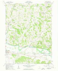
 1962 Warsaw1963 Print · USGSCoshocton County's river valleys and wooded uplands are captured here in the early sixties, showing the vital influence of the Walhonding River. Genealogists and historians can locate rural landmarks like Mohawk Village, Wilson Chapel, and the Old Railroad Grade.3 unique versions available
 - 1962 Map of Kimbolton, 1963 Print
 1962 Kimbolton1963 Print · USGSGuernsey County's rolling hills and the Wills Creek valley are captured in the early sixties, showing the landscape before modern development. Genealogists can trace family names through rural landmarks like Kimbolton Cem, Wheeling Sch, and the remote settlement of Postboy.3 unique versions available
 - 1962 Map of Trinway, 1963 Print
 1962 Trinway1963 Print · USGSThe Muskingum River valley and its complex rail junctions define this corner of Ohio in the early sixties. Genealogists can trace family landmarks like Mt Zion Cem, Broomstick Cem, and the old church at Wakatomika.4 unique versions available
 - 1966 Map of Marion, 1968 Print
 1966 Marion1968 Print · USGSCentral Ohio in the mid-sixties is captured during a period of rapid highway expansion and industrial connectivity. Genealogists and historians can trace rail-and-river networks through towns like Marion, Urbana, and Mount Vernon, or locate landmarks such as Malabar Farm and Black Hand Rock.3 unique versions available
End of results
Showing maps 1-20 of 20
Top cities of Coshocton County
- Coshocton historical maps
- Warsaw historical maps
- Conesville historical maps
- Plainfield historical maps
- Nellie historical maps
Frequently asked questions
- What are the different types of historical maps available for Coshocton County?
- What is the oldest map of Coshocton County?
- Where can I purchase historical maps of Coshocton County for my home or office?
- Where can I download high-res historical maps of Coshocton County?
- Are there historical topographic maps available for Coshocton County?
- Is there historical aerial imagery available for Coshocton County?
- Where are historical maps of Coshocton County sourced from?