Old Maps of Coshocton County, Ohio for Academic Research
Study the evolution of Coshocton County with 137 high-resolution historic maps. Whether you're teaching, researching, or modeling changes in land use, these maps provide essential visual documentation of urban, environmental, and geographic change.
- Analyze long-term change: Track patterns in development, transportation, and natural features.
- Ideal for environmental or urban studies: Support academic projects with primary historical map data.
- Use in the classroom or lab: Educators and researchers rely on these maps to bring historical context to life.
These maps are a powerful tool for teaching, research, and visualizing how Coshocton County has changed over the decades.
Coshocton County, OH maps
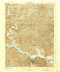
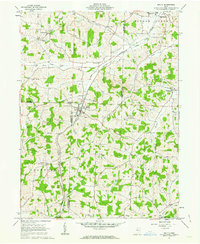
(137)- 1908 Map of Conesville, 1961 Print
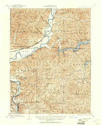 1908 Conesville1961 Print · USGSEastern Ohio at the dawn of the twentieth century was a landscape of river-valley commerce and tight-knit rural school districts. Researchers can trace the legacy of family farms and early industry through sites like Morgan Mill, Conesville, and the Science Hill School.
 - 1909 Map of Cambridge, 1963 Print
 1909 Cambridge1963 Print · USGSGuernsey County and the city of Cambridge are documented here in the early nineteen-hundreds, showing a region structured by river valleys and the historic National Road. Genealogists can trace early homesteads near Barnes Mill, the Galigher PO post office, and dozens of rural school sites.
 - 1910 Map of Frazeysburg, 1937 Print
 1910 Frazeysburg1937 Print · USGSMuskingum and Licking Counties are captured here during a pivotal era of rail dominance and canal obsolescence. Researchers can locate vanished rural schoolhouses like Pisgah School or trace the early paths of the Ohio Canal near Dresden.2 unique versions available
 - 1910 Map of Conesville, 1948 Print
 1910 Conesville1948 Print · USGSThe Muskingum River valley and the Ohio Canal are captured here in the decade before the Great War. Genealogists can trace family homesteads near dozens of rural landmarks like Young America School, Otsego, and Munroe Basin.
 - 1911 Map of Newcomerstown, 1959 Print
 1911 Newcomerstown1959 Print · USGSTuscarawas County in the early twentieth century is captured here as a corridor of heavy rail and old canal routes. Genealogists can locate family-named rural schools like Steitz School or May School and trace the original path of the Ohio Canal near Port Washington.
 - 1912 Map of Cambridge, 1946 Print
 1912 Cambridge1946 Print · USGSGuernsey County was a bustling hub of rail and river commerce at the start of the century. You can trace the path of the National Road and locate family landmarks like Barnes Mill, Zion Church, and dozens of district schools.2 unique versions available
 - 1913 Map of Newcomerstown, 1943 Print
 1913 Newcomerstown1943 Print · USGSTuscarawas County's industrial and educational roots are on display in the years before the Great War. Genealogists and historians can trace the Pennsylvania and Ohio Canal, locate the West Lafayette College, and find family schoolhouses like Putt School and Steitz School.
 - 1913 Map of Brinkhaven, 1958 Print
 1913 Brinkhaven1958 Print · USGSCoshocton County was a landscape of steep ridges and river valleys just before the First World War. Researchers can locate dozens of country schoolhouses and churches, such as Nigger Run School, Tiverton Center, and Wilson Chapel.
 - 1913 Map of Coshocton, 1964 Print
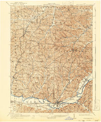
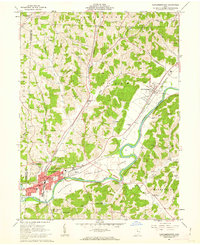
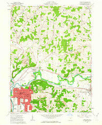
 1913 Coshocton1964 Print · USGSCoshocton and the Muskingum River headwaters are captured here just before the Great War, showing a landscape defined by the Ohio Canal and converging rail lines. Genealogists can trace family roots through dozens of rural schools like Soggy Hill School and vanished post offices like Clark PO.
 - 1915 Map of Brinkhaven, 1925 Print
 1915 Brinkhaven1925 Print · USGSCoshocton and Knox counties come alive in the decade before the Great War, showing a network of river-valley rail towns and upland farmsteads. Genealogists can trace family footprints across dozens of local landmarks like Nigger Run School 23, Mohawk Village, and New Guilford.2 unique versions available
 - 1915 Map of Coshocton, 1939 Print
 1915 Coshocton1939 Print · USGSCoshocton and the river forks are captured here just before the Great War, showing the region's transition from canal power to a rail-driven economy. Genealogists can locate dozens of numbered district schools and rural post offices like Bloomfield Clark PO, Roscoe, and Becks Mills.2 unique versions available
 - 1943 Map of Coshocton
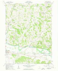
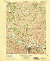 1943 Coshocton1943 Print · USGSCoshocton and its surrounding river valleys are captured here during the early years of the war, showcasing a dense network of rural schools and rail-fed towns. Researchers can locate the COUNTY INFIRMARY, trace the old CANAL route near Canal Lewisville, or find family sites near Soggy Hill Sch and Helmick Sta.
 - 1943 Map of Newcomerstown
 1943 Newcomerstown1943 Print · USGSThe Tuscarawas River valley was a thriving industrial and rail corridor during the mid-forties. Genealogists can locate family homesteads near dozens of rural schools like Goose Leg Sch, and trace river crossings at Sells Ford and Browning Ford.
 - 1950 Map of Marion
 1950 Marion1950 Print · USGSCentral Ohio was a powerhouse of rail and river industry at the mid-century point, serving as a vital corridor between the Great Lakes and the Ohio River valley. Genealogists and rail historians can trace the paths of the Erie RR and Nickel Plate Road through towns like Bucyrus, Galion, and Upper Sandusky.
 - 1951 Map of Canton
 1951 Canton1951 Print · USGSThe industrial heartland of Ohio and Pennsylvania reached its mid-century peak during this era of heavy rail and river transit. Genealogists and historians can trace the development of steel towns like Aliquippa and Weirton alongside the Ohio River and major lines of the Pennsylvania RR.
 - 1953 Map of Canton
 1953 Canton1953 Print · USGSThe industrial heartland of Ohio and Pennsylvania is captured at its mid-century peak in this detailed regional survey. Genealogists and historians can trace the vast rail networks of the Pennsylvania RR and find local landmarks like Nimisila Reservoir and Tappan Reservoir.
 - 1957 Map of Canton, 1971 Print
 1957 Canton1971 Print · USGSThe industrial heartland of eastern Ohio and western Pennsylvania comes alive in this mid-century survey of the Ohio River Valley. Trace the heritage of rail and river commerce through Pittsburgh, the massive steel towns along the Ohio River, and major junctions on the Pennsylvania RR.3 unique versions available
 - 1961 Map of Walhonding, 1963 Print
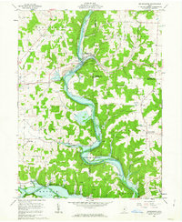
 1961 Walhonding1963 Print · USGSKnox and Coshocton counties are captured in the early sixties as the landscape's industrial and spiritual roots remained clearly visible. Genealogists and historians can trace family locations near Butler Ch, Newcastle Cem, and the old oil wells of Rabbit Ridge.4 unique versions available
 - 1961 Map of Baltic, 1963 Print
 1961 Baltic1963 Print · USGSThe tri-county border area of Tuscarawas, Holmes, and Coshocton comes into focus in the early sixties. Genealogists and local historians can locate rural landmarks like Mt Zion Cem, Union Valley Sch, and the Clay Pit Kilns near Baltic.2 unique versions available
 - 1961 Map of Newcomerstown, 1963 Print
 1961 Newcomerstown1963 Print · USGSThe Tuscarawas River valley in the early 1960s reveals a landscape shaped by coal extraction and old transit corridors. Researchers can trace the legacy of the Canal (Abandoned) and locate landmarks like the Cy Young Memorial Park and Stark Patent.2 unique versions available
 - 1961 Map of Fresno, 1963 Print
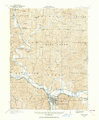
 1961 Fresno1963 Print · USGSIn the early sixties, the Tuscarawas River valley was a busy corridor for the Pennsylvania railroad and the expanding brick and mining industries. Genealogists can trace family names at Woods College Cem and Fairview Cem, or locate the Old Stone Fort near Orange.4 unique versions available
 - 1961 Map of Brinkhaven, 1963 Print
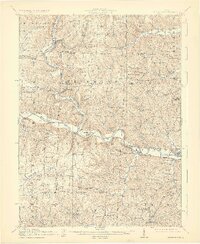
 1961 Brinkhaven1963 Print · USGSIn the early sixties, the Mohican River valley supported a mix of rail transit and active drilling near Brinkhaven. Researchers can trace old family burial sites like Borden Cem and rural landmarks such as Tiverton Ch and Riley Chapel.4 unique versions available
 - 1961 Map of Coshocton, 1963 Print
 1961 Coshocton1963 Print · USGSCoshocton and its surrounding river forks are captured here in the early sixties, showing the industrial and agricultural heart of the county. Genealogists and historians can trace the locations of Sacred Heart Ch, Oak Grove Cem, and the specialized U S Hydrologic Experiment Station.4 unique versions available
 - 1961 Map of New Bedford, 1963 Print
 1961 New Bedford1963 Print · USGSThe rural borderlands of Holmes and Coshocton counties are captured here in the early sixties as a landscape of ridge-top farms and valley industry. Genealogists can locate family landmarks like Oak Hill Ch, Knob Cem, and the historic Becks Mills settlement.2 unique versions available
 - 1962 Map of Marion
 1962 Marion1962 Print · USGSCentral Ohio during the post-war era showcases a dense network of railroad towns and emerging interstate highways. Genealogists can trace family roots in smaller settlements like Houcktown and Marseilles or locate landmarks near Indian Lake.
Showing maps 1-25 of 137
Top cities of Coshocton County
- Coshocton historical maps
- Warsaw historical maps
- Conesville historical maps
- Plainfield historical maps
- Nellie historical maps
Frequently asked questions
- What are the different types of historical maps available for Coshocton County?
- What is the oldest map of Coshocton County?
- Where can I purchase historical maps of Coshocton County for my home or office?
- Where can I download high-res historical maps of Coshocton County?
- Are there historical topographic maps available for Coshocton County?
- Is there historical aerial imagery available for Coshocton County?
- Where are historical maps of Coshocton County sourced from?