2020s Maps of Chagrin Falls, Ohio
Explore 2 historic maps of Chagrin Falls from the 2020s. These maps offer a rare glimpse into what life looked like during the 2020s — showing old roads, neighborhoods, homes, and landmarks that have changed or disappeared over time.
Whether you're researching your family's past, planning a metal detecting trip, or studying how Chagrin Falls's landscape evolved across the 2020s, these high-resolution maps are a powerful tool for exploring the history of this region.
- Focus on a specific era: All maps on this page are from the 2020s, giving you a focused view of this time period.
- See what’s changed: Compare century-old streets, trails, and buildings to today's modern landscape using overlays and satellite layers.
- Research with precision: Use these maps for genealogy, historical research, land use analysis, or educational projects.
- View, download, or print: Maps are fully viewable online in high resolution, and can be downloaded or printed for your own records.
Start exploring Chagrin Falls's history through authentic maps from the 2020s. This is your window into the past.
Chagrin Falls, OH maps
(2)- 2023 Map of South Russell, 2023 Print
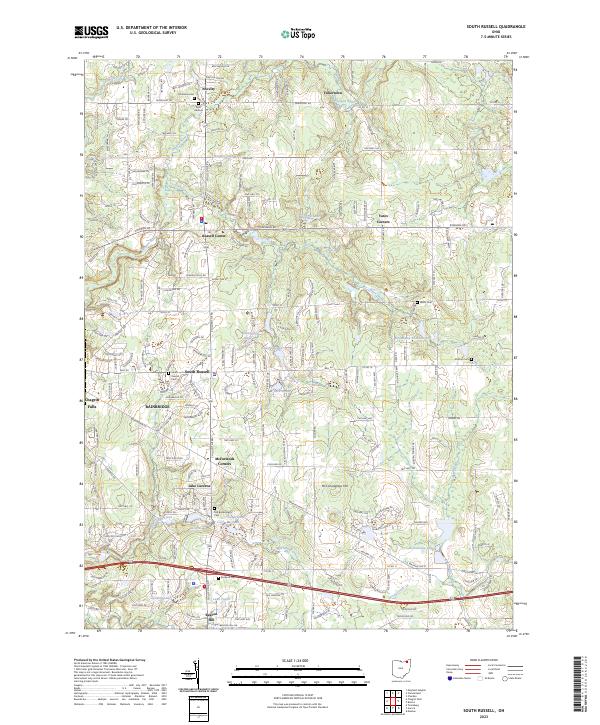 2023 South Russell2023 Print · USGSGeauga County's suburban and rural transition is on display here in the early twenty-first century, showing a landscape shaped by the Chagrin River. Researchers can trace local history through numerous burial grounds like Munn Cem and South Russell Cem or explore established hamlets such as Novelty and Yates Corners.
 - 2023 Map of Chagrin Falls, 2023 Print
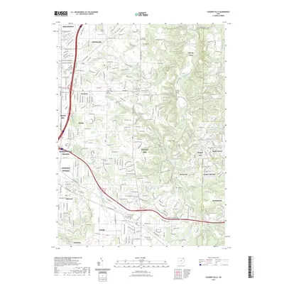 2023 Chagrin Falls2023 Print · USGSModern-day Cuyahoga County comes into focus as a blend of established villages and quiet river valleys. Researchers can trace family sites at Grove Hill Cemetery or explore landmarks like Ursuline College and the Chagrin Falls Park.
End of results
Showing maps 1-2 of 2
Top cities near Chagrin Falls
- Cleveland historical maps
- Cuyahoga Falls historical maps
- Euclid historical maps
- Mentor historical maps
- Cleveland Heights historical maps
- Garfield Heights historical maps
See more
Top neighborhoods of Chagrin Falls
- Chagrin Falls West Side Historic District historical maps
- Chagrin Falls Triangle Park Commercial Historic District historical maps
Frequently asked questions
- What are the different types of historical maps available for Chagrin Falls?
- What is the oldest map of Chagrin Falls?
- Where can I purchase historical maps of Chagrin Falls for my home or office?
- Where can I download high-res historical maps of Chagrin Falls?
- Are there historical topographic maps available for Chagrin Falls?
- Is there historical aerial imagery available for Chagrin Falls?
- Where are historical maps of Chagrin Falls sourced from?