1990s Maps of Cleveland, Ohio
Explore 8 historic maps of Cleveland from the 1990s. These maps offer a rare glimpse into what life looked like during the 1990s — showing old roads, neighborhoods, homes, and landmarks that have changed or disappeared over time.
Whether you're researching your family's past, planning a metal detecting trip, or studying how Cleveland's landscape evolved across the 1990s, these high-resolution maps are a powerful tool for exploring the history of this region.
- Focus on a specific era: All maps on this page are from the 1990s, giving you a focused view of this time period.
- See what’s changed: Compare century-old streets, trails, and buildings to today's modern landscape using overlays and satellite layers.
- Research with precision: Use these maps for genealogy, historical research, land use analysis, or educational projects.
- View, download, or print: Maps are fully viewable online in high resolution, and can be downloaded or printed for your own records.
Start exploring Cleveland's history through authentic maps from the 1990s. This is your window into the past.
Cleveland, OH maps
(8)- 1994 Map of Cleveland North
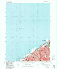
 1994 Cleveland North1994 Print · USGSThe Lake Erie shoreline in the mid-nineties shows the urban density of Northeast Ohio giving way to coastal preserves. Researchers can trace the development of lakeside towns like Eastlake and Madison while locating landmarks like Burke Lakefront Airport and Fairport Harbor.
 - 1994 Map of Cleveland South
 1994 Cleveland South1994 Print · USGSThe metropolitan corridor between Akron and Cleveland is shown here in the mid-nineties during a period of significant suburban growth. Researchers can trace the path of the Ohio Turnpike or explore expansive recreation lands like West Branch State Park.
 - 1994 Map of Cleveland North, 1997 Print
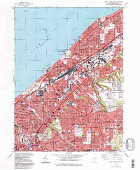
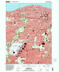
 1994 Cleveland North1997 Print · USGSCleveland's lakefront and industrial heart are captured here in the mid-1990s, showcasing a landscape of massive public infrastructure and dense neighborhood blocks. Researchers can trace the legacy of the Municipal Stadium, the grounds of Fenn College, and the sprawling Cleveland Lakefront State Park.
 - 1994 Map of East Cleveland, 1997 Print
 1994 East Cleveland1997 Print · USGSGreater Cleveland’s eastern lakefront and inner suburbs reached their peak industrial and residential density by the mid-nineties. Genealogists and historians can trace neighborhood evolution through sites like Lake View Cemetery, the Collinwood Yard, and Notre Dame College.
 - 1994 Map of North Olmsted, 2000 Print
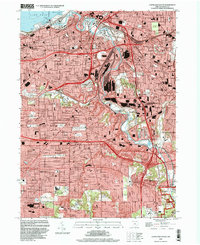
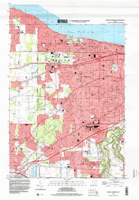 1994 North Olmsted2000 Print · USGSThe western Cleveland suburbs are shown here in the mid-nineties as they matured into dense residential communities. Genealogists can trace local roots through numerous sites like Butternut Ridge Cemetery, Holy Trinity School, and Evergreen Cemetery.
 - 1994 Map of Shaker Heights, 2000 Print
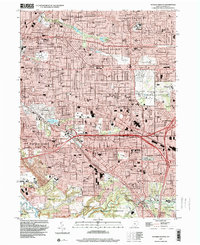 1994 Shaker Heights2000 Print · USGSCuyahoga County’s eastern suburbs are shown here in the mid-nineties, a landscape of planned residential communities and extensive park systems. Researchers can trace local institutions like John Carroll University or find family markers in Calvary Cemetery and Highland Park Cemetery.
 - 1994 Map of Lakewood, 2000 Print
 1994 Lakewood2000 Print · USGSGreater Cleveland neighborhoods like Lakewood and Rocky River appear in full suburban maturity during the 1990s. Researchers can trace local parish history at St Patricks Cem or explore the vast footprint of the Cleveland-Hopkins International Airport.
 - 1994 Map of Cleveland South, 2000 Print
 1994 Cleveland South2000 Print · USGSThe industrial heart of the Cuyahoga Valley and the surrounding suburbs are shown here in the mid-nineties. You can trace family history at Woodland Cemetery, locate the Stearns Homestead, or explore the rail networks of Conrail and the Baltimore and Ohio.
End of results
Showing maps 1-8 of 8
Top cities near Cleveland
- Parma historical maps
- Lakewood historical maps
- Euclid historical maps
- Strongsville historical maps
- Cleveland Heights historical maps
- Brunswick historical maps
See more
Top neighborhoods of Cleveland
- Bellaire-Puritas historical maps
- Cudell historical maps
- Jefferson historical maps
- Kamms Corner historical maps
- West Boulevard historical maps
- Industrial Valley historical maps
See more
Frequently asked questions
- What are the different types of historical maps available for Cleveland?
- What is the oldest map of Cleveland?
- Where can I purchase historical maps of Cleveland for my home or office?
- Where can I download high-res historical maps of Cleveland?
- Are there historical topographic maps available for Cleveland?
- Is there historical aerial imagery available for Cleveland?
- Where are historical maps of Cleveland sourced from?