Old Maps of Cuyahoga County, Ohio for Genealogy
Trace your family roots with 143 historic maps of Cuyahoga County. These high-res maps reveal old neighborhoods, homesites, landmarks, and streets — helping you uncover where your ancestors lived and how the area evolved over time.
- Explore historic neighborhoods: Identify where your relatives may have lived in the 1800s or 1900s.
- Compare maps over time: Trace the changes in streets, buildings, and landmarks for multi-generational research.
- Perfect for genealogy & ancestry research: Used by family historians and researchers to map out lineage and migration.
These maps are an incredible resource for exploring your personal connection to Cuyahoga County's past.
Cuyahoga County, OH maps
(143)- 1901 Map of Euclid, 1963 Print
 1901 Euclid1963 Print · USGSThe Lake Erie shoreline east of Cleveland was a bustling network of rail and recreation at the turn of the century. Trace early suburban development in Nottingham and Collamer, or locate landmarks like Euclid Beach Park and the Garfield Tomb.
 - 1902 Map of Berea, 1958 Print
 1902 Berea1958 Print · USGSCuyahoga and Lorain counties appear here at the turn of the century, when electric railways and steam lines were transforming small villages into bustling suburbs. Genealogists and local historians can trace family-named landmarks and early rail junctions in Berea, Olmsted Falls, and the lakeside community of Clifton Park.2 unique versions available
 - 1903 Map of Cleveland, 1939 Print
 1903 Cleveland1939 Print · USGSThe Cleveland lakefront and Cuyahoga valley are captured here at the start of the twentieth century as rail lines and industry expanded southward. Genealogists and local historians can locate early landmarks like Riverside Cemetery, Walling Corners, and Brandywine.2 unique versions available
 - 1903 Map of Euclid, 1939 Print
 1903 Euclid1939 Print · USGSThe Lake Erie shoreline east of Cleveland at the turn of the century shows a landscape of growing rail suburbs and lakeside resorts. Genealogists and local historians can trace old neighborhoods like Bluestone and Nottingham or locate the Garfield Tomb and Euclid Beach Park during their early years.2 unique versions available
 - 1904 Map of Berea
 1904 Berea1904 Print · USGSWestern Cuyahoga and northern Lorain counties are seen here at the start of the century as electric railways began connecting rural towns to the city. Trace the early streets of Olmsted Falls, the winding Rocky River, and vanished stops like Hardscrabble and Copopa.7 unique versions available
 - 1905 Map of Mentor, 1961 Print
 1905 Mentor1961 Print · USGSLake County and Geauga County thrived in the early twentieth century as a hub for electric rail travel and river-powered industry. Genealogists and historians can trace the foundations of Willoughby and Painesville or locate early milling sites like Wilson Mills and Fowlers Mill.
 - 1906 Map of Chagrin Falls, 1955 Print
 1906 Chagrin Falls1955 Print · USGSThe Western Reserve landscape of Northeast Ohio is captured here during a period of rapid transit growth and settlement. Researchers can trace early township hubs and rail stops like Falls Junction Glenwillow PO, Orange Hill Church, and the winding Cleveland and Garrettsville Electric RR.
 - 1907 Map of Mentor, 1947 Print
 1907 Mentor1947 Print · USGSNortheast Ohio thrives at the turn of the century, where the electric railway and steam lines meet the Lake Erie shore. Genealogists can trace early homesteads near Eagles Mill, Richmond Grand River PO, and the old postal stop at Mulberry Corners.
 - 1908 Map of Chagrin Falls, 1939 Print
 1908 Chagrin Falls1939 Print · USGSThe Chagrin Valley at the turn of the century was a crossroads of electric interurban lines and early rural post offices. Trace the old rail stops at Aurora Station and Cannons Crossing, or locate family landmarks like Orange Hill Church.2 unique versions available
 - 1950 Map of Cleveland
 1950 Cleveland1950 Print · USGSCovers Cuyahoga County, including Cleveland, Akron, and other nearby areas
 - 1950 Map of Erie, 1953 Print
 1950 Erie1953 Print · USGSThe northern and southern shores of the Great Lakes meet in the mid-twentieth century, showcasing the vital shipping and rail corridors between Ontario and Pennsylvania. Trace the routes of the Michigan Central railroad or locate coastal landmarks like Presque Isle Light and the settlement of Iona Station.
 - 1953 Map of South Russell, 1954 Print
 1953 South Russell1954 Print · USGSGeauga County’s rolling landscape is shown here in the early fifties as the area began transitioning from rural farmsteads to suburban enclaves. Researchers can trace historic cemeteries and civic landmarks like Music Cem, Novelty P O, and the Chagrin Falls Airport.
 - 1953 Map of Chagrin Falls, 1955 Print
 1953 Chagrin Falls1955 Print · USGSCuyahoga County in the mid-1950s shows a landscape of growing suburbs, river valleys, and recreational estates. Researchers can find numerous historic cemeteries and social landmarks such as Beechbrook Orphanage, Orange Hill Cem, and the Solon Airport.
 - 1953 Map of West View, 1955 Print
 1953 West View1955 Print · USGSLorain and Cuyahoga counties are shown here in the mid-1950s, a landscape defined by small farming hamlets and active railroads. Researchers can trace historic family lands near Hardscrabble, locate old burials at St Marys Cem, and follow the path of the New York Central through West View.
 - 1953 Map of Shaker Heights, 1955 Print
 1953 Shaker Heights1955 Print · USGSThe eastern suburbs of Cleveland come into sharp focus in the early 1950s as the Heights communities and industrial corridors expanded. Genealogists and local historians can locate neighborhood landmarks like Calvary Cemetery, the Cranwood Race Track, and dozens of parochial schools like St Cecilia Sch.
 - 1953 Map of Broadview Heights, 1955 Print
 1953 Broadview Heights1955 Print · USGSBroadview Heights and the southern Cleveland suburbs appear in the early fifties during a period of major infrastructure expansion. Genealogists and local historians can locate early broadcast sites like Television Station (WXEL), local schools including Marycrest Sch, and the emerging path of the Ohio Turnpike.2 unique versions available
 - 1953 Map of Berea, 1955 Print
 1953 Berea1955 Print · USGSSouthwestern Cleveland suburbs were expanding rapidly in the early fifties as the rural lines of Medina County met the industrial growth of Cuyahoga County. Genealogists and historians can trace the grounds of Crile General Hospital, find the Old Soldiers Cemetery, and locate early schoolhouses like Fairwood Sch.
 - 1953 Map of East Cleveland, 1955 Print
 1953 East Cleveland1955 Print · USGSCuyahoga County’s eastern suburbs and shoreline thrive in the early fifties as neighborhoods like Euclid and Cleveland integrate. Genealogists and historians can locate numerous local institutions, from Lake View Cemetery and Case Observatory to Euclid Beach Park.
 - 1953 Map of Twinsburg, 1955 Print
 1953 Twinsburg1955 Print · USGSNortheastern Ohio is shown here during a period of rapid post-war expansion, with the Ohio Turnpike still under construction. Genealogists and local historians can locate Crown Hill Cemetery, the Cleveland Boys Sch, and rail-side hamlets like Falls Junction and Glenwillow.
 - 1953 Map of Cleveland South, 1955 Print
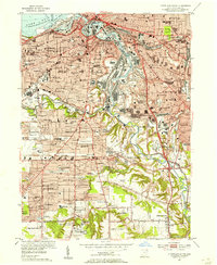 1953 Cleveland South1955 Print · USGSPostwar Cleveland and its southern suburbs appear here as a thriving industrial hub along the winding Cuyahoga River. Genealogists and local historians can trace parish schools and numerous cemeteries like St Theodosius Cemetery and Woodland Cemetery.
 - 1953 Map of Northfield, 1955 Print
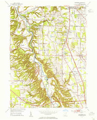 1953 Northfield1955 Print · USGSThe Cuyahoga Valley in the early 1950s reveals a landscape poised between its industrial rail past and the coming highway era. Genealogists and researchers can trace the early path of the Ohio Turnpike, the mill site at Jaite, and mid-century landmarks like the Drive-in Theater.2 unique versions available
 - 1953 Map of Lakewood, 1955 Print
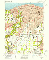 1953 Lakewood1955 Print · USGSCuyahoga County’s western suburbs are shown in detail during the early fifties, featuring the deep gorge of the Rocky River. Genealogists and historians can trace local parish roots at St James Sch or locate family plots in Lakewood Park Cem and Holy Cross Cem.
 - 1953 Map of North Olmsted, 1955 Print
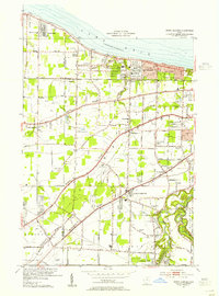 1953 North Olmsted1955 Print · USGSCoastal Cuyahoga and Lorain Counties are captured in the mid-1950s as suburban growth reaches the old ridge roads. Genealogists can trace family plots at Sunset Memorial Park Cemetery or locate local landmarks like Avon Airport and Olmsted Falls.
 - 1953 Map of Mayfield Heights, 1955 Print
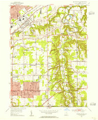 1953 Mayfield Heights1955 Print · USGSGreater Cleveland’s eastern suburbs were undergoing a mid-century transformation as residential grids met the river valley. Genealogists can locate family sites near the Little Church in the Vale or the Borromeo Seminary and trace the original County Airport grounds.2 unique versions available
 - 1953 Map of Cleveland North, 1955 Print
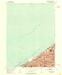 1953 Cleveland North1955 Print · USGSCleveland's lakefront and urban core are captured here in the early fifties during the city's industrial and maritime height. Genealogists and local historians can trace neighborhood landmarks from Gordon Park to Bratenahl, including Fenn College and the New York Central rail lines.
Showing maps 1-25 of 143
Top cities of Cuyahoga County
- Cleveland historical maps
- Parma historical maps
- Lakewood historical maps
- Euclid historical maps
- Strongsville historical maps
- Cleveland Heights historical maps
See more
Frequently asked questions
- What are the different types of historical maps available for Cuyahoga County?
- What is the oldest map of Cuyahoga County?
- Where can I purchase historical maps of Cuyahoga County for my home or office?
- Where can I download high-res historical maps of Cuyahoga County?
- Are there historical topographic maps available for Cuyahoga County?
- Is there historical aerial imagery available for Cuyahoga County?
- Where are historical maps of Cuyahoga County sourced from?