1900s (20th Century) Maps of Yorkshire, Ohio
Explore 9 historic maps of Yorkshire from the 1900s (20th Century). These maps offer a rare glimpse into what life looked like during the 1900s — showing old roads, neighborhoods, homes, and landmarks that have changed or disappeared over time.
Whether you're researching your family's past, planning a metal detecting trip, or studying how Yorkshire's landscape evolved across the 1900s, these high-resolution maps are a powerful tool for exploring the history of this region.
- Focus on a specific era: All maps on this page are from the 1900s, giving you a focused view of this time period.
- See what’s changed: Compare century-old streets, trails, and buildings to today's modern landscape using overlays and satellite layers.
- Research with precision: Use these maps for genealogy, historical research, land use analysis, or educational projects.
- View, download, or print: Maps are fully viewable online in high resolution, and can be downloaded or printed for your own records.
Start exploring Yorkshire's history through authentic maps from the 1900s. This is your window into the past.
Yorkshire, OH maps
(9)- 1908 Map of St. Henry, 1944 Print
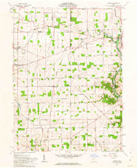
 1908 St. Henry1944 Print · USGSMercer and Darke counties at the start of the twentieth century show a landscape defined by rail-side commerce and early drainage engineering. Genealogists can trace family roots in settlements like St Henry, Burkettsville, and Coldwater, or locate landmarks such as Goulder School and Gilbert Sta.
 - 1909 Map of Loramie, 1961 Print
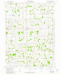
 1909 Loramie1961 Print · USGSWestern Ohio at the opening of the twentieth century was a landscape defined by the transition from canal transport to electric rail. Genealogists can trace family names across dozens of rural school districts like Walkup School and Diters School, or locate old parish centers such as Maria Stein and St John.
 - 1911 Map of Loramie, 1936 Print
 1911 Loramie1936 Print · USGSWestern Ohio at the start of the twentieth century shows a landscape transitioning from the canal era to the age of electric rail. Researchers can trace the Miami and Erie Canal through Minster and New Bremen, or locate family sites near St Patricks Church and Schwaberow School.
 - 1944 Map of Loramie
 1944 Loramie1944 Print · USGSWest-central Ohio farmland is captured here during the mid-forties, showing the intricate grid of rural school districts and turnpikes. Researchers can trace family-named sites like Fledderjohn Sch and St Patricks Ch near the Loramie Reservoir.
 - 1953 Map of Muncie, 1966 Print
 1953 Muncie1966 Print · USGSIndiana and Ohio borderlands thrive in the early fifties, showing a landscape defined by manufacturing cities and an intensive railroad network. Genealogists can trace family roots across the Indiana-Ohio line through Muncie, Celina, and Portland via the Pennsylvania railroad.5 unique versions available
 - 1956 Map of Muncie
 1956 Muncie1956 Print · USGSEastern Indiana and western Ohio are shown at a peak of rail-driven industry in the mid-fifties. Genealogists and rail historians can trace the paths of the Pennsylvania RR through Muncie or locate landmarks like Lake Saint Marys (Grand Lake Reservoir) and Frances Slocum State Forest.
 - 1961 Map of Osgood, 1963 Print
 1961 Osgood1963 Print · USGSThis western Ohio landscape at the start of the sixties reveals a countryside shaped by the historic Treaty Line and the remnants of the canal era. Genealogists can locate numerous rural burial sites like Walkup Cem and St Martins Cem near settlements like Osgood and Willowdell.3 unique versions available
 - 1961 Map of North Star, 1963 Print
 1961 North Star1963 Print · USGSIn the early 1960s, this portion of Darke and Mercer counties remained a strictly agricultural landscape defined by the Greenville Treaty Line. Family researchers can trace ancestral properties near North Star or locate quiet burial grounds like Brock Cem and Holsapple Cem.2 unique versions available
 - 1986 Map of Piqua
 1986 Piqua1986 Print · USGSThe western Ohio and eastern Indiana borderlands appear here in the mid-1980s, showcasing a landscape of river-valley industry and fertile plains. Researchers can trace historic rail lines like Conrail and Norfolk and Western through towns like Greenville and Winchester.3 unique versions available
End of results
Showing maps 1-9 of 9
Top cities near Yorkshire
- Piqua historical maps
- Greenville historical maps
- Celina historical maps
- Saint Marys historical maps
- Coldwater historical maps
- New Bremen historical maps
See more
Frequently asked questions
- What are the different types of historical maps available for Yorkshire?
- What is the oldest map of Yorkshire?
- Where can I purchase historical maps of Yorkshire for my home or office?
- Where can I download high-res historical maps of Yorkshire?
- Are there historical topographic maps available for Yorkshire?
- Is there historical aerial imagery available for Yorkshire?
- Where are historical maps of Yorkshire sourced from?