2020s Maps of Erie County, Ohio
Explore 14 historic maps of Erie County from the 2020s. These maps offer a rare glimpse into what life looked like during the 2020s — showing old roads, neighborhoods, homes, and landmarks that have changed or disappeared over time.
Whether you're researching your family's past, planning a metal detecting trip, or studying how Erie County's landscape evolved across the 2020s, these high-resolution maps are a powerful tool for exploring the history of this region.
- Focus on a specific era: All maps on this page are from the 2020s, giving you a focused view of this time period.
- See what’s changed: Compare century-old streets, trails, and buildings to today's modern landscape using overlays and satellite layers.
- Research with precision: Use these maps for genealogy, historical research, land use analysis, or educational projects.
- View, download, or print: Maps are fully viewable online in high resolution, and can be downloaded or printed for your own records.
Start exploring Erie County's history through authentic maps from the 2020s. This is your window into the past.
Erie County, OH maps
(14)- 2023 Map of Kipton, 2023 Print
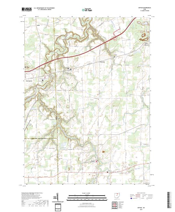 2023 Kipton2023 Print · USGSKipton and the rural townships of North Central Ohio appear here in the early twenty-first century, showing a landscape of scattered villages and family farmsteads. Genealogists can locate several historic burial sites like Harrison Cemetery and Sanders Hill Cemetery, alongside landmarks like Firelands Boy Scout Lake.
 - 2023 Map of Bellevue, 2023 Print
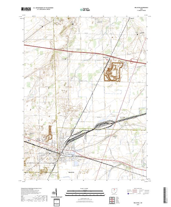 2023 Bellevue2023 Print · USGSInland from Lake Erie in the 2020s, this area of northern Ohio reveals a landscape defined by county-line crossroads and municipal reservoirs. Researchers can trace family history through a dozen rural burial grounds including Wickwire Cem and Sandhill Cem near the hamlet of Weyers.
 - 2023 Map of Vermilion West, 2023 Print
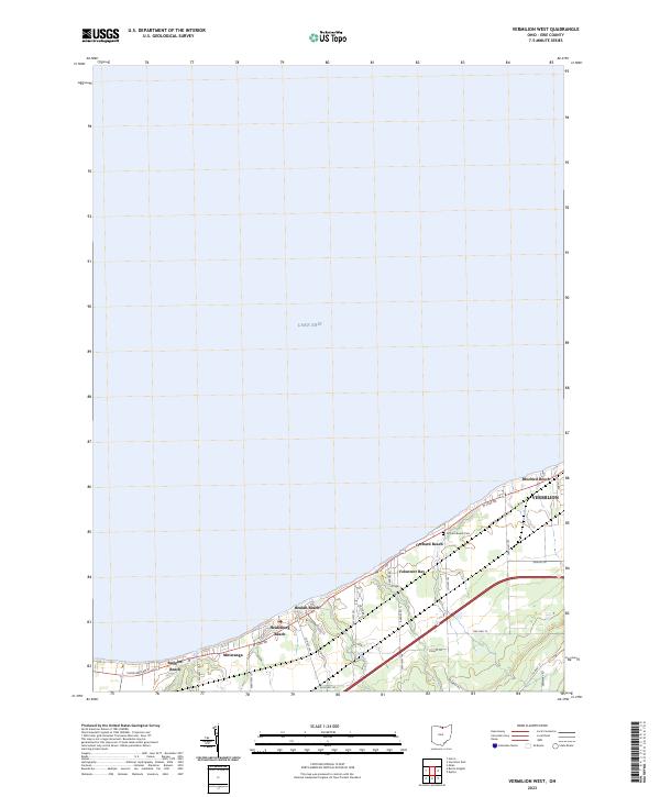 2023 Vermilion West2023 Print · USGSThe Erie County shoreline west of Vermilion is captured in the early 2020s, showing a dense network of lakefront communities and coastal creeks. Researchers can trace the layout of historic summer colonies such as Mitiwanga, Ruggles Beach, and Beulah Beach along the bluffs of Lake Erie.
 - 2023 Map of Sandusky, 2023 Print
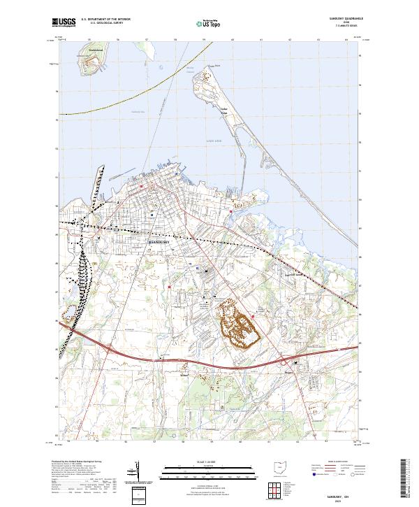 2023 Sandusky2023 Print · USGSThe Lake Erie shoreline and Sandusky’s urban grid appear here in high detail, showing the city's growth and maritime infrastructure. Genealogists can locate several significant burial sites, including the Cholera Cem, Saint Marys Cem, and the Ohio Veterans Home Cem.
 - 2023 Map of Gypsum, 2023 Print
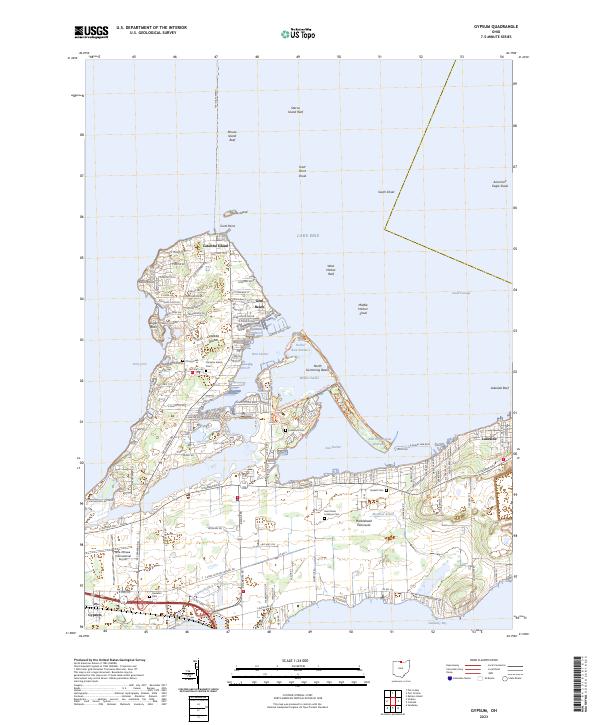 2023 Gypsum2023 Print · USGSThe Lake Erie shoreline in the early 2020s reveals a detailed landscape of coastal communities and maritime hazards. Researchers can trace local history through sites like Catawba Island Cem or explore the resort layout of Lakeside and Gem Beach.
 - 2023 Map of Vermilion East, 2023 Print
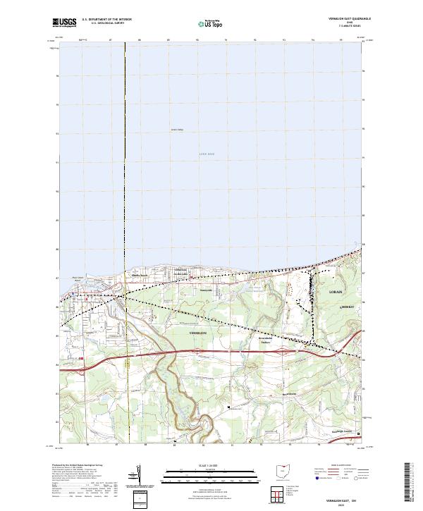 2023 Vermilion East2023 Print · USGSThe Lake Erie shoreline near the Lorain and Erie county line shows a landscape of coastal communities and deep river valleys in this modern survey. Researchers can locate family landmarks like Rugby Cem and Kendeigh Corner or trace the winding course of the Vermilion River.
 - 2023 Map of Kimball, 2023 Print
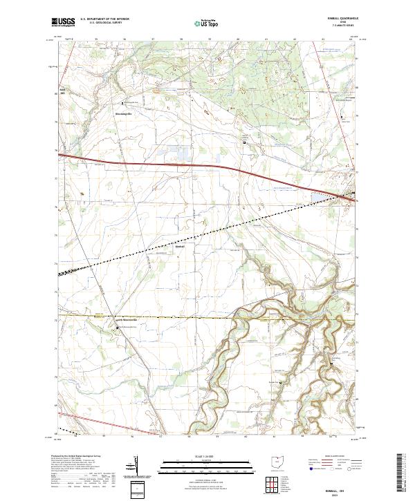 2023 Kimball2023 Print · USGSThe borderlands of Erie and Huron counties are captured here in the early twenty-first century, showing a landscape shaped by water and memory. Genealogists can locate several local burial sites like Bloomingville Cem and Ruggles Cem among the fertile bends of the Huron River.
 - 2023 Map of Berlin Heights, 2023 Print
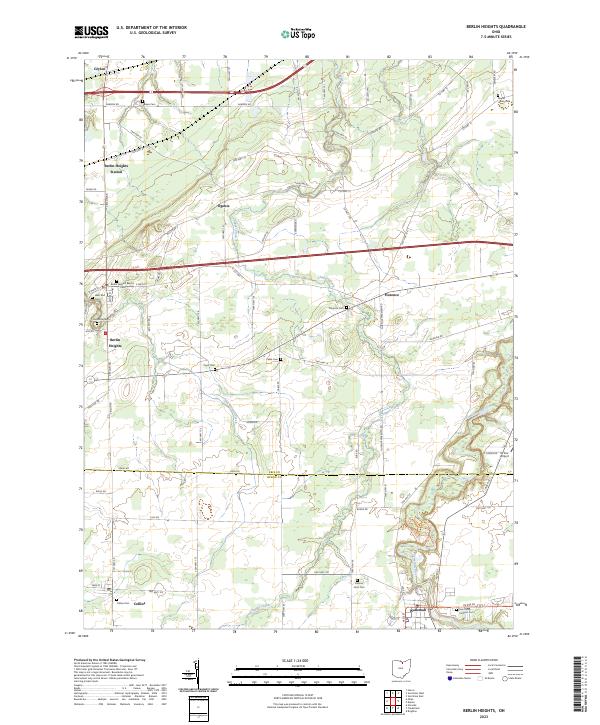 2023 Berlin Heights2023 Print · USGSNorthern Ohio's farm country and river valleys are captured here in the 2020s, spanning the border of Erie and Huron counties. Researchers can locate many local landmarks like Maple Grove Cem, Saint Mary Catholic Cem, and the village of Wakeman.
 - 2023 Map of Put-in-Bay, 2023 Print
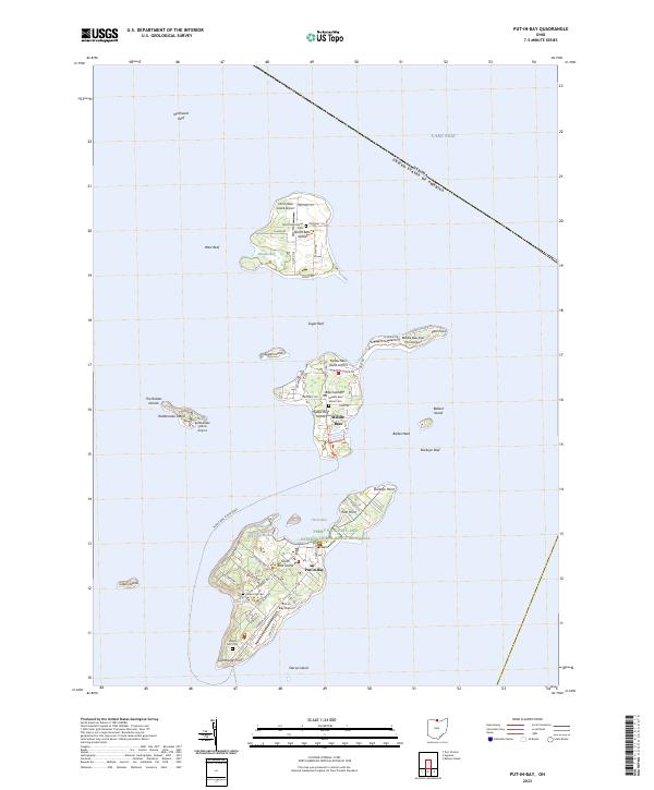 2023 Put-in-Bay2023 Print · USGSThe Bass Islands of Lake Erie are captured in detail during the early 2020s, showing the modern layout of this famous archipelago. Trace family sites at Crown Hill Cem and locate local landmarks like the Perry's Victory and International Peace Memorial.
 - 2023 Map of Kelleys Island, 2023 Print
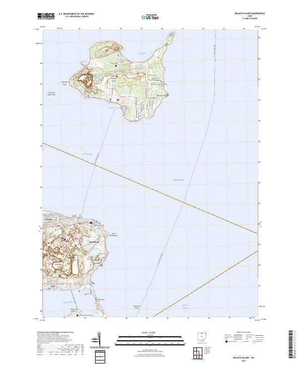 2023 Kelleys Island2023 Print · USGSKelleys Island and the Marblehead Peninsula appear here in the early twenty-first century, showing the enduring maritime character of Erie County. Researchers can locate numerous burial grounds like Confederate Stockade Cem and trace paths like the Kelleys Island East Quarry Trl.
 - 2023 Map of Huron, 2023 Print
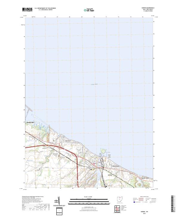 2023 Huron2023 Print · USGSThe Erie County shoreline comes into focus in this recent survey of the waterfront between Sandusky and Huron. Researchers can trace local landmarks from Hinde Airport and Huron Cem to the beach communities of Rye Beach and Nickel Plate Beach.
 - 2023 Map of Milan, 2023 Print
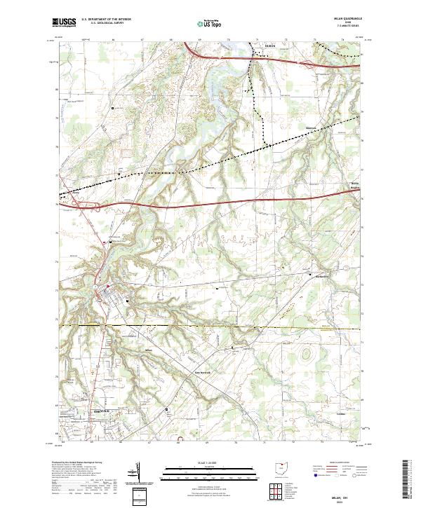 2023 Milan2023 Print · USGSNorth Central Ohio's river valleys and rural townships are captured here in the early twenty-first century. Genealogists can trace family footprints across numerous sites like Saint Marys Cem, Milan North Cem, and the historic settlement at Shinrock.
 - 2023 Map of Castalia, 2023 Print
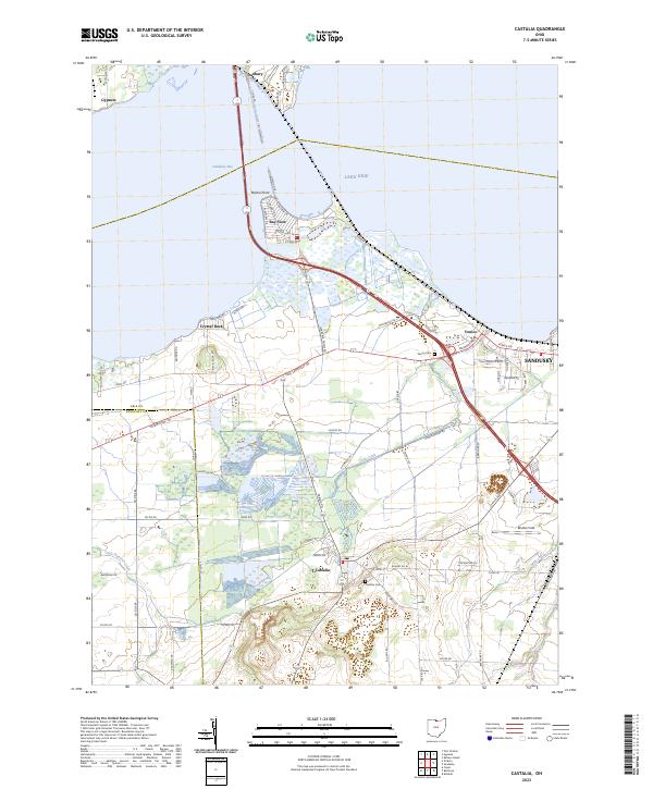 2023 Castalia2023 Print · USGSThe Erie County shoreline near Castalia and Sandusky is shown in this recent survey of the bay. Researchers can trace local lineage through Castalia Cem, explore the residential layout of Bay View, or locate the historic path of Old Railroad Rd.
 - 2023 Map of Vickery, 2023 Print
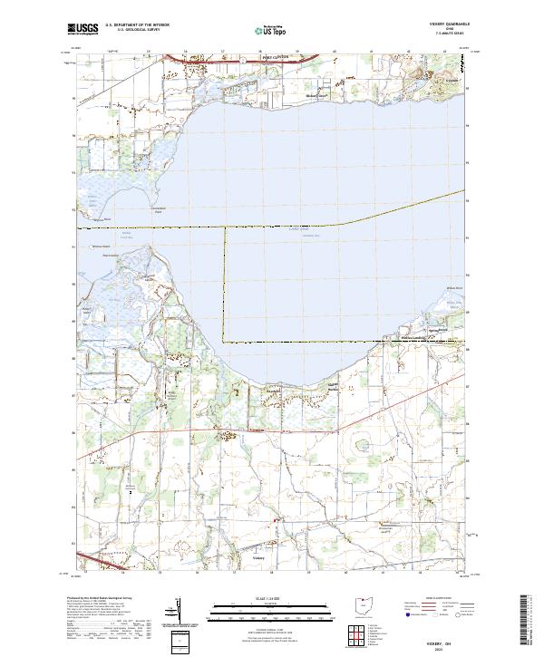 2023 Vickery2023 Print · USGSThe marshes and inlets of Sandusky Bay are captured here in the early 2020s, showing a landscape defined by the water. Researchers can locate Whites Landing, the rural community of Vickery, and the McCreery Farm Cem.
End of results
Showing maps 1-14 of 14
Top cities of Erie County
Frequently asked questions
- What are the different types of historical maps available for Erie County?
- What is the oldest map of Erie County?
- Where can I purchase historical maps of Erie County for my home or office?
- Where can I download high-res historical maps of Erie County?
- Are there historical topographic maps available for Erie County?
- Is there historical aerial imagery available for Erie County?
- Where are historical maps of Erie County sourced from?