Old Maps of Thivener, Clay Township for Hiking & Exploration
Hike through history with 13 historic maps of Thivener. Explore old trails, ghost towns, and forgotten backroads — perfect for outdoor adventurers and local explorers.
- Rediscover forgotten places: Map out old mining camps, roads, and footpaths that no longer exist on modern maps.
- Layer with modern tools: Combine with LiDAR or satellite views to plan hikes through historical terrain.
- Made for exploration: Popular among hikers, overlanders, and local history lovers.
Use these maps to find adventure and explore the hidden past of Thivener.
Thivener, Clay Township maps
(13)- 1906 Map of Glenwood, 1958 Print
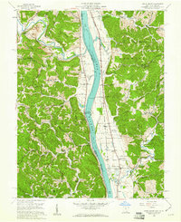
 1906 Glenwood1958 Print · USGSThe Ohio River valley was a bustling corridor of steam and rail at the start of the 1900s, anchoring the border between Mason County and Ohio. Researchers can trace riverside settlements like Mercers Bottom, find vanished post offices such as Thivener PO, and follow the Baltimore and Ohio RR through Apple Grove.
 - 1908 Map of Glenwood
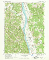
 1908 Glenwood1908 Print · USGSThe Ohio River valley at the turn of the century shows a landscape of riverfront rail towns and high ridges before modern development. Genealogists can trace early post offices like Yellowtown Thivener PO and settlements at Mercers Bottom or Ben Lomond.3 unique versions available
 - 1957 Map of Huntington, 1966 Print
 1957 Huntington1966 Print · USGSThe industrial heart of the Ohio River valley is captured here in the mid-sixties, showing the growth of Huntington and Ashland. Researchers can trace the extensive rail networks of the Chesapeake and Ohio RR and locate sites like the Chief Cornstalk Hunting Ground.3 unique versions available
 - 1958 Map of Apple Grove, 1961 Print
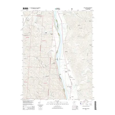
 1958 Apple Grove1961 Print · USGSThe Ohio River valley south of Point Pleasant was a landscape of river-and-rail industry and small farming hamlets in the late fifties. Genealogists and historians can trace family roots through landmarks like Mercers Bottom, the Clay Chapel Cem, and Beale Chapel.2 unique versions available
 - 1960 Map of Huntington
 1960 Huntington1960 Print · USGSThe tri-state river valley thrived in the late fifties as a hub of heavy industry and Appalachian rail transit. Genealogists and historians can trace the connection between river towns like Ashland and Portsmouth or locate family homesteads near Coleman Ridge.
 - 1968 Map of Apple Grove, 1970 Print
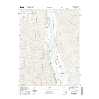
 1968 Apple Grove1970 Print · USGSThe Ohio River valley in the late sixties shows a landscape defined by the Baltimore and Ohio railroad and river navigation. Genealogists can locate family landmarks like Beale Chapel, Mercers Bottom, and the Clay Sch near Ben Lomond.3 unique versions available
 - 1981 Map of Ironton, 1982 Print
 1981 Ironton1982 Print · USGSThe tri-state river valley at the start of the eighties shows a landscape shaped by heavy industry, atomic energy, and sprawling national forests. Researchers can trace the legacy of iron production at Harrison Furnace or follow the historic rail lines of the C & O RR and N & W RR.
 - 2002 Map of Apple Grove, 2006 Print
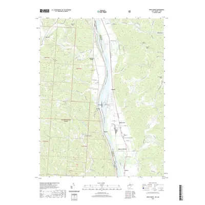
 2002 Apple Grove2006 Print · USGSLife along the Ohio River at the dawn of the 21st century centered on riverfront hamlets and the ridges of the Wayne National Forest. Researchers can trace local heritage through sites like Mercers Bottom, Sunnyside School, and several family-linked cemeteries like Kings Chapel.
 - 2011 Map of Apple Grove, 2011 Print
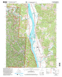
 2011 Apple Grove2011 Print · USGSCovers Thivener, including Ohio Township, Mercers Bottom, and other nearby areas
 - 2014 Map of Apple Grove, 2014 Print
 2014 Apple Grove2014 Print · USGSCovers Thivener, including Ohio Township, Mercers Bottom, and other nearby areas
 - 2016 Map of Apple Grove, 2016 Print
 2016 Apple Grove2016 Print · USGSCovers Thivener, including Ohio Township, Mercers Bottom, and other nearby areas
 - 2019 Map of Apple Grove, 2019 Print
 2019 Apple Grove2019 Print · USGSCovers Thivener, including Ohio Township, Mercers Bottom, and other nearby areas
 - 2023 Map of Apple Grove, 2023 Print
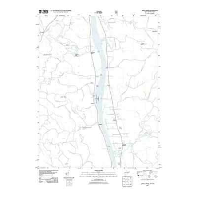
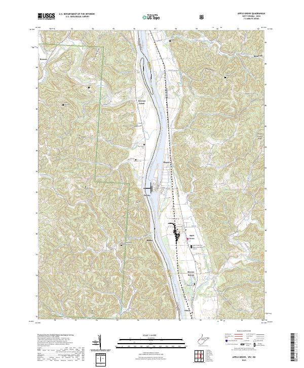 2023 Apple Grove2023 Print · USGSThe Ohio River borderlands between Ohio and West Virginia are detailed in this recent survey of the valley and its flanking ridges. Researchers can trace numerous burial sites like Bethel Methodist Episcopal Cem and riverside hamlets such as Mercers Bottom and Apple Grove.
End of results
Showing maps 1-13 of 13
Top cities near Thivener
- Point Pleasant historical maps
- Gallipolis historical maps
- Addison historical maps
- Rio Grande historical maps
- Crown City historical maps
- Athalia historical maps
See more
Frequently asked questions
- What are the different types of historical maps available for Thivener?
- What is the oldest map of Thivener?
- Where can I purchase historical maps of Thivener for my home or office?
- Where can I download high-res historical maps of Thivener?
- Are there historical topographic maps available for Thivener?
- Is there historical aerial imagery available for Thivener?
- Where are historical maps of Thivener sourced from?