1990s Maps of Russell Township, Ohio
Explore 5 historic maps of Russell Township from the 1990s. These maps offer a rare glimpse into what life looked like during the 1990s — showing old roads, neighborhoods, homes, and landmarks that have changed or disappeared over time.
Whether you're researching your family's past, planning a metal detecting trip, or studying how Russell Township's landscape evolved across the 1990s, these high-resolution maps are a powerful tool for exploring the history of this region.
- Focus on a specific era: All maps on this page are from the 1990s, giving you a focused view of this time period.
- See what’s changed: Compare century-old streets, trails, and buildings to today's modern landscape using overlays and satellite layers.
- Research with precision: Use these maps for genealogy, historical research, land use analysis, or educational projects.
- View, download, or print: Maps are fully viewable online in high resolution, and can be downloaded or printed for your own records.
Start exploring Russell Township's history through authentic maps from the 1990s. This is your window into the past.
Russell Township, OH maps
(5)- 1994 Map of Cleveland North
 1994 Cleveland North1994 Print · USGSThe Lake Erie shoreline in the mid-nineties shows the urban density of Northeast Ohio giving way to coastal preserves. Researchers can trace the development of lakeside towns like Eastlake and Madison while locating landmarks like Burke Lakefront Airport and Fairport Harbor.
 - 1994 Map of Cleveland South
 1994 Cleveland South1994 Print · USGSThe metropolitan corridor between Akron and Cleveland is shown here in the mid-nineties during a period of significant suburban growth. Researchers can trace the path of the Ohio Turnpike or explore expansive recreation lands like West Branch State Park.
 - 1994 Map of Chesterland, 1997 Print
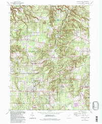 1994 Chesterland1997 Print · USGSThe Chagrin River valley and the expansive grounds of the Holden Arboretum define this area of Northeast Ohio in the 1990s. Genealogists can trace family sites at All Souls Cemetery or explore the historic crossroads of Mulberry Corners and Fowlers Mill.
 - 1994 Map of Mayfield Heights, 1997 Print
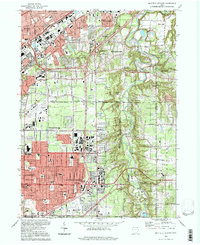 1994 Mayfield Heights1997 Print · USGSEastern Cuyahoga and Lake Counties are shown here during the late twentieth-century suburban boom. Genealogists and local historians can trace burial sites like Knollwood Cemetery, fly over Cuyahoga Airport, or locate the Little Church in the Vale.
 - 1994 Map of Chagrin Falls, 2000 Print
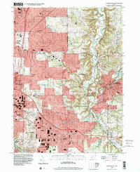 1994 Chagrin Falls2000 Print · USGSEastern Cuyahoga County and the Chagrin Valley are shown here in the late twentieth century as suburban residential growth met preserved parklands. Genealogists and local historians can trace landmarks like Evergreen Cem, Bentleyville, and the industrial Millpond in Chagrin Falls.
End of results
Showing maps 1-5 of 5
Top cities near Russell Township
- Cleveland historical maps
- Euclid historical maps
- Mentor historical maps
- Cleveland Heights historical maps
- Garfield Heights historical maps
- Shaker Heights historical maps
See more
Top neighborhoods of Russell Township
Frequently asked questions
- What are the different types of historical maps available for Russell Township?
- What is the oldest map of Russell Township?
- Where can I purchase historical maps of Russell Township for my home or office?
- Where can I download high-res historical maps of Russell Township?
- Are there historical topographic maps available for Russell Township?
- Is there historical aerial imagery available for Russell Township?
- Where are historical maps of Russell Township sourced from?