1900s (20th Century) Maps of Greene County, Ohio
Explore 38 historic maps of Greene County from the 1900s (20th Century). These maps offer a rare glimpse into what life looked like during the 1900s — showing old roads, neighborhoods, homes, and landmarks that have changed or disappeared over time.
Whether you're researching your family's past, planning a metal detecting trip, or studying how Greene County's landscape evolved across the 1900s, these high-resolution maps are a powerful tool for exploring the history of this region.
- Focus on a specific era: All maps on this page are from the 1900s, giving you a focused view of this time period.
- See what’s changed: Compare century-old streets, trails, and buildings to today's modern landscape using overlays and satellite layers.
- Research with precision: Use these maps for genealogy, historical research, land use analysis, or educational projects.
- View, download, or print: Maps are fully viewable online in high resolution, and can be downloaded or printed for your own records.
Start exploring Greene County's history through authentic maps from the 1900s. This is your window into the past.
Greene County, OH maps
(38)- 1904 Map of Springfield, 1952 Print
 1904 Springfield1952 Print · USGSWest-central Ohio was a bustling network of electric railways and turnpikes at the opening of the twentieth century. Researchers can trace the early industrial footprint of Springfield or locate family roots near Yellow Springs, Pitchin, and the Masonic Home.2 unique versions available
 - 1904 Map of Dayton, 1956 Print
 1904 Dayton1956 Print · USGSThe Miami Valley at the dawn of the 1900s shows a landscape transformed by the Miami and Erie Canal and a dense network of interurban electric railways. Researchers can trace historic river communities like Osborn and Tipp City or follow the early path of the National Road.
 - 1906 Map of Dayton, 1935 Print
 1906 Dayton1935 Print · USGSThe Dayton region in the early twentieth century shows a landscape transitioning from the canal era to the age of electric interurbans and railroads. Trace the original sites of Osborn and Fairfield or locate the path of the Miami and Erie Canal.2 unique versions available
 - 1906 Map of Springfield, 1942 Print
 1906 Springfield1942 Print · USGSSpringfield and the surrounding Clark and Greene County townships are shown here during the peak era of electric traction and steam rail. Genealogists can trace family footprints through Ferncliff Cemetery, the Masonic Home, and settlements like Yellow Springs and Enon.
 - 1907 Map of South Charleston, 1943 Print
 1907 South Charleston1943 Print · USGSThe Clark County countryside at the turn of the century shows a landscape dominated by rail travel and local school districts. Genealogists can locate family-named landmarks such as Yeazel School, Pancake Chapel, and the settlement of Dolly Varden.2 unique versions available
 - 1913 Map of Waynesville
 1913 Waynesville1913 Print · USGSThe Miami and Erie Canal and a dense network of electric railways define this Ohio landscape in the decade before the Great War. Researchers can trace the early footprints of Waynesville, Centerville, and Springboro alongside rural landmarks like Washington Mills and Lantz School.
 - 1915 Map of Waynesville, 1942 Print
 1915 Waynesville1942 Print · USGSThe Dayton suburbs and Warren County countryside are captured here just before the Great War, during the heyday of electric interurban rail. Genealogists can locate specific local landmarks like Lantz School, Wittes Corners, and the historic community of Shakertown.
 - 1916 Map of Octa, 1941 Print
 1916 Octa1941 Print · USGSFayette and Greene Counties are captured here at a peak of rural development, prior to the consolidation of its numerous neighborhood school districts. You can trace the rail-era infrastructure of Octa and Jeffersonville or locate early community sites like Dakin Chapel and the Selden PO.
 - 1917 Map of Xenia, 1934 Print
 1917 Xenia1934 Print · USGSGreene County was a thriving center of rail and education during the early twentieth century, anchored by the hub of Xenia. Genealogists can trace family roots through dozens of local landmarks, from Wilberforce University to the Soldiers and Sailors Orphans Home and Lumberton.2 unique versions available
 - 1944 Map of Octa
 1944 Octa1944 Print · USGSSouthwestern Ohio at the end of the Second World War shows a landscape dense with rural schoolhouses and rail-connected villages. Genealogists can trace family roots through dozens of local landmarks like Sugar Grove Sch, Selden PO, and the junction at Octa.
 - 1947 Map of Columbus, 1948 Print
 1947 Columbus1948 Print · USGSCentral Ohio in the late 1940s is captured in this survey, showing the post-war transition of its rail hubs and military airfield expansions. Genealogists and historians can trace the paths of the Ohio Canal, the Pennsylvania RR lines, and the Camp Sherman Military Reservation.
 - 1953 Map of Cincinnati, 1965 Print
 1953 Cincinnati1965 Print · USGSThe Ohio River valley and the industrial heartland of Indiana and Ohio are captured here during the mid-century peak of rail and river commerce. Genealogists and historians can trace connections between Cincinnati and outlying military sites like Camp Atterbury and Bakalar AFB.3 unique versions available
 - 1954 Map of Clifton, 1956 Print
 1954 Clifton1956 Print · USGSSouth of Springfield in the mid-fifties, this area shows a landscape of river valleys and agricultural crossroads. Genealogists can trace family names through Bethel Cem, Emery Chapel, and old routes like Hustead Road or Pitchin Pike.
 - 1955 Map of New Burlington, 1956 Print
 1955 New Burlington1956 Print · USGSGreene and Clinton Counties are shown in the mid-1950s as a landscape of established townships and winding creek forks. Genealogists and local historians can trace family roots through numerous sites like New Burlington Cem, Richland Ch, and McKay Cem.2 unique versions available
 - 1955 Map of Waynesville, 1956 Print
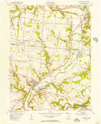 1955 Waynesville1956 Print · USGSThe Little Miami River valley in the mid-fifties remains a landscape of small railroad hamlets and historic church communities. Genealogists and historians can trace family locations near Waynesville, Spring Valley, and the now-submerged banks of Caesar Creek.2 unique versions available
 - 1955 Map of Yellow Springs, 1956 Print
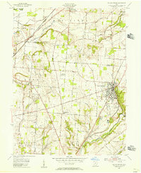 1955 Yellow Springs1956 Print · USGSMid-century Greene County centers on the academic and social landscape of Yellow Springs as it appeared in the mid-fifties. Local researchers can trace family landmarks and rural life at Antioch College, Pleasant Grove Ch, and the small settlement of Goes.2 unique versions available
 - 1955 Map of Cedarville, 1956 Print
 1955 Cedarville1956 Print · USGSGreene County in the mid-fifties is captured here as a busy intersection of rail lines and higher education. Genealogists and historians can trace the foundations of Central State College, the small community of New Jasper, and the grounds of Massies Creek Cem.2 unique versions available
 - 1955 Map of Bellbrook, 1956 Print
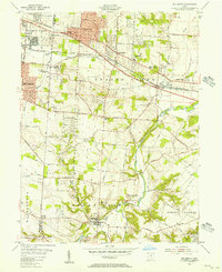 1955 Bellbrook1956 Print · USGSThe Greene County countryside near Bellbrook is caught in a moment of mid-century transition as suburban growth reaches toward the Little Miami River. Genealogists can trace old family footprints at Pioneer Cemetery, Washington Mills, and several rural churches including Mt Zion Ch.
 - 1955 Map of Port William, 1956 Print
 1955 Port William1956 Print · USGSThe agricultural landscape of Clinton and Greene Counties comes alive in the mid-fifties, centered on the village of Port William. Genealogists can trace family footprints across several rural burial grounds like Cline Cem and old school sites such as Caesar Creek Sch.3 unique versions available
 - 1955 Map of Xenia, 1956 Print
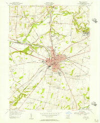 1955 Xenia1956 Print · USGSMid-century Greene County centers on the thriving rail crossroads of Xenia and the nearby academic hubs of Wilberforce. Genealogists and local historians can trace family plots at Woodland Cem or locate historic institutions like the Soldiers and Sailors Orphans Home.
 - 1955 Map of Fairborn, 1957 Print
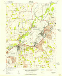 1955 Fairborn1957 Print · USGSGreene County is defined by the massive expansion of the Wright-Patterson Air Force Base during the mid-fifties. Researchers can trace the growth of Fairborn, locate the Wright Bros Memorial, and find family-named landmarks like the John Cox Cemetery.
 - 1957 Map of Cincinnati
 1957 Cincinnati1957 Print · USGSThe Ohio River valley and its surrounding highlands thrived during the mid-fifties industrial peak, centered on the bustling Cincinnati and Dayton metropolitan hubs. Researchers can trace the extensive rail networks and military sites like Wright-Patterson AFB and Camp Atterbury.
 - 1961 Map of Columbus
 1961 Columbus1961 Print · USGSCentral and Southern Ohio are captured here in the early sixties, as the region's industrial rail hubs and military bases reached their peak. Genealogists and historians can trace the transition from urban Columbus to rural townships along the Scioto River, locating Lockbourne USAF and old junctions like Washington Court House.
 - 1961 Map of Jamestown, 1963 Print
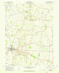 1961 Jamestown1963 Print · USGSJamestown and its surrounding agricultural townships are captured here in the early sixties, showing a landscape defined by small farming communities and historic burial grounds. Genealogists can trace family locations near the Quaker Cem, Old Silver Creek Cem, or the Township Sch at Grape Grove.2 unique versions available
 - 1961 Map of Bowersville, 1963 Print
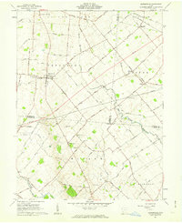 1961 Bowersville1963 Print · USGSThe rural landscape of Greene and Clinton counties is documented here in the early sixties, showing a region defined by its small farming settlements and family cemeteries. Genealogists can trace local roots at Hussey Cem and Grassy Run Cem or locate old community centers like Bowersville and Bloomington.2 unique versions available
Showing maps 1-25 of 38
Top cities of Greene County
Frequently asked questions
- What are the different types of historical maps available for Greene County?
- What is the oldest map of Greene County?
- Where can I purchase historical maps of Greene County for my home or office?
- Where can I download high-res historical maps of Greene County?
- Are there historical topographic maps available for Greene County?
- Is there historical aerial imagery available for Greene County?
- Where are historical maps of Greene County sourced from?