Old Maps of Beavercreek Township, Ohio for Academic Research
Study the evolution of Beavercreek Township with 43 high-resolution historic maps. Whether you're teaching, researching, or modeling changes in land use, these maps provide essential visual documentation of urban, environmental, and geographic change.
- Analyze long-term change: Track patterns in development, transportation, and natural features.
- Ideal for environmental or urban studies: Support academic projects with primary historical map data.
- Use in the classroom or lab: Educators and researchers rely on these maps to bring historical context to life.
These maps are a powerful tool for teaching, research, and visualizing how Beavercreek Township has changed over the decades.
Beavercreek Township, OH maps
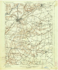
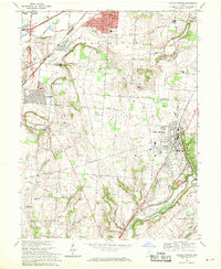
(43)- 1904 Map of Springfield, 1952 Print
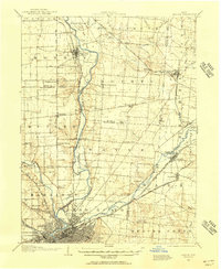
 1904 Springfield1952 Print · USGSWest-central Ohio was a bustling network of electric railways and turnpikes at the opening of the twentieth century. Researchers can trace the early industrial footprint of Springfield or locate family roots near Yellow Springs, Pitchin, and the Masonic Home.2 unique versions available
 - 1904 Map of Dayton, 1956 Print
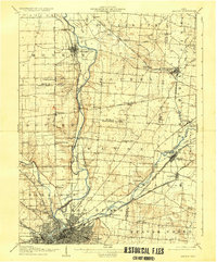
 1904 Dayton1956 Print · USGSThe Miami Valley at the dawn of the 1900s shows a landscape transformed by the Miami and Erie Canal and a dense network of interurban electric railways. Researchers can trace historic river communities like Osborn and Tipp City or follow the early path of the National Road.
 - 1906 Map of Dayton, 1935 Print
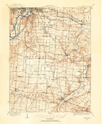
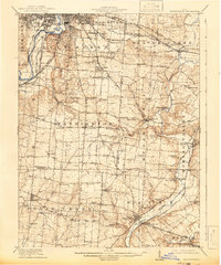
 1906 Dayton1935 Print · USGSThe Dayton region in the early twentieth century shows a landscape transitioning from the canal era to the age of electric interurbans and railroads. Trace the original sites of Osborn and Fairfield or locate the path of the Miami and Erie Canal.2 unique versions available
 - 1906 Map of Springfield, 1942 Print
 1906 Springfield1942 Print · USGSSpringfield and the surrounding Clark and Greene County townships are shown here during the peak era of electric traction and steam rail. Genealogists can trace family footprints through Ferncliff Cemetery, the Masonic Home, and settlements like Yellow Springs and Enon.
 - 1913 Map of Waynesville
 1913 Waynesville1913 Print · USGSThe Miami and Erie Canal and a dense network of electric railways define this Ohio landscape in the decade before the Great War. Researchers can trace the early footprints of Waynesville, Centerville, and Springboro alongside rural landmarks like Washington Mills and Lantz School.
 - 1915 Map of Waynesville, 1942 Print
 1915 Waynesville1942 Print · USGSThe Dayton suburbs and Warren County countryside are captured here just before the Great War, during the heyday of electric interurban rail. Genealogists can locate specific local landmarks like Lantz School, Wittes Corners, and the historic community of Shakertown.
 - 1917 Map of Xenia, 1934 Print
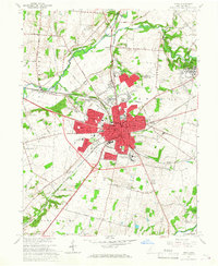
 1917 Xenia1934 Print · USGSGreene County was a thriving center of rail and education during the early twentieth century, anchored by the hub of Xenia. Genealogists can trace family roots through dozens of local landmarks, from Wilberforce University to the Soldiers and Sailors Orphans Home and Lumberton.2 unique versions available
 - 1947 Map of Columbus, 1948 Print
 1947 Columbus1948 Print · USGSCentral Ohio in the late 1940s is captured in this survey, showing the post-war transition of its rail hubs and military airfield expansions. Genealogists and historians can trace the paths of the Ohio Canal, the Pennsylvania RR lines, and the Camp Sherman Military Reservation.
 - 1953 Map of Cincinnati, 1965 Print
 1953 Cincinnati1965 Print · USGSThe Ohio River valley and the industrial heartland of Indiana and Ohio are captured here during the mid-century peak of rail and river commerce. Genealogists and historians can trace connections between Cincinnati and outlying military sites like Camp Atterbury and Bakalar AFB.3 unique versions available
 - 1955 Map of Yellow Springs, 1956 Print
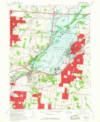
 1955 Yellow Springs1956 Print · USGSMid-century Greene County centers on the academic and social landscape of Yellow Springs as it appeared in the mid-fifties. Local researchers can trace family landmarks and rural life at Antioch College, Pleasant Grove Ch, and the small settlement of Goes.2 unique versions available
 - 1955 Map of Bellbrook, 1956 Print
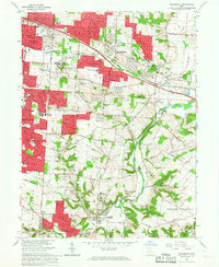
 1955 Bellbrook1956 Print · USGSThe Greene County countryside near Bellbrook is caught in a moment of mid-century transition as suburban growth reaches toward the Little Miami River. Genealogists can trace old family footprints at Pioneer Cemetery, Washington Mills, and several rural churches including Mt Zion Ch.
 - 1955 Map of Xenia, 1956 Print
 1955 Xenia1956 Print · USGSMid-century Greene County centers on the thriving rail crossroads of Xenia and the nearby academic hubs of Wilberforce. Genealogists and local historians can trace family plots at Woodland Cem or locate historic institutions like the Soldiers and Sailors Orphans Home.
 - 1955 Map of Fairborn, 1957 Print
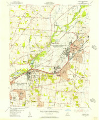 1955 Fairborn1957 Print · USGSGreene County is defined by the massive expansion of the Wright-Patterson Air Force Base during the mid-fifties. Researchers can trace the growth of Fairborn, locate the Wright Bros Memorial, and find family-named landmarks like the John Cox Cemetery.
 - 1957 Map of Cincinnati
 1957 Cincinnati1957 Print · USGSThe Ohio River valley and its surrounding highlands thrived during the mid-fifties industrial peak, centered on the bustling Cincinnati and Dayton metropolitan hubs. Researchers can trace the extensive rail networks and military sites like Wright-Patterson AFB and Camp Atterbury.
 - 1961 Map of Columbus
 1961 Columbus1961 Print · USGSCentral and Southern Ohio are captured here in the early sixties, as the region's industrial rail hubs and military bases reached their peak. Genealogists and historians can trace the transition from urban Columbus to rural townships along the Scioto River, locating Lockbourne USAF and old junctions like Washington Court House.
 - 1962 Map of Columbus
 1962 Columbus1962 Print · USGSCentral Ohio during the early sixties reveals a transition from the industrial corridors of Columbus to the forested ridges of the south. Genealogists and historians can trace the rail networks of the Baltimore & Ohio RR and find local landmarks like Washington Court House and Camp Sherman Military Reservation.
 - 1965 Map of Xenia, 1967 Print
 1965 Xenia1967 Print · USGSGreene County is shown here in the mid-1960s as the rail networks of the Pennsylvania Railroad and Baltimore and Ohio still define the local economy. Researchers can locate the Central State University campus, the Soldiers and Sailors Orphans Home, and several burial sites including Massies Creek Cemetery.4 unique versions available
 - 1965 Map of Fairborn, 1967 Print
 1965 Fairborn1967 Print · USGSThe Dayton suburbs and Fairborn area undergo rapid postwar expansion during the mid-sixties, centered on the massive Wright-Patterson Air Force Base. Researchers can trace the early layout of Wright State University and vanished rail stops along the Erie Lackawanna.6 unique versions available
 - 1965 Map of Bellbrook, 1967 Print
 1965 Bellbrook1967 Print · USGSGreene and Montgomery Counties are captured during a period of suburban transition in the mid-1960s. Researchers can locate family landmarks like the Pioneer Cem, the historic Covered Bridge, and old schoolhouses including Bell Sch.5 unique versions available
 - 1967 Map of Columbus, 1969 Print
 1967 Columbus1969 Print · USGSCentral Ohio during the late sixties serves as a vital corridor of rail and aviation, from the industrial streets of Springfield to the hangar lines of Lockbourne Air Force Base. Genealogists and researchers can trace the growth of towns like Circleville and London or locate rural landmarks such as St Paul church and the London Correctional Institution.2 unique versions available
 - 1968 Map of Yellow Springs, 1970 Print
 1968 Yellow Springs1970 Print · USGSThe Yellow Springs and Fairborn corridor is captured here in the late sixties as suburban growth met historic academic and rural landscapes. Genealogists and historians can locate legacy sites like Antioch College, the Mud Run Cem, and several local schools like Hustead Sch.4 unique versions available
 - 1986 Map of Springfield
 1986 Springfield1986 Print · USGSCentral Ohio in the mid-1980s shows the bustling rail-and-road network connecting Springfield and Xenia to the western outskirts of Columbus. Researchers can trace old family sites and transit routes through Glen Haven Mem Cem, Madison Lake State Park, and the CONRAIL line.2 unique versions available
 - 1986 Map of Dayton
 1986 Dayton1986 Print · USGSThe Miami Valley and the Indiana-Ohio borderlands reached a peak of suburban and industrial connectivity in the mid-eighties. Genealogists and historians can trace family burial sites at Miami Memorial Garden (Cem) and the development surrounding Wright-Patterson Air Force Base.2 unique versions available
 - 2010 Map of Fairborn, 2010 Print
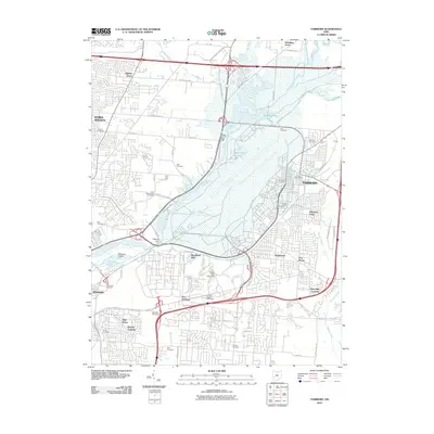 2010 Fairborn2010 Print · USGSCovers Beavercreek Township, including Dayton, Beavercreek, and other nearby areas
 - 2010 Map of Xenia, 2010 Print
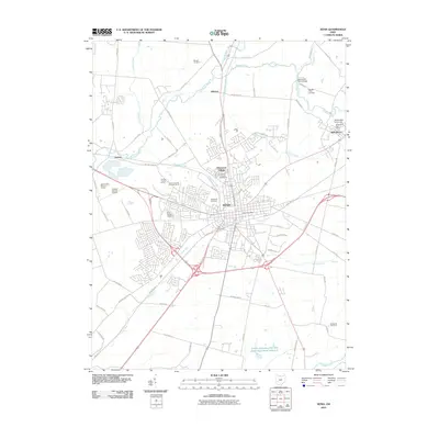 2010 Xenia2010 Print · USGSCovers Beavercreek Township, including Xenia, Oldtown, and other nearby areas
Showing maps 1-25 of 43
Top cities near Beavercreek Township
- Dayton historical maps
- Springfield historical maps
- Kettering historical maps
- Beavercreek historical maps
- Huber Heights historical maps
- Fairborn historical maps
See more
Top neighborhoods of Beavercreek Township
Frequently asked questions
- What are the different types of historical maps available for Beavercreek Township?
- What is the oldest map of Beavercreek Township?
- Where can I purchase historical maps of Beavercreek Township for my home or office?
- Where can I download high-res historical maps of Beavercreek Township?
- Are there historical topographic maps available for Beavercreek Township?
- Is there historical aerial imagery available for Beavercreek Township?
- Where are historical maps of Beavercreek Township sourced from?