Old Maps of Hamilton County, Ohio
Explore 59 old maps of Hamilton County, spanning from 1898 to today. These high-resolution historic maps reveal how streets, neighborhoods, landmarks, and natural features evolved over time — perfect for genealogy, metal detecting, research, and local history exploration.
What you can do with these maps:
- See how Hamilton County changed over time: Compare historical maps to modern-day views to trace roads, homesites, rail lines & more.
- View detailed metadata: Each map includes creators, publishers, year, scale, and archive source.
- Overlay maps with satellite & LiDAR: Visualize the past alongside modern tools to explore terrain & human change.
- Trusted historical sources: Maps sourced from the USGS, Library of Congress, and other archives.
- Access maps your way: View online, download high-res files, or order prints for personal or research use.
Start exploring old maps of Hamilton County to uncover forgotten places, hidden landmarks, and the deep history beneath your feet.
Hamilton County, OH maps
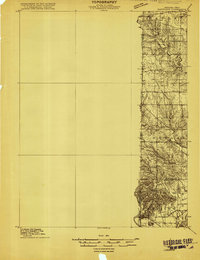
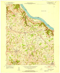
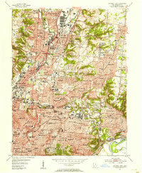
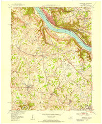
(59)- 1898 Map of East Cincinnati, 1964 Print
 1898 East Cincinnati1964 Print · USGSCovers Hamilton County, including Cincinnati, Covington, and other nearby areas
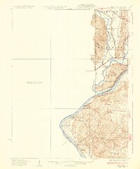
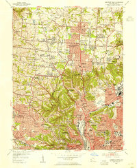
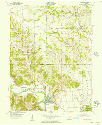
 - 1904 Map of Mason, 1958 Print
 1904 Mason1958 Print · USGSCovers Hamilton County, including Hamilton, Middletown, and other nearby areas
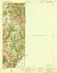
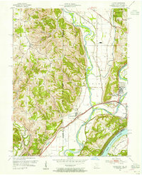
 - 1906 Map of Mason, 1939 Print
 1906 Mason1939 Print · USGSCovers Hamilton County, including Hamilton, Middletown, and other nearby areas2 unique versions available
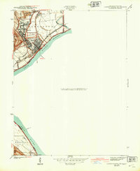
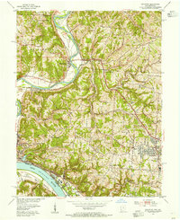
 - 1914 Map of East Cincinnati
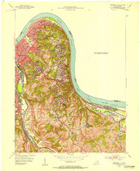
 1914 East Cincinnati1914 Print · USGSCovers Hamilton County, including Cincinnati, Covington, and other nearby areas4 unique versions available
 - 1914 Map of West Cincinnati
 1914 West Cincinnati1914 Print · USGSCovers Hamilton County, including Cincinnati, Covington, and other nearby areas4 unique versions available
 - 1915 Map of Lawrenceburg
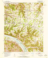
 1915 Lawrenceburg1915 Print · USGSCovers Hamilton County, including Burlington, Harrison, and other nearby areas
 - 1915 Map of Hamilton
 1915 Hamilton1915 Print · USGSCovers Hamilton County, including Hamilton, Fairfield, and other nearby areas2 unique versions available
 - 1915 Map of Harrison
 1915 Harrison1915 Print · USGSCovers Hamilton County, including Oxford, Harrison, and other nearby areas2 unique versions available
 - 1917 Map of Hamilton, 1942 Print
 1917 Hamilton1942 Print · USGSCovers Hamilton County, including Hamilton, Fairfield, and other nearby areas
 - 1928 Map of Lawrenceburg, 1962 Print
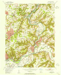
 1928 Lawrenceburg1962 Print · USGSCovers Hamilton County, including Burlington, Harrison, and other nearby areas
 - 1932 Map of Lawrenceburg
 1932 Lawrenceburg1932 Print · USGSCovers Hamilton County, including Burlington, Harrison, and other nearby areas3 unique versions available
 - 1943 Map of Hooven
 1943 Hooven1943 Print · USGSCovers Hamilton County, including Harrison, Greendale, and other nearby areas
 - 1943 Map of Lawrenceburg
 1943 Lawrenceburg1943 Print · USGSCovers Hamilton County, including Burlington, Lawrenceburg, and other nearby areas
 - 1950 Map of Covington, 1953 Print
 1950 Covington1953 Print · USGSCovers Hamilton County, including Cincinnati, Covington, and other nearby areas
 - 1951 Map of Burlington, 1953 Print
 1951 Burlington1953 Print · USGSCovers Hamilton County, including Cincinnati, Florence, and other nearby areas
 - 1952 Map of Newport, 1953 Print
 1952 Newport1953 Print · USGSCovers Hamilton County, including Cincinnati, Covington, and other nearby areas
 - 1953 Map of Withamsville, 1955 Print
 1953 Withamsville1955 Print · USGSCovers Hamilton County, including Cincinnati, Newtown, and other nearby areas
 - 1953 Map of Madeira, 1955 Print
 1953 Madeira1955 Print · USGSCovers Hamilton County, including Cincinnati, Blue Ash, and other nearby areas
 - 1953 Map of Cincinnati East, 1955 Print
 1953 Cincinnati East1955 Print · USGSCovers Hamilton County, including Cincinnati, Norwood, and other nearby areas
 - 1953 Map of Cincinnati West, 1955 Print
 1953 Cincinnati West1955 Print · USGSCovers Hamilton County, including Cincinnati, North College Hill, and other nearby areas
 - 1953 Map of Cincinnati, 1965 Print
 1953 Cincinnati1965 Print · USGSCovers Hamilton County, including Indianapolis, Cincinnati, and other nearby areas3 unique versions available
 - 1954 Map of Hooven, 1955 Print
 1954 Hooven1955 Print · USGSCovers Hamilton County, including Harrison, Greendale, and other nearby areas3 unique versions available
 - 1954 Map of Addyston, 1955 Print
 1954 Addyston1955 Print · USGSCovers Hamilton County, including Cincinnati, Cheviot, and other nearby areas
 - 1955 Map of Burlington, 1956 Print
 1955 Burlington1956 Print · USGSCovers Hamilton County, including Cincinnati, Florence, and other nearby areas
 - 1955 Map of Harrison, 1956 Print
 1955 Harrison1956 Print · USGSCovers Hamilton County, including Harrison, West Harrison, and other nearby areas5 unique versions available
Showing maps 1-25 of 59
Top cities of Hamilton County
- Cincinnati historical maps
- Norwood historical maps
- Forest Park historical maps
- Sharonville historical maps
- Blue Ash historical maps
- Springdale historical maps
See more
Frequently asked questions
- What are the different types of historical maps available for Hamilton County?
- What is the oldest map of Hamilton County?
- Where can I purchase historical maps of Hamilton County for my home or office?
- Where can I download high-res historical maps of Hamilton County?
- Are there historical topographic maps available for Hamilton County?
- Is there historical aerial imagery available for Hamilton County?
- Where are historical maps of Hamilton County sourced from?