1960s Maps of Fairfield Township, Ohio
Explore 5 historic maps of Fairfield Township from the 1960s. These maps offer a rare glimpse into what life looked like during the 1960s — showing old roads, neighborhoods, homes, and landmarks that have changed or disappeared over time.
Whether you're researching your family's past, planning a metal detecting trip, or studying how Fairfield Township's landscape evolved across the 1960s, these high-resolution maps are a powerful tool for exploring the history of this region.
- Focus on a specific era: All maps on this page are from the 1960s, giving you a focused view of this time period.
- See what’s changed: Compare century-old streets, trails, and buildings to today's modern landscape using overlays and satellite layers.
- Research with precision: Use these maps for genealogy, historical research, land use analysis, or educational projects.
- View, download, or print: Maps are fully viewable online in high resolution, and can be downloaded or printed for your own records.
Start exploring Fairfield Township's history through authentic maps from the 1960s. This is your window into the past.
Fairfield Township, OH maps
(5)- 1960 Map of Willard, 1961 Print
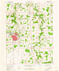 1960 Willard1961 Print · USGSHuron County's rail and agricultural heartland is documented here during the early sixties, centered on the bustling junction of the Baltimore and Ohio. Researchers can trace family roots at St Josephs Cem, locate the small settlement of Celeryville, or explore the rural crossroads at Guinea Corners.3 unique versions available
 - 1960 Map of Monroeville, 1961 Print
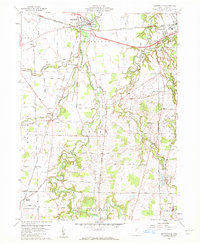 1960 Monroeville1961 Print · USGSHuron County's rural townships and rail junctions are captured here in the early sixties, showing the agricultural heart of Northern Ohio. Researchers can trace family history through sites like Havana, St Peters Ch, and the BALTIMORE AND OHIO rail corridors.2 unique versions available
 - 1960 Map of Greenwich, 1961 Print
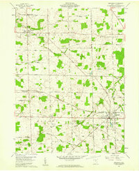 1960 Greenwich1961 Print · USGSHuron County's rural townships and rail corridors are captured here in the early sixties, showing a landscape defined by the Connecticut Western Reserve. Genealogists can locate family landmarks like Ripley Chapel, the Township Cem, and the rail junction at Greenwich.3 unique versions available
 - 1960 Map of Norwalk, 1961 Print
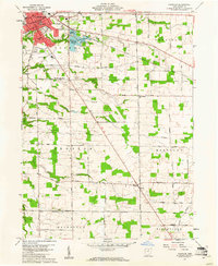 1960 Norwalk1961 Print · USGSNorwalk and the surrounding townships of the Connecticut Western Reserve are captured here in the early sixties as the city expanded southward into Bronson. Genealogists and researchers can trace the locations of Woodlawn Cemetery, St Marys School, and the rural crossroads of Olena.2 unique versions available
 - 1961 Map of Toledo
 1961 Toledo1961 Print · USGSThe western basin of Lake Erie and the industrial heart of Northern Ohio are captured here during the post-war era. Researchers can trace historical rail lines like the New York Central or locate landmarks like the Erie Ordnance Depot and Pelee Island.
End of results
Showing maps 1-5 of 5
Top cities near Fairfield Township
- Norwalk historical maps
- Shelby historical maps
- Willard historical maps
- Bellevue historical maps
- Milan historical maps
- New Haven historical maps
See more
Top neighborhoods of Fairfield Township
Frequently asked questions
- What are the different types of historical maps available for Fairfield Township?
- What is the oldest map of Fairfield Township?
- Where can I purchase historical maps of Fairfield Township for my home or office?
- Where can I download high-res historical maps of Fairfield Township?
- Are there historical topographic maps available for Fairfield Township?
- Is there historical aerial imagery available for Fairfield Township?
- Where are historical maps of Fairfield Township sourced from?