1900-1909 Maps of Jackson County, Ohio
Explore 6 historic maps of Jackson County from 1900-1909. These maps offer a rare glimpse into what life looked like during the 1900s — showing old roads, neighborhoods, homes, and landmarks that have changed or disappeared over time.
Whether you're researching your family's past, planning a metal detecting trip, or studying how Jackson County's landscape evolved across the 1900s, these high-resolution maps are a powerful tool for exploring the history of this region.
- Focus on a specific era: All maps on this page are from the 1900s, giving you a focused view of this time period.
- See what’s changed: Compare century-old streets, trails, and buildings to today's modern landscape using overlays and satellite layers.
- Research with precision: Use these maps for genealogy, historical research, land use analysis, or educational projects.
- View, download, or print: Maps are fully viewable online in high resolution, and can be downloaded or printed for your own records.
Start exploring Jackson County's history through authentic maps from the 1900s. This is your window into the past.
Jackson County, OH maps
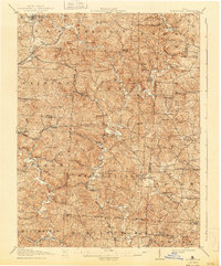
(6)- 1905 Map of Wilkesville, 1958 Print
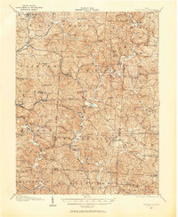 1905 Wilkesville1958 Print · USGSVinton County and its neighbors at the height of the early industrial era show a landscape shaped by charcoal furnaces and narrow-gauge rail interests. Genealogists can trace family footprints across dozens of local school districts like Auburn School or within established centers like Wilkesville and Minerton.
 - 1906 Map of Waverly
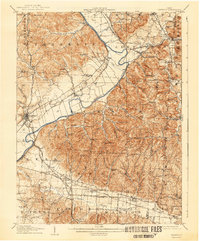
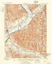 1906 Waverly1906 Print · USGSSouthern Ohio at the turn of the century shows a bustling corridor of river valleys and rail junctions centered on Waverly. Genealogists and historians can trace defunct post offices like Stony Creek Sta Pride PO and rural landmarks like Lilly Chapel or Cars Run School.
 - 1906 Map of Bidwell, 1954 Print
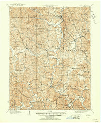 1906 Bidwell1954 Print · USGSGallia County at the turn of the century is a network of small townships and valley settlements connected by the Gallipolis and Chillicothe RR. Researchers can trace rural life through a wealth of local landmarks like Centerville Thurman PO, Ghee Bridge, and the Tomato Valley School.
 - 1908 Map of Bidwell
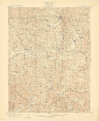 1908 Bidwell1908 Print · USGSGallia County at the turn of the century is a landscape of creek-side hamlets and hill-country schools. Genealogists can trace family roots through numerous local landmarks like Tomato Valley School, Tabor Church, and the Centerville Thurman P O post office.2 unique versions available
 - 1908 Map of Wilkesville, 1943 Print
 1908 Wilkesville1943 Print · USGSThe Vinton County hills are seen here during a peak era of iron furnaces and rail expansion before the Great War. Genealogists and researchers can trace dozens of family-named landmarks and institutions, from the Vinton Furnace site to Boring Church and the Haggerty School.
 - 1908 Map of Waverly, 1944 Print
 1908 Waverly1944 Print · USGSThe Scioto River valley at the start of the twentieth century was a vital crossroads of five competing railroads. Local historians can trace early mail stops like Robbins Dove PO and rural landmarks such as Lily Chapel or Meadow Run Church.
End of results
Showing maps 1-6 of 6
Top cities of Jackson County
Frequently asked questions
- What are the different types of historical maps available for Jackson County?
- What is the oldest map of Jackson County?
- Where can I purchase historical maps of Jackson County for my home or office?
- Where can I download high-res historical maps of Jackson County?
- Are there historical topographic maps available for Jackson County?
- Is there historical aerial imagery available for Jackson County?
- Where are historical maps of Jackson County sourced from?