Old Maps of Jackson County, Ohio for Academic Research
Study the evolution of Jackson County with 121 high-resolution historic maps. Whether you're teaching, researching, or modeling changes in land use, these maps provide essential visual documentation of urban, environmental, and geographic change.
- Analyze long-term change: Track patterns in development, transportation, and natural features.
- Ideal for environmental or urban studies: Support academic projects with primary historical map data.
- Use in the classroom or lab: Educators and researchers rely on these maps to bring historical context to life.
These maps are a powerful tool for teaching, research, and visualizing how Jackson County has changed over the decades.
Jackson County, OH maps
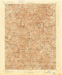
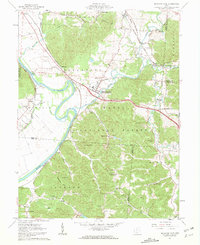
(121)- 1905 Map of Wilkesville, 1958 Print
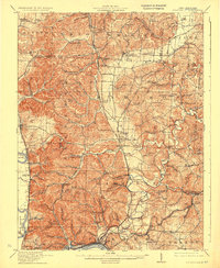
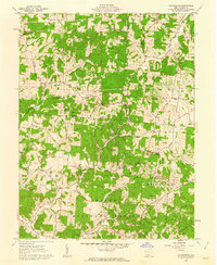
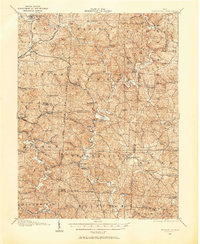 1905 Wilkesville1958 Print · USGSVinton County and its neighbors at the height of the early industrial era show a landscape shaped by charcoal furnaces and narrow-gauge rail interests. Genealogists can trace family footprints across dozens of local school districts like Auburn School or within established centers like Wilkesville and Minerton.
 - 1906 Map of Waverly
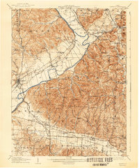
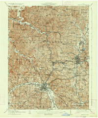
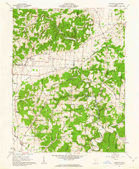
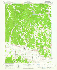
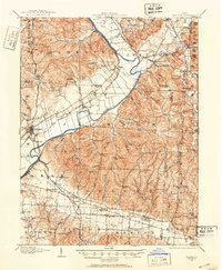 1906 Waverly1906 Print · USGSSouthern Ohio at the turn of the century shows a bustling corridor of river valleys and rail junctions centered on Waverly. Genealogists and historians can trace defunct post offices like Stony Creek Sta Pride PO and rural landmarks like Lilly Chapel or Cars Run School.
 - 1906 Map of Bidwell, 1954 Print
 1906 Bidwell1954 Print · USGSGallia County at the turn of the century is a network of small townships and valley settlements connected by the Gallipolis and Chillicothe RR. Researchers can trace rural life through a wealth of local landmarks like Centerville Thurman PO, Ghee Bridge, and the Tomato Valley School.
 - 1908 Map of Bidwell
 1908 Bidwell1908 Print · USGSGallia County at the turn of the century is a landscape of creek-side hamlets and hill-country schools. Genealogists can trace family roots through numerous local landmarks like Tomato Valley School, Tabor Church, and the Centerville Thurman P O post office.2 unique versions available
 - 1908 Map of Wilkesville, 1943 Print
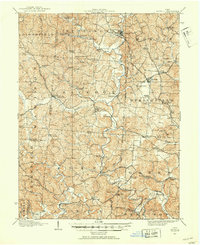
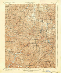
 1908 Wilkesville1943 Print · USGSThe Vinton County hills are seen here during a peak era of iron furnaces and rail expansion before the Great War. Genealogists and researchers can trace dozens of family-named landmarks and institutions, from the Vinton Furnace site to Boring Church and the Haggerty School.
 - 1908 Map of Waverly, 1944 Print
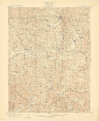
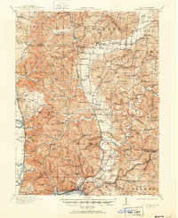
 1908 Waverly1944 Print · USGSThe Scioto River valley at the start of the twentieth century was a vital crossroads of five competing railroads. Local historians can trace early mail stops like Robbins Dove PO and rural landmarks such as Lily Chapel or Meadow Run Church.
 - 1911 Map of Sciotoville, 1952 Print
 1911 Sciotoville1952 Print · USGSThe industrial riverfronts and rural hollows of southern Ohio are shown here in the early twentieth century before modern development. Genealogists and historians can trace numerous rural landmarks like Davis Sta George PO, Harrison Furnace School, and the brickyards near New Boston.2 unique versions available
 - 1912 Map of Oak Hill, 1935 Print
 1912 Oak Hill1935 Print · USGSSouthern Ohio's iron-producing hill country is captured here during its industrial peak before the mid-century decline. Genealogists and historians can locate family homesites near landmark sites like Jefferson Furnace, the village of South Webster, and dozens of rural schools including Riegel School.2 unique versions available
 - 1913 Map of Sciotoville, 1924 Print
 1913 Sciotoville1924 Print · USGSScioto County during the early twentieth century shows a landscape of river-front industry and deep-hollow settlements. Genealogists can trace family footprints across dozens of local school sites like Noel School and early industrial markers such as Scioto Furnace and Star Brickyard.2 unique versions available
 - 1913 Map of Jackson, 1934 Print
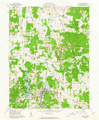
 1913 Jackson1934 Print · USGSThe coal and iron heart of southern Ohio comes into focus during the early twentieth century, showing the dense rail networks of the Wellston and Jackson districts. Genealogists can trace family roots through numerous rural landmarks like the Jackson Furnace, School No 10, and Ridgewood Cemetery.2 unique versions available
 - 1944 Map of Jackson
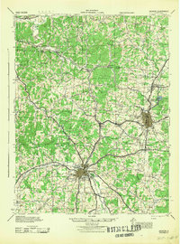 1944 Jackson1944 Print · USGSSouthern Ohio's industrial and rural heartland is detailed here during the mid-forties, centered on the coal and iron hubs of Jackson and Wellston. Genealogists can trace family roots through dozens of local landmarks like Ridgewood Cemetery and schools such as Oakland Sch.
 - 1947 Map of Columbus, 1948 Print
 1947 Columbus1948 Print · USGSCentral Ohio in the late 1940s is captured in this survey, showing the post-war transition of its rail hubs and military airfield expansions. Genealogists and historians can trace the paths of the Ohio Canal, the Pennsylvania RR lines, and the Camp Sherman Military Reservation.
 - 1957 Map of Huntington, 1966 Print
 1957 Huntington1966 Print · USGSThe industrial heart of the Ohio River valley is captured here in the mid-sixties, showing the growth of Huntington and Ashland. Researchers can trace the extensive rail networks of the Chesapeake and Ohio RR and locate sites like the Chief Cornstalk Hunting Ground.3 unique versions available
 - 1960 Map of Huntington
 1960 Huntington1960 Print · USGSThe tri-state river valley thrived in the late fifties as a hub of heavy industry and Appalachian rail transit. Genealogists and historians can trace the connection between river towns like Ashland and Portsmouth or locate family homesteads near Coleman Ridge.
 - 1961 Map of Columbus
 1961 Columbus1961 Print · USGSCentral and Southern Ohio are captured here in the early sixties, as the region's industrial rail hubs and military bases reached their peak. Genealogists and historians can trace the transition from urban Columbus to rural townships along the Scioto River, locating Lockbourne USAF and old junctions like Washington Court House.
 - 1961 Map of Mc Arthur
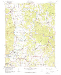
 1961 Mc Arthur1961 Print · USGSCentral Vinton County during the early 1960s was a landscape defined by the intersection of industrial mining and deep state forests. You can trace early settlements and cemeteries like Dundas, Radcliff, and Hixon Cem along the busy Baltimore and Ohio rail lines.5 unique versions available
 - 1961 Map of Petersburg, 1962 Print
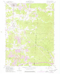
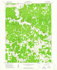
 1961 Petersburg1962 Print · USGSJackson County hill country in the early sixties shows a landscape of timber and coal extraction near the Wayne National Forest. Genealogists and historians can locate numerous family burial sites like Stephenson Cem and small rural hubs including Mabee Corner and Hamilton Sch.3 unique versions available
 - 1961 Map of Stockdale, 1962 Print
 1961 Stockdale1962 Print · USGSSouthern Ohio at the start of the 1960s reveals a patchwork of small-scale agriculture and timberlands within the Wayne National Forest. Genealogists and local historians can trace legacy landmarks like German Cemetery, the C & O Railroad corridor, and rural schools like Madison School.2 unique versions available
 - 1961 Map of Minford, 1962 Print
 1961 Minford1962 Print · USGSScioto County's hill country is captured here during the early sixties, showing a landscape defined by industrial history and small-town growth. You can trace early rail lines to Scioto Furnace or locate family plots at Bennett Cem and Lair Cem.2 unique versions available
 - 1961 Map of South Webster, 1962 Print
 1961 South Webster1962 Print · USGSIn the early 1960s, this pocket of Scioto County remained a landscape of deep hollows and rail-linked industrial hamlets. Researchers can trace the roots of the local clay and iron trades at Olive Furnace, Firebrick, and the Bloom High Sch campus.2 unique versions available
 - 1961 Map of Byer, 1963 Print
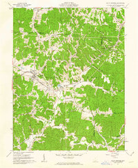
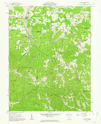
 1961 Byer1963 Print · USGSJackson County’s wooded ridges and railroad junctions are captured here in the early sixties as the timber and mining industries shaped the local economy. Researchers can locate family cemeteries and crossroads including Savageville, the Leo Petroglyph State Memorial, and the station at Byer.4 unique versions available
 - 1961 Map of Oak Hill, 1963 Print
 1961 Oak Hill1963 Print · USGSOak Hill and the surrounding Jackson County hills are shown here in the early sixties as a center of clay works and rail activity. Genealogists can locate family landmarks like Oak Hill Cem, Moriah Ch, and the Baltimore and Ohio line.3 unique versions available
 - 1961 Map of Beaver, 1963 Print
 1961 Beaver1963 Print · USGSSouthern Ohio at the start of the 1960s reveals a landscape of wooded hollows and industrial rail lines along the Pike and Jackson county line. Genealogists and researchers can trace family landmarks like Beaver Union Cem, Linn Hill Ch, and the crossroads at Limerick.5 unique versions available
 - 1961 Map of Gallia, 1963 Print
 1961 Gallia1963 Print · USGSThe tri-county borderlands of southern Ohio appear here in the early sixties, caught between active industrial clay mining and the growing preserve of the Wayne National Forest. Researchers can trace old family lines through the Poetker Cemetery, the village of Gallia, and several country churches like Sardis Church.3 unique versions available
 - 1961 Map of Richmond Dale, 1963 Print
 1961 Richmond Dale1963 Print · USGSRoss and Pike counties are captured here in the early sixties, showing a landscape defined by the convergence of major rail lines and the Scioto River. Genealogists can trace family names at Little Mound Cem or the rural settlement of Limerick, while industrial historians can follow the Baltimore and Ohio Railroad.2 unique versions available
Showing maps 1-25 of 121
Top cities of Jackson County
Frequently asked questions
- What are the different types of historical maps available for Jackson County?
- What is the oldest map of Jackson County?
- Where can I purchase historical maps of Jackson County for my home or office?
- Where can I download high-res historical maps of Jackson County?
- Are there historical topographic maps available for Jackson County?
- Is there historical aerial imagery available for Jackson County?
- Where are historical maps of Jackson County sourced from?