Old Maps of Chandler, Ohio for Academic Research
Study the evolution of Chandler with 14 high-resolution historic maps. Whether you're teaching, researching, or modeling changes in land use, these maps provide essential visual documentation of urban, environmental, and geographic change.
- Analyze long-term change: Track patterns in development, transportation, and natural features.
- Ideal for environmental or urban studies: Support academic projects with primary historical map data.
- Use in the classroom or lab: Educators and researchers rely on these maps to bring historical context to life.
These maps are a powerful tool for teaching, research, and visualizing how Chandler has changed over the decades.
Chandler, OH maps
(14)- 1901 Map of Cadiz, 1954 Print
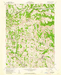
 1901 Cadiz1954 Print · USGSEastern Ohio at the dawn of the twentieth century was a landscape of ridge-top villages and bustling rail junctions. Trace the steam-era connections between Cadiz Junc and Jewett, or locate historic settlements like Bloomingdale and Amsterdam.2 unique versions available
 - 1903 Map of Cadiz, 1941 Print
 1903 Cadiz1941 Print · USGSEastern Ohio at the turn of the century was a landscape of busy rail corridors and small valley towns. Genealogists and historians can trace old homesteads and rail stops near Amsterdam, Bloomingdale, and the junction at Jewett along the Wheeling and Lake Erie line.
 - 1951 Map of Canton
 1951 Canton1951 Print · USGSThe industrial heartland of Ohio and Pennsylvania reached its mid-century peak during this era of heavy rail and river transit. Genealogists and historians can trace the development of steel towns like Aliquippa and Weirton alongside the Ohio River and major lines of the Pennsylvania RR.
 - 1953 Map of Canton
 1953 Canton1953 Print · USGSThe industrial heartland of Ohio and Pennsylvania is captured at its mid-century peak in this detailed regional survey. Genealogists and historians can trace the vast rail networks of the Pennsylvania RR and find local landmarks like Nimisila Reservoir and Tappan Reservoir.
 - 1957 Map of Canton, 1971 Print
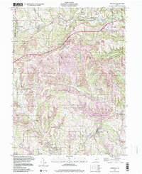
 1957 Canton1971 Print · USGSThe industrial heartland of eastern Ohio and western Pennsylvania comes alive in this mid-century survey of the Ohio River Valley. Trace the heritage of rail and river commerce through Pittsburgh, the massive steel towns along the Ohio River, and major junctions on the Pennsylvania RR.3 unique versions available
 - 1960 Map of Smithfield, 1961 Print
 1960 Smithfield1961 Print · USGSJefferson County at the dawn of the sixties shows a landscape transformed by industry and rail. Genealogists can trace family roots through Pine Run Cem and Township Cem, or locate old rail stops like Weems (Smithfield Sta).4 unique versions available
 - 1962 Map of Canton
 1962 Canton1962 Print · USGSThe industrial heartland of Eastern Ohio and Western Pennsylvania thrives in the early sixties as steel mills and rail lines dominate the river valleys. Genealogists and historians can trace local landmarks like McKinley National Memorial, Malone College, and industrial sites such as Republic Steel Corp.2 unique versions available
 - 1986 Map of Pittsburgh West
 1986 Pittsburgh West1986 Print · USGSThe Tri-State region's coal and rail corridors are captured in the mid-eighties as industry and aviation expanded. Trace the legacy of extraction at Nelms Mine No 1, locate Short Creek PO, or follow the Chessie System tracks along the Ohio River.3 unique versions available
 - 1997 Map of Smithfield, 2000 Print
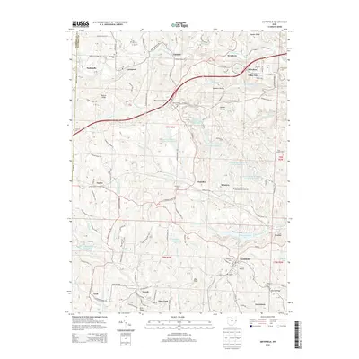
 1997 Smithfield2000 Print · USGSJefferson County, Ohio, was shaped by both the railroad and the coal industry in the late twentieth century. Genealogists and researchers can trace family landmarks like Mt Moriah Ch, Pine Run Cem, and the rail station at Weems (Smithfield Sta).
 - 2010 Map of Smithfield, 2010 Print
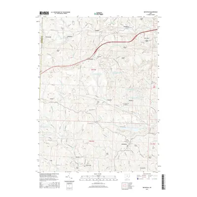
 2010 Smithfield2010 Print · USGSCovers Chandler, including Smithfield, Bloomingdale, and other nearby areas
 - 2013 Map of Smithfield, 2013 Print
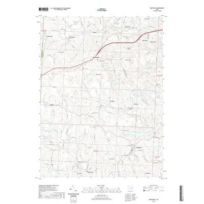
 2013 Smithfield2013 Print · USGSCovers Chandler, including Smithfield, Bloomingdale, and other nearby areas
 - 2016 Map of Smithfield, 2016 Print
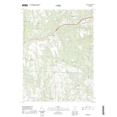
 2016 Smithfield2016 Print · USGSCovers Chandler, including Smithfield, Bloomingdale, and other nearby areas
 - 2019 Map of Smithfield, 2019 Print
 2019 Smithfield2019 Print · USGSCovers Chandler, including Smithfield, Bloomingdale, and other nearby areas
 - 2023 Map of Smithfield, 2023 Print
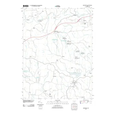
 2023 Smithfield2023 Print · USGSJefferson County’s industrial and rural heritage is on full display here in the early 2020s. Researchers can trace family history through sites like the McIntyre African Methodist Episcopal Cem or study coal-era landscapes at Boich Mining Company Pond Number Two.
End of results
Showing maps 1-14 of 14
Top cities near Chandler
- Wheeling historical maps
- Weirton historical maps
- Steubenville historical maps
- Martins Ferry historical maps
- Toronto historical maps
- St. Clairsville historical maps
See more
Frequently asked questions
- What are the different types of historical maps available for Chandler?
- What is the oldest map of Chandler?
- Where can I purchase historical maps of Chandler for my home or office?
- Where can I download high-res historical maps of Chandler?
- Are there historical topographic maps available for Chandler?
- Is there historical aerial imagery available for Chandler?
- Where are historical maps of Chandler sourced from?