Old Maps of Lake County, Ohio for Genealogy
Trace your family roots with 78 historic maps of Lake County. These high-res maps reveal old neighborhoods, homesites, landmarks, and streets — helping you uncover where your ancestors lived and how the area evolved over time.
- Explore historic neighborhoods: Identify where your relatives may have lived in the 1800s or 1900s.
- Compare maps over time: Trace the changes in streets, buildings, and landmarks for multi-generational research.
- Perfect for genealogy & ancestry research: Used by family historians and researchers to map out lineage and migration.
These maps are an incredible resource for exploring your personal connection to Lake County's past.
Lake County, OH maps
(78)- 1904 Map of Chardon, 1962 Print
 1904 Chardon1962 Print · USGSGeauga and Lake Counties are shown here during the early twentieth century, just as the region's electric and steam rail networks were at their peak. Researchers can trace the routes of the Cleveland and Chardon Electric RR and find local landmarks like Indian Point or the Infirmary.
 - 1905 Map of Perry, 1943 Print
 1905 Perry1943 Print · USGSLake County’s shoreline at the opening of the twentieth century was a critical corridor of rail and road travel. Genealogists can trace family footprints through Painesville, Madison, and Unionville, or locate specific properties near North Ridge and Genung Corners.
 - 1905 Map of Mentor, 1961 Print
 1905 Mentor1961 Print · USGSLake County and Geauga County thrived in the early twentieth century as a hub for electric rail travel and river-powered industry. Genealogists and historians can trace the foundations of Willoughby and Painesville or locate early milling sites like Wilson Mills and Fowlers Mill.
 - 1906 Map of Chardon, 1940 Print
 1906 Chardon1940 Print · USGSGeauga and Lake Counties are mapped here during the era of steam and electric rail, showing the landscape between Chardon and Painesville. Researchers can trace old township boundaries and find landmarks like the Infirmary, Bass Lake, and the New York Chicago and St Louis RR.2 unique versions available
 - 1907 Map of Mentor, 1947 Print
 1907 Mentor1947 Print · USGSNortheast Ohio thrives at the turn of the century, where the electric railway and steam lines meet the Lake Erie shore. Genealogists can trace early homesteads near Eagles Mill, Richmond Grand River PO, and the old postal stop at Mulberry Corners.
 - 1950 Map of Cleveland
 1950 Cleveland1950 Print · USGSCovers Lake County, including Cleveland, Akron, and other nearby areas
 - 1950 Map of Erie, 1953 Print
 1950 Erie1953 Print · USGSThe northern and southern shores of the Great Lakes meet in the mid-twentieth century, showcasing the vital shipping and rail corridors between Ontario and Pennsylvania. Trace the routes of the Michigan Central railroad or locate coastal landmarks like Presque Isle Light and the settlement of Iona Station.
 - 1953 Map of Mayfield Heights, 1955 Print
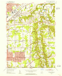 1953 Mayfield Heights1955 Print · USGSGreater Cleveland’s eastern suburbs were undergoing a mid-century transformation as residential grids met the river valley. Genealogists can locate family sites near the Little Church in the Vale or the Borromeo Seminary and trace the original County Airport grounds.2 unique versions available
 - 1953 Map of Chesterland, 1955 Print
 1953 Chesterland1955 Print · USGSGeauga and Lake counties are shown here in the early fifties, featuring the established settlements of Chesterland and Kirtland. Genealogists can trace local roots through the Center Chardon Cem or find early industry at Fowlers Mill.
 - 1953 Map of Mentor, 1955 Print
 1953 Mentor1955 Print · USGSLake Erie's southern shore in the early fifties shows a bustling maritime and rail landscape, from the industry of Painesville to the quiet bluffs of Kirtland Hills. Researchers can trace old neighborhood boundaries and find local landmarks like the Old Lighthouse, Lake Erie College, and the Mentor Harbor Yacht Club.2 unique versions available
 - 1953 Map of Eastlake, 1955 Print
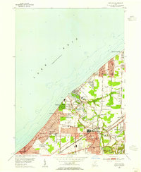 1953 Eastlake1955 Print · USGSLake County's shoreline was undergoing rapid suburbanization in the early 1950s as residential neighborhoods expanded along the lakefront. Researchers can trace the development of Eastlake and Willoughby, finding landmarks like Lost Nation Airport, Lincoln Sch Cem, and the lakeside village of Timberlake.
 - 1956 Map of Cleveland, 1967 Print
 1956 Cleveland1967 Print · USGSNortheast Ohio and Western Pennsylvania are shown at their industrial height during the mid-fifties, from the steel mills to the lakeshore. Researchers can trace the massive Ravenna Arsenal, the Ohio Turnpike, and vanished rail sidings of the B & O RR.3 unique versions available
 - 1959 Map of Erie, 1974 Print
 1959 Erie1974 Print · USGSCoastal communities and busy international rail lines define the North Shore and Pennsylvania lakefront during the late fifties and early seventies. Researchers can trace historic docklands and depot sites in Erie, Port Burwell, and Simcoe alongside the extensive reaches of Long Point.2 unique versions available
 - 1960 Map of Painesville, 1961 Print
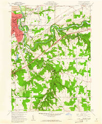 1960 Painesville1961 Print · USGSPainesville and the surrounding townships of Lake County are captured here just as the suburban era was maturing in the early sixties. Genealogists and local historians can trace family plots in Evergreen Cemetery or locate landmarks like Harvey High Sch and Leroy Center.5 unique versions available
 - 1960 Map of Perry, 1961 Print
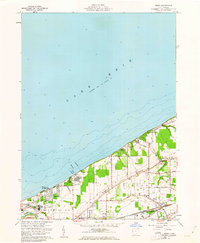 1960 Perry1961 Print · USGSLake Erie's shoreline meets the rail-and-road network of Lake County at the start of the sixties. Genealogists and local historians can trace the foundations of Painesville on-the-Lake, find the Perry Cem, and locate the Hale Rd Sch.4 unique versions available
 - 1960 Map of Thompson, 1961 Print
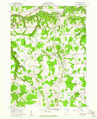 1960 Thompson1961 Print · USGSThompson and the Grand River valley are captured in 1960, showing the intersection of Lake, Geauga, and Ashtabula counties. Genealogists can trace family names and landmarks like Maple Grove Cem, St Patricks Ch, and the high ridges of The Edges.4 unique versions available
 - 1960 Map of Madison, 1962 Print
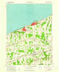 1960 Madison1962 Print · USGSThe Lake Erie shoreline and the rail corridors of Lake County are captured here in the early sixties. Genealogists and historians can trace family-named sites like Fairview Cem or locate community hubs such as Madison-on-the-Lake and Unionville.4 unique versions available
 - 1962 Map of Cleveland
 1962 Cleveland1962 Print · USGSNortheast Ohio and the Pennsylvania borderlands appear here during the industrial peak of the early sixties. Genealogists and historians can trace the expansive rail lines of the Nickel Plate Road and the growth of suburbs from Parma to Lyndhurst.
 - 1963 Map of Mayfield Heights, 1964 Print
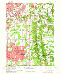 1963 Mayfield Heights1964 Print · USGSSuburban growth meets the river valley in the 1960s as residential tracts fill in between historic country estates. Trace the development of Mayfield Heights and Gates Mills alongside landmarks like Little Church in the Vale and Gilmour Academy.6 unique versions available
 - 1963 Map of Chesterland, 1964 Print
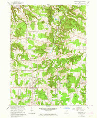 1963 Chesterland1964 Print · USGSGeauga and Lake Counties are shown during a period of growth in the early sixties, balancing wooded conservation with suburban development. Genealogists and local historians can trace family plots and landmarks at All Souls Cemetery, Pecks Corners, and the historic Fowlers Mill.3 unique versions available
 - 1963 Map of Mentor, 1964 Print
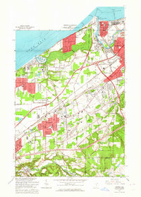 1963 Mentor1964 Print · USGSEarly 1960s Lake County comes alive in this survey of the shoreline from Fairport Harbor to Mentor-on-the-Lake. Genealogists and historians can trace the industrial salt works, the US Coast Guard Station, and old family landmarks along North Ridge and the Grand River.5 unique versions available
 - 1963 Map of Eastlake, 1965 Print
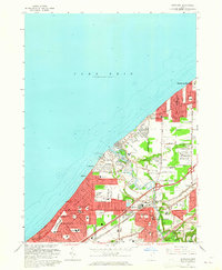 1963 Eastlake1965 Print · USGSLake County's shoreline was undergoing rapid suburbanization in the early sixties as industrial hubs like Eastlake expanded. Researchers can trace local development through many named schools like Shoregate Sch, the grounds of Camp Herbert, and the winding Chagrin River.4 unique versions available
 - 1965 Map of Erie
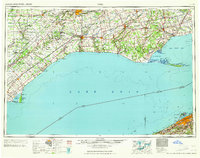 1965 Erie1965 Print · USGSSouthern Ontario and the Pennsylvania shore are captured in the late fifties, showcasing a robust rail-and-water economy. Trace family roots and old harbor towns like Port Stanley or explore the Six Nations Indian Reserve.
 - 1985 Map of Cleveland North, 1986 Print
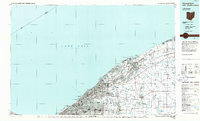 1985 Cleveland North1986 Print · USGSThe Ohio shoreline of Lake Erie in the mid-1980s reveals a bustling landscape of industrial rail lines and expanding lakefront communities. Trace the infrastructure of the era through Burke Lakefront Airport, the sprawling CONRAIL lines, and parks like Headlands Beach State Park.
 - 1994 Map of Cleveland North
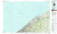 1994 Cleveland North1994 Print · USGSThe Lake Erie shoreline in the mid-nineties shows the urban density of Northeast Ohio giving way to coastal preserves. Researchers can trace the development of lakeside towns like Eastlake and Madison while locating landmarks like Burke Lakefront Airport and Fairport Harbor.
Showing maps 1-25 of 78
Top cities of Lake County
- Mentor historical maps
- Willoughby historical maps
- Painesville historical maps
- Eastlake historical maps
- Willowick historical maps
- Wickliffe historical maps
See more
Frequently asked questions
- What are the different types of historical maps available for Lake County?
- What is the oldest map of Lake County?
- Where can I purchase historical maps of Lake County for my home or office?
- Where can I download high-res historical maps of Lake County?
- Are there historical topographic maps available for Lake County?
- Is there historical aerial imagery available for Lake County?
- Where are historical maps of Lake County sourced from?