Old Maps of Buena Vista Beach, North Perry for Academic Research
Study the evolution of Buena Vista Beach with 13 high-resolution historic maps. Whether you're teaching, researching, or modeling changes in land use, these maps provide essential visual documentation of urban, environmental, and geographic change.
- Analyze long-term change: Track patterns in development, transportation, and natural features.
- Ideal for environmental or urban studies: Support academic projects with primary historical map data.
- Use in the classroom or lab: Educators and researchers rely on these maps to bring historical context to life.
These maps are a powerful tool for teaching, research, and visualizing how Buena Vista Beach has changed over the decades.
Buena Vista Beach, North Perry maps
(13)- 1905 Map of Perry, 1943 Print
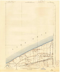 1905 Perry1943 Print · USGSLake County’s shoreline at the opening of the twentieth century was a critical corridor of rail and road travel. Genealogists can trace family footprints through Painesville, Madison, and Unionville, or locate specific properties near North Ridge and Genung Corners.
 - 1950 Map of Cleveland
 1950 Cleveland1950 Print · USGSCovers Buena Vista Beach, including Cleveland, Akron, and other nearby areas
 - 1956 Map of Cleveland, 1967 Print
 1956 Cleveland1967 Print · USGSNortheast Ohio and Western Pennsylvania are shown at their industrial height during the mid-fifties, from the steel mills to the lakeshore. Researchers can trace the massive Ravenna Arsenal, the Ohio Turnpike, and vanished rail sidings of the B & O RR.3 unique versions available
 - 1960 Map of Perry, 1961 Print
 1960 Perry1961 Print · USGSLake Erie's shoreline meets the rail-and-road network of Lake County at the start of the sixties. Genealogists and local historians can trace the foundations of Painesville on-the-Lake, find the Perry Cem, and locate the Hale Rd Sch.4 unique versions available
 - 1962 Map of Cleveland
 1962 Cleveland1962 Print · USGSNortheast Ohio and the Pennsylvania borderlands appear here during the industrial peak of the early sixties. Genealogists and historians can trace the expansive rail lines of the Nickel Plate Road and the growth of suburbs from Parma to Lyndhurst.
 - 1985 Map of Cleveland North, 1986 Print
 1985 Cleveland North1986 Print · USGSThe Ohio shoreline of Lake Erie in the mid-1980s reveals a bustling landscape of industrial rail lines and expanding lakefront communities. Trace the infrastructure of the era through Burke Lakefront Airport, the sprawling CONRAIL lines, and parks like Headlands Beach State Park.
 - 1994 Map of Cleveland North
 1994 Cleveland North1994 Print · USGSThe Lake Erie shoreline in the mid-nineties shows the urban density of Northeast Ohio giving way to coastal preserves. Researchers can trace the development of lakeside towns like Eastlake and Madison while locating landmarks like Burke Lakefront Airport and Fairport Harbor.
 - 1994 Map of Perry, 1997 Print
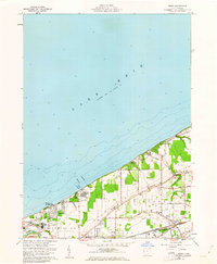
 1994 Perry1997 Print · USGSThe Lake Erie shoreline in the mid-1990s showcases the industrial and residential development of Lake County. Local researchers can trace the growth of Shoreland and North Perry alongside notable sites like Camp Roosevelt and the Hale Rd Sch.
 - 2010 Map of Perry, 2010 Print
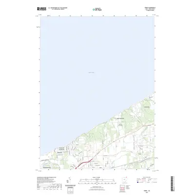
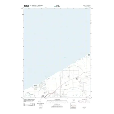 2010 Perry2010 Print · USGSCovers Buena Vista Beach, including Painesville, Perry, and other nearby areas
 - 2013 Map of Perry, 2013 Print
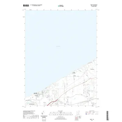
 2013 Perry2013 Print · USGSCovers Buena Vista Beach, including Painesville, Perry, and other nearby areas
 - 2016 Map of Perry, 2016 Print
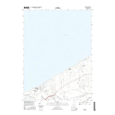 2016 Perry2016 Print · USGSCovers Buena Vista Beach, including Painesville, Perry, and other nearby areas
 - 2019 Map of Perry, 2019 Print
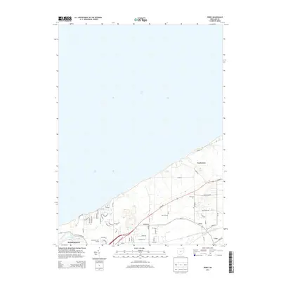
 2019 Perry2019 Print · USGSCovers Buena Vista Beach, including Painesville, Perry, and other nearby areas
 - 2023 Map of Perry, 2023 Print
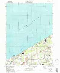
 2023 Perry2023 Print · USGSThe Lake Erie shoreline in Lake County is captured here in the early twenty-first century. Genealogists and local historians can trace the developments of Perry, North Perry, and Shoreland, or locate the historic Perry Cem.
End of results
Showing maps 1-13 of 13
Top cities near Buena Vista Beach
- Mentor historical maps
- Painesville historical maps
- North Madison historical maps
- Kirtland historical maps
- Geneva historical maps
- Chardon historical maps
See more
Frequently asked questions
- What are the different types of historical maps available for Buena Vista Beach?
- What is the oldest map of Buena Vista Beach?
- Where can I purchase historical maps of Buena Vista Beach for my home or office?
- Where can I download high-res historical maps of Buena Vista Beach?
- Are there historical topographic maps available for Buena Vista Beach?
- Is there historical aerial imagery available for Buena Vista Beach?
- Where are historical maps of Buena Vista Beach sourced from?