1960s Maps of Lawrence County, Ohio
Explore 18 historic maps of Lawrence County from the 1960s. These maps offer a rare glimpse into what life looked like during the 1960s — showing old roads, neighborhoods, homes, and landmarks that have changed or disappeared over time.
Whether you're researching your family's past, planning a metal detecting trip, or studying how Lawrence County's landscape evolved across the 1960s, these high-resolution maps are a powerful tool for exploring the history of this region.
- Focus on a specific era: All maps on this page are from the 1960s, giving you a focused view of this time period.
- See what’s changed: Compare century-old streets, trails, and buildings to today's modern landscape using overlays and satellite layers.
- Research with precision: Use these maps for genealogy, historical research, land use analysis, or educational projects.
- View, download, or print: Maps are fully viewable online in high resolution, and can be downloaded or printed for your own records.
Start exploring Lawrence County's history through authentic maps from the 1960s. This is your window into the past.
Lawrence County, OH maps
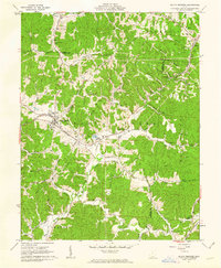
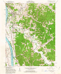
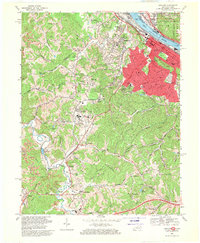
(18)- 1960 Map of Huntington
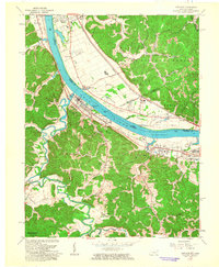
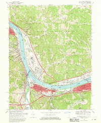
 1960 Huntington1960 Print · USGSThe tri-state river valley thrived in the late fifties as a hub of heavy industry and Appalachian rail transit. Genealogists and historians can trace the connection between river towns like Ashland and Portsmouth or locate family homesteads near Coleman Ridge.
 - 1961 Map of South Webster, 1962 Print
 1961 South Webster1962 Print · USGSIn the early 1960s, this pocket of Scioto County remained a landscape of deep hollows and rail-linked industrial hamlets. Researchers can trace the roots of the local clay and iron trades at Olive Furnace, Firebrick, and the Bloom High Sch campus.2 unique versions available
 - 1961 Map of Mercerville, 1963 Print
 1961 Mercerville1963 Print · USGSGallia County at the start of the sixties reveals a landscape of Appalachian ridges shaped by both agriculture and industry. Researchers can trace the many rural congregations at Lincoln Chapel and Bethesda Ch, or locate family sites near Saundersville and Leaper.4 unique versions available
 - 1961 Map of Kitts Hill, 1963 Print
 1961 Kitts Hill1963 Print · USGSThe ridges of southern Ohio appear as a network of small family farmsteads and forest lands in the early sixties. Genealogists can trace deep roots through dozens of family burial grounds and country churches like Oakland Chapel and Bazell Cem near Rock Camp.
 - 1961 Map of Gallia, 1963 Print
 1961 Gallia1963 Print · USGSThe tri-county borderlands of southern Ohio appear here in the early sixties, caught between active industrial clay mining and the growing preserve of the Wayne National Forest. Researchers can trace old family lines through the Poetker Cemetery, the village of Gallia, and several country churches like Sardis Church.3 unique versions available
 - 1961 Map of Greenup, 1963 Print
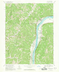
 1961 Greenup1963 Print · USGSThe Ohio River valley in the early sixties was a bustling nexus of rail traffic and river commerce connecting Kentucky and Ohio. Genealogists can trace family roots through numerous hill-country burial sites like Womack Cemetery or locate landmarks such as Our Lady of Fatima Shrine and the Drive-in Theatre.
 - 1961 Map of Aid, 1963 Print
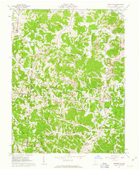
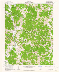
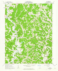 1961 Aid1963 Print · USGSLawrence County, Ohio, was a land of timbered ridges and coal mining during the early sixties. Genealogists can trace family roots through numerous remote burial sites like Gallicat Cem or visit the Covered Bridge near Scottown.
 - 1961 Map of Sherritts, 1963 Print
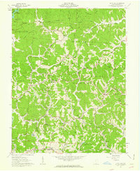
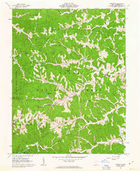 1961 Sherritts1963 Print · USGSLawrence County was a center of Appalachian forestry and mining in the early sixties. Researchers can trace family history through dozens of landmarks like Slab Fork Ch Cem, Macedonia Ch, and the high fire-watch at Kimble Lookout Tower.3 unique versions available
 - 1961 Map of Pedro, 1963 Print
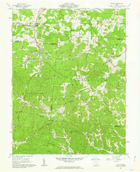
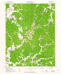 1961 Pedro1963 Print · USGSLawrence County's industrial and forest lands are captured here in the early sixties, showing the transition from iron furnaces to strip mining. Genealogists and historians can trace Detroit Toledo and Ironton RR stops and ruins like Buckhorn Furnace or Lawrence Furnace.4 unique versions available
 - 1961 Map of Wheelersburg, 1963 Print
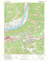
 1961 Wheelersburg1963 Print · USGSThe Ohio River valley in the early 1960s reveals a landscape defined by industry and community growth near Wheelersburg. Researchers can trace old property lines within the French Grants or locate landmarks like the Greenup Locks and Dam and the local Drive-in Theater.4 unique versions available
 - 1961 Map of Ironton, 1963 Print
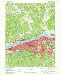
 1961 Ironton1963 Print · USGSThe industrial river valley and the wooded hills of the Wayne National Forest meet in this early 1960s survey of the Ohio-Kentucky border. Genealogists can trace family names at Calvary Cem or locate community hubs like Quinn Chapel and the Vesuvius Furnace (Ruins).2 unique versions available
 - 1961 Map of Waterloo, 1963 Print
 1961 Waterloo1963 Print · USGSSouthern Ohio's ridge-and-hollow country is captured here in the early sixties as small communities and extractive industries defined the local landscape. Researchers can trace family history through sites like Saunders Cem and Mt Zion Ch or locate industrial markers like the Tipple and Strip Mine sites.4 unique versions available
 - 1961 Map of Patriot, 1963 Print
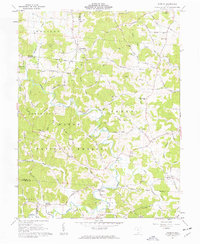 1961 Patriot1963 Print · USGSGallia County in the early sixties remains a landscape of remote ridges and hollows within the Wayne National Forest. Researchers can trace family history through numerous landmark churches like Corinth Ch and cemeteries including Wagner Cem and Siloam Cem.3 unique versions available
 - 1968 Map of Ashland, 1970 Print
 1968 Ashland1970 Print · USGSAshland and its surrounding riverfront communities thrived in the late sixties as a hub of industry and education. Genealogists can trace family landmarks like the Boyd County Home, Calvary Cem, and the Federal Youth Center.3 unique versions available
 - 1968 Map of Athalia, 1970 Print
 1968 Athalia1970 Print · USGSThe Ohio River corridor comes alive in the late sixties as the riverbank settlements of Athalia and Crown City transition into the hills of the Wayne National Forest. Genealogists and historians can trace the paths of Hannan Trace Road to local landmarks like Wilma Chapel and Cremans Chapel Cem.4 unique versions available
 - 1968 Map of Huntington, 1970 Print
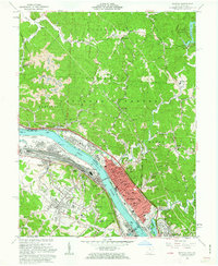
 1968 Huntington1970 Print · USGSHuntington and the Ohio River valley reached a peak of industrial and rail connectivity during the late sixties. Genealogists and historians can trace family locations through Spring Hill Cemetery, numerous city schools like Buffington Sch, and the riverside rail networks of the B & O.4 unique versions available
 - 1968 Map of Barboursville, 1970 Print
 1968 Barboursville1970 Print · USGSThe riverfront communities of West Virginia and Ohio thrived during the late sixties along the winding Ohio River. Genealogists and historians can locate family landmarks such as White Chapel Cem, Fairland High Sch, and the old County Fairgrounds.3 unique versions available
 - 1968 Map of Catlettsburg, 1970 Print
 1968 Catlettsburg1970 Print · USGSThe tri-state junction of Kentucky, Ohio, and West Virginia is captured here in the late sixties at the busy confluence of the Big Sandy and Ohio Rivers. Researchers can trace the industrial footprint of Kenova and Catlettsburg or locate family sites like Sandhill Cem and Mt Pleasant Ch.3 unique versions available
End of results
Showing maps 1-18 of 18
Top cities of Lawrence County
- Ironton historical maps
- South Point historical maps
- Coal Grove historical maps
- Chesapeake historical maps
- Proctorville historical maps
- Athalia historical maps
See more
Frequently asked questions
- What are the different types of historical maps available for Lawrence County?
- What is the oldest map of Lawrence County?
- Where can I purchase historical maps of Lawrence County for my home or office?
- Where can I download high-res historical maps of Lawrence County?
- Are there historical topographic maps available for Lawrence County?
- Is there historical aerial imagery available for Lawrence County?
- Where are historical maps of Lawrence County sourced from?