Old Maps of Lawrence County, Ohio for Metal Detecting
Plan your next treasure hunt with 145 historic maps of Lawrence County. Find old homesites, ghost towns, trails, and gathering spots that may be lost to time — perfect for identifying promising metal detecting locations.
- Locate forgotten sites: Uncover places like long-lost settlements, abandoned rail lines, or gathering spots.
- Plan better hunts: Use map overlays combined with LiDAR or satellite views to narrow in on historically rich areas.
- Made for detectorists: Thousands of hobbyists use these maps to discover relics, coins, and hidden history.
Use these historic maps to boost your research and find new opportunities beneath the surface of Lawrence County.
Lawrence County, OH maps
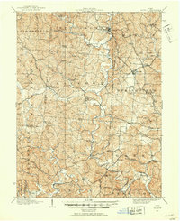
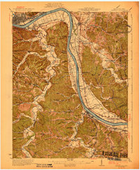
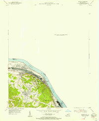
(145)- 1892 Map of Huntington, 1895 Print
 1892 Huntington1895 Print · USGSWest Virginia and Ohio meet along the river in the late nineteenth century, showing the rail-fueled growth of Huntington and Wayne. Local historians can trace the paths of the Chesapeake and Ohio Railroad past Barboursville and find early landmarks like Blue Sulphur Sp's and Davis Mill.
 - 1898 Map of Huntington
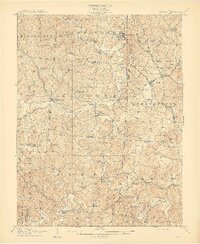
 1898 Huntington1898 Print · USGSNear the turn of the century, the Ohio River valley was transforming through the expansion of the Chesapeake and Ohio RR. Modern researchers can trace early nineteenth-century settlements from the bustling streets of Huntington to the inland hubs of Hamlin and Barboursville.3 unique versions available
 - 1898 Map of Ironton, 1955 Print
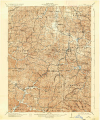
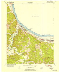
 1898 Ironton1955 Print · USGSSouthern Ohio's iron-producing region and the bustling riverfront at Ironton are documented here just before the turn of the century. Genealogists can trace family footprints near Vesuvius Furnace, Woodland Cemetery, and old post offices like Culbertson P.O.
 - 1900 Map of Ironton, 1918 Print
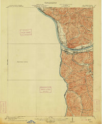
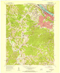
 1900 Ironton1918 Print · USGSThe Ohio River valley and the iron-rich hills of Lawrence County are seen here at the turn of the century during a peak in industrial activity. Genealogists and historians can trace defunct post offices like Orr P.O. and explore the rail corridors of the Ironton R.R. and Cincinnati Hamilton & Dayton R.R.2 unique versions available
 - 1901 Map of Guyandot, 1953 Print
 1901 Guyandot1953 Print · USGSThe Ohio River valley at the start of the twentieth century shows a bustling corridor of industry and river commerce. Genealogists and historians can trace the early footprints of Huntington and Ceredo alongside early rail routes like the Baltimore and Ohio RR.
 - 1901 Map of Ceredo, 1953 Print
 1901 Ceredo1953 Print · USGSThe tri-state convergence of West Virginia, Ohio, and Kentucky comes alive in this early 20th-century survey of the Ohio River valley. Genealogists and rail historians can trace the vital transport networks of Kenova and Ceredo, alongside family-named landmarks like Walker Br and Rice Run.2 unique versions available
 - 1902 Map of Guyandot
 1902 Guyandot1902 Print · USGSThe industrial hub of Huntington and the river town of Guyandot sit at the center of this early century border survey. Genealogists can trace family names and small settlements along Twelvepole Creek and Russell Creek, including Lavalette, Shoals, and Dickson.4 unique versions available
 - 1903 Map of Kenova
 1903 Kenova1903 Print · USGSThe tri-state river junction at Ashland and Kenova was a bustling industrial hub after the turn of the century. Trace early rail lines and mining settlements like Coalton and Boghead, or locate family landmarks along the Little Sandy River and Means Tunnel.5 unique versions available
 - 1904 Map of Kenova
 1904 Kenova1904 Print · USGSThe tri-state confluence of the Ohio River and Big Sandy River hums with early industrial activity at the start of the century. Genealogists can trace rail-side settlements and remote homesteads along Blaine Creek and near Mt Savage or Webbville.
 - 1906 Map of Bidwell, 1954 Print
 1906 Bidwell1954 Print · USGSGallia County at the turn of the century is a network of small townships and valley settlements connected by the Gallipolis and Chillicothe RR. Researchers can trace rural life through a wealth of local landmarks like Centerville Thurman PO, Ghee Bridge, and the Tomato Valley School.
 - 1906 Map of Athalia, 1956 Print
 1906 Athalia1956 Print · USGSLawrence and Gallia counties in the early 1900s are captured here as a landscape of river ferries and ridge-top farm communities. You can trace early post offices at Willowwood, follow the Baltimore and Ohio RR, or locate old river crossings like the Crown City Ferry.
 - 1908 Map of Bidwell
 1908 Bidwell1908 Print · USGSGallia County at the turn of the century is a landscape of creek-side hamlets and hill-country schools. Genealogists can trace family roots through numerous local landmarks like Tomato Valley School, Tabor Church, and the Centerville Thurman P O post office.2 unique versions available
 - 1908 Map of Athalia
 1908 Athalia1908 Print · USGSThe Ohio River borderlands in the early twentieth century were a network of ferry crossings and small river towns. Genealogists can trace family names and farmsteads near Athalia, Crown City, and the Baltimore and Ohio RR corridor.3 unique versions available
 - 1912 Map of Oak Hill, 1935 Print
 1912 Oak Hill1935 Print · USGSSouthern Ohio's iron-producing hill country is captured here during its industrial peak before the mid-century decline. Genealogists and historians can locate family homesites near landmark sites like Jefferson Furnace, the village of South Webster, and dozens of rural schools including Riegel School.2 unique versions available
 - 1913 Map of Ceredo
 1913 Ceredo1913 Print · USGSThe confluence of the Ohio and Big Sandy rivers comes alive in this pre-war survey of the West Virginia-Ohio borderlands. Genealogists and rail historians can trace the early footprints of Kenova, Ceredo, and the winding path of Twelvepole Creek.4 unique versions available
 - 1926 Map of Greenup
 1926 Greenup1926 Print · USGSGreenup County in the mid-1920s is a landscape of riverfront rail towns and a high density of rural schoolhouses tucked into the Kentucky hollows. Genealogists and historians can trace family locations near Old Steam Furnace School, Nonchalanta, and Taylor Sta McCall PO.3 unique versions available
 - 1930 Map of Greenup
 1930 Greenup1930 Print · USGSThe industrial corridor of the Ohio River valley is captured here in the early twentieth century, showing the borderlands of Greenup County and southern Ohio. Researchers can trace the legacy of iron production at Franklin Furnace or locate family roots near Tongs P O and Wurtland.3 unique versions available
 - 1953 Map of Ashland, 1955 Print
 1953 Ashland1955 Print · USGSAshland was a thriving river and rail hub during the mid-fifties, dominated by its industrial waterfront and expanding hillside suburbs. Local researchers can trace family roots through the Rose Hill Burial Park, Summit settlement, and the grounds of the Federal Correctional Institution.
 - 1953 Map of Greenup, 1955 Print
 1953 Greenup1955 Print · USGSThe riverfront of Greenup County is captured here in the early fifties, showing the busy industrial corridor along the Ohio River. Researchers can trace old family burials at Cochran Cem, locate Biggs Sch, or follow the Chesapeake and Ohio rail line through Wurtland.
 - 1953 Map of Catlettsburg, 1955 Print
 1953 Catlettsburg1955 Print · USGSThe industrial riverfront of northeastern Kentucky is captured here just after the war, where the Ohio and Big Sandy rivers converge. Researchers can trace the mid-century footprint of Catlettsburg and Ashland alongside landmarks like England Hill Sch and Lock No 29.
 - 1953 Map of Ironton, 1955 Print
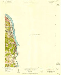
 1953 Ironton1955 Print · USGSThe Ohio River bank was a hive of industrial and residential growth in the early fifties as the railroad and river trade intersected. Trace the development of communities like Flatwoods and Russell or locate family burial sites at Rude Cem and Baldridge Cem.
 - 1957 Map of Catlettsburg, 1958 Print
 1957 Catlettsburg1958 Print · USGSThe tri-state river junction comes alive in the late fifties, showing the industrial heart of the OHIO RIVER valley. Genealogists and historians can trace family roots through the England Hill Sch, Williams Cem, and the historic streets of Kenova.2 unique versions available
 - 1957 Map of Huntington, 1959 Print
 1957 Huntington1959 Print · USGSThe industrial and academic heart of the Tri-State area comes alive in this late 1950s survey of the Ohio River valley. Researchers can trace the sprawling grounds of Marshall College, locate family plots in Spring Hill Cemetery, or follow the busy tracks of the Baltimore and Ohio railroad.
 - 1957 Map of Barboursville, 1959 Print
 1957 Barboursville1959 Print · USGSThe Barboursville and Guyandotte river valleys in the late fifties reveal a landscape of growing suburbs and river industry. Genealogists can locate family names at White Chapel Memorial Gardens or trace landmarks like the Fairland High Sch and Lock No 27.2 unique versions available
 - 1957 Map of Huntington, 1966 Print
 1957 Huntington1966 Print · USGSThe industrial heart of the Ohio River valley is captured here in the mid-sixties, showing the growth of Huntington and Ashland. Researchers can trace the extensive rail networks of the Chesapeake and Ohio RR and locate sites like the Chief Cornstalk Hunting Ground.3 unique versions available
Showing maps 1-25 of 145
Top cities of Lawrence County
- Ironton historical maps
- South Point historical maps
- Coal Grove historical maps
- Chesapeake historical maps
- Proctorville historical maps
- Athalia historical maps
See more
Frequently asked questions
- What are the different types of historical maps available for Lawrence County?
- What is the oldest map of Lawrence County?
- Where can I purchase historical maps of Lawrence County for my home or office?
- Where can I download high-res historical maps of Lawrence County?
- Are there historical topographic maps available for Lawrence County?
- Is there historical aerial imagery available for Lawrence County?
- Where are historical maps of Lawrence County sourced from?