2020s Maps of Mason Township, Ohio
Explore 4 historic maps of Mason Township from the 2020s. These maps offer a rare glimpse into what life looked like during the 2020s — showing old roads, neighborhoods, homes, and landmarks that have changed or disappeared over time.
Whether you're researching your family's past, planning a metal detecting trip, or studying how Mason Township's landscape evolved across the 2020s, these high-resolution maps are a powerful tool for exploring the history of this region.
- Focus on a specific era: All maps on this page are from the 2020s, giving you a focused view of this time period.
- See what’s changed: Compare century-old streets, trails, and buildings to today's modern landscape using overlays and satellite layers.
- Research with precision: Use these maps for genealogy, historical research, land use analysis, or educational projects.
- View, download, or print: Maps are fully viewable online in high resolution, and can be downloaded or printed for your own records.
Start exploring Mason Township's history through authentic maps from the 2020s. This is your window into the past.
Mason Township, OH maps
(4)- 2023 Map of Athalia, 2023 Print
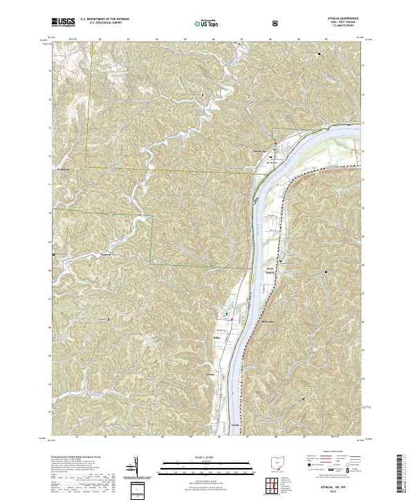 2023 Athalia2023 Print · USGSThe riverfront communities of southern Ohio and West Virginia are captured here along the banks of the Ohio River. Researchers can trace old family burial grounds like Good Hope Cem and Calloway Cem or locate small settlements such as Platform and Miller.
 - 2023 Map of Mercerville, 2023 Print
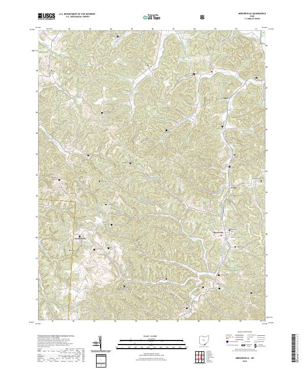 2023 Mercerville2023 Print · USGSGallia County at the southern edge of the Ohio hill country is documented here in the early twenty-first century. Genealogists can trace family names through dozens of upland burial sites like Old Walnut Ridge Cem, Mercerville Cem, and Siloam Cem.
 - 2023 Map of Aid, 2023 Print
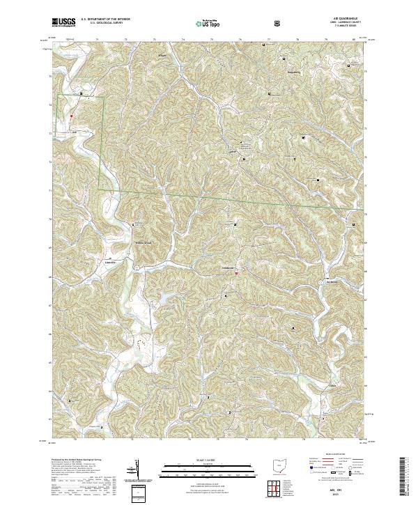 2023 Aid2023 Print · USGSLawrence County's high ridges and creek valleys are documented here in the early twenty-first century. Genealogists can locate family landmarks like Aid Cem, Brammer Cem, and the community of Willow Wood.
 - 2023 Map of Waterloo, 2023 Print
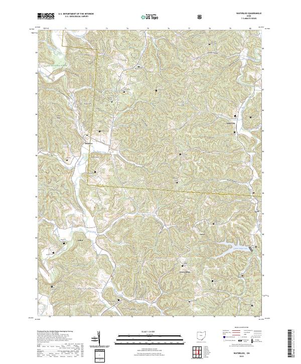 2023 Waterloo2023 Print · USGSModern Lawrence County retains its traditional character in this survey of the southern Ohio hill country. Genealogists can locate dozens of family burial sites such as Flag Spring Cem and Okey Cem near the communities of Waterloo and Arabia.
End of results
Showing maps 1-4 of 4
Top cities near Mason Township
- Huntington historical maps
- Ashland historical maps
- Rome historical maps
- Gallipolis historical maps
- South Point historical maps
- Kenova historical maps
See more
Top neighborhoods of Mason Township
- Rappsburg historical maps
- Suiter historical maps
- Wilgus historical maps
- Okey historical maps
- Saundersville historical maps
- Greasy Ridge historical maps
See more
Frequently asked questions
- What are the different types of historical maps available for Mason Township?
- What is the oldest map of Mason Township?
- Where can I purchase historical maps of Mason Township for my home or office?
- Where can I download high-res historical maps of Mason Township?
- Are there historical topographic maps available for Mason Township?
- Is there historical aerial imagery available for Mason Township?
- Where are historical maps of Mason Township sourced from?