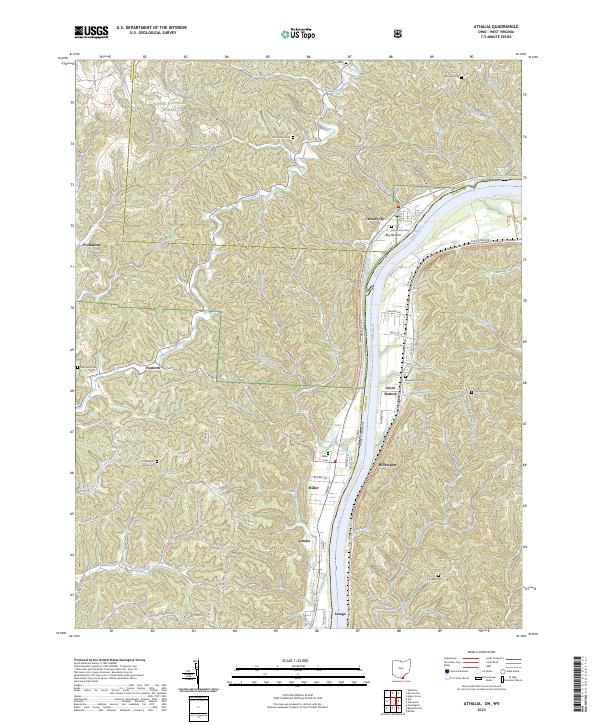
2023 Map of Athalia
USGS Topo · Published 2023About this map
The Ohio River forms the central artery of this landscape, separating the riverbank settlements of Crown City, Miller, and Athalia on the western shore from Millersport and Lesage in West Virginia. The river valley is flanked by the undulating hills of the Wayne National Forest, where a network of creek drainages like Indian Guyan Creek and Federal Creek cut through the terrain. The topography reveals a transition from the industrial and transport-heavy river corridor to more remote uplands marked by family cemeteries and forest roads.
Find a feature on this map
87 named features on this map. Tap any name to fly to it.
Don’t see what you’re looking for? This feature index may not catch every label — zoom into the map to look around manually.
Map Details
Editions of this 2023 Athalia Map
This is the sole edition of this map. No revisions or reprints were ever made.
Other maps of this area

1892 · Huntington
USGS Topo · 1:125,000

1898 · Huntington
USGS Topo · 1:125,000

1901 · Guyandot
USGS Topo · 1:62,500

1902 · Guyandot
USGS Topo · 1:62,500

1902 · Milton
USGS Topo · 1:62,500

1906 · Athalia
USGS Topo · 1:62,500

1906 · Glenwood
USGS Topo · 1:62,500

1908 · Athalia
USGS Topo · 1:62,500

1908 · Glenwood
USGS Topo · 1:62,500

1931 · Milton
USGS Topo · 1:62,500