Old Maps of Lorain County, Ohio for Hiking & Exploration
Hike through history with 127 historic maps of Lorain County. Explore old trails, ghost towns, and forgotten backroads — perfect for outdoor adventurers and local explorers.
- Rediscover forgotten places: Map out old mining camps, roads, and footpaths that no longer exist on modern maps.
- Layer with modern tools: Combine with LiDAR or satellite views to plan hikes through historical terrain.
- Made for exploration: Popular among hikers, overlanders, and local history lovers.
Use these maps to find adventure and explore the hidden past of Lorain County.
Lorain County, OH maps
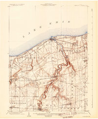
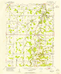
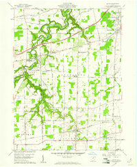
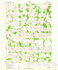
(127)- 1901 Map of Oberlin, 1952 Print
 1901 Oberlin1952 Print · USGSLorain County at the turn of the century shows a bustling corridor of electric interurbans and industrial sandstone quarries. Researchers can trace early railroad junctions at Elyria and Grafton, or locate lakeside settlements like Beach Park and Lake Breeze.3 unique versions available
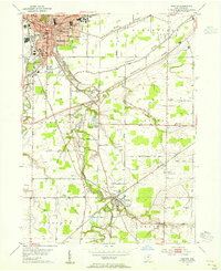
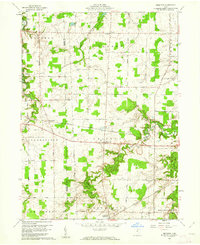
 - 1902 Map of Berea, 1958 Print
 1902 Berea1958 Print · USGSCuyahoga and Lorain counties appear here at the turn of the century, when electric railways and steam lines were transforming small villages into bustling suburbs. Genealogists and local historians can trace family-named landmarks and early rail junctions in Berea, Olmsted Falls, and the lakeside community of Clifton Park.2 unique versions available
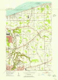
 - 1903 Map of Vermilion, 1932 Print
 1903 Vermilion1932 Print · USGSThe Lake Erie shoreline in the early twentieth century served as a vital transit hub where rail lines and electric cars converged on the coast. Genealogists and local historians can trace the early layouts of Vermilion, Wakeman, and Birmingham, or locate the specific placement of the Quarry and numerous creek-side homesteads.2 unique versions available
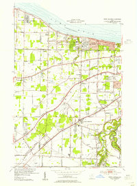
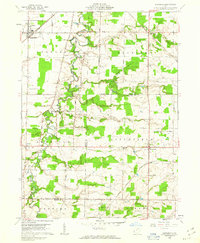
 - 1903 Map of Oberlin, 1943 Print
 1903 Oberlin1943 Print · USGSLorain County at the turn of the century is a hub of industrial growth and rail transit between the Lake Erie shore and the interior. Trace the complex web of electric lines and steam railroads connecting Lorain, Elyria, and Oberlin, or locate old stone Quarry sites near North Amherst and Grafton.
 - 1904 Map of Berea
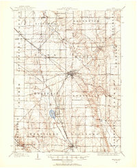
 1904 Berea1904 Print · USGSWestern Cuyahoga and northern Lorain counties are seen here at the start of the century as electric railways began connecting rural towns to the city. Trace the early streets of Olmsted Falls, the winding Rocky River, and vanished stops like Hardscrabble and Copopa.7 unique versions available
 - 1904 Map of Medina, 1954 Print
 1904 Medina1954 Print · USGSMedina and its surrounding townships are captured in the early 1900s, showing a landscape defined by the intersection of early pikes and competing steam and electric railroads. Genealogists can trace family connections in vanished stops and crossroads like River Styx, Abbeyville, and Sherman Corners.2 unique versions available
 - 1904 Map of Wellington, 1958 Print
 1904 Wellington1958 Print · USGSNorth-central Ohio at the turn of the century is a network of growing rail towns and agricultural townships. Genealogists can trace family roots through settlements like Wellington, Homerville, and Lodi, while following the paths of the Wheeling and Lake Erie RR and Salt Creek.
 - 1906 Map of Medina, 1941 Print
 1906 Medina1941 Print · USGSIn Medina County at the dawn of the twentieth century, the rural landscape is a bustling network of electric rail lines and crossroads hamlets. Trace the early paths of the Cleveland Southwestern and Columbus Electric RR and find vanished rail stops like Lester or the community of River Styx.
 - 1906 Map of Wellington, 1942 Print
 1906 Wellington1942 Print · USGSNorth-central Ohio at the opening of the twentieth century was a landscape of thriving rail-junction towns and fertile creek bottoms. Genealogists and historians can trace the early footprints of Wellington, Sullivan, and Lodi as they were connected by the Baltimore and Ohio and several electric rail lines.
 - 1908 Map of New London, 1948 Print
 1908 New London1948 Print · USGSNorth-central Ohio at the turn of the century was a landscape of thriving rail junctions and rural school districts. Genealogists can trace family roots through numerous local landmarks like Barlams Store, Todd School, and the busy junction at New London.
 - 1950 Map of Cleveland
 1950 Cleveland1950 Print · USGSCovers Lorain County, including Cleveland, Akron, and other nearby areas
 - 1953 Map of West View, 1955 Print
 1953 West View1955 Print · USGSLorain and Cuyahoga counties are shown here in the mid-1950s, a landscape defined by small farming hamlets and active railroads. Researchers can trace historic family lands near Hardscrabble, locate old burials at St Marys Cem, and follow the path of the New York Central through West View.
 - 1953 Map of Grafton, 1955 Print
 1953 Grafton1955 Print · USGSMid-century Lorain County reveals a landscape shaped by glacial ridges and the growing suburbs of Elyria. Genealogists can locate family sites near Butternut Ridge Cem or trace rural landmarks like the Grafton State Farm and the WEOL Radio Towers.
 - 1953 Map of Avon, 1955 Print
 1953 Avon1955 Print · USGSCoastal Lorain County in the mid-fifties reveals a landscape of growing lakefront towns and historic ridgeline roads. Genealogists and local historians can trace the foundations of Avon Lake, the rural reaches of Shawville, and parish sites like St Teresa Ch.
 - 1953 Map of North Olmsted, 1955 Print
 1953 North Olmsted1955 Print · USGSCoastal Cuyahoga and Lorain Counties are captured in the mid-1950s as suburban growth reaches the old ridge roads. Genealogists can trace family plots at Sunset Memorial Park Cemetery or locate local landmarks like Avon Airport and Olmsted Falls.
 - 1956 Map of Cleveland, 1967 Print
 1956 Cleveland1967 Print · USGSNortheast Ohio and Western Pennsylvania are shown at their industrial height during the mid-fifties, from the steel mills to the lakeshore. Researchers can trace the massive Ravenna Arsenal, the Ohio Turnpike, and vanished rail sidings of the B & O RR.3 unique versions available
 - 1956 Map of Toledo, 1968 Print
 1956 Toledo1968 Print · USGSNorthwest Ohio and the Lake Erie shoreline are shown in detail during the late fifties, showcasing a landscape of heavy industry, railroads, and island communities. Genealogists and historians can trace rail networks like the Chesapeake & Ohio RR or locate landmarks such as the Erie Proving Ground and Kelleys Island.4 unique versions available
 - 1959 Map of Vermilion East, 1960 Print
 1959 Vermilion East1960 Print · USGSThe Lake Erie shoreline and the Vermilion River valley are captured here in the late fifties, showing the area's transition into a modern transit corridor. Genealogists and local historians can locate early landmarks like Brownhelm Cem and the Brownhelm (Station) along the New York Central tracks.2 unique versions available
 - 1959 Map of Kipton, 1961 Print
 1959 Kipton1961 Print · USGSLorain County in the late fifties shows a landscape of traditional farming and growing industry, from the quarrying district of South Amherst to the quiet village of Kipton. Genealogists and researchers can trace local landmarks like Henrietta Cem, the Nickel Plate Road, and the path of the Vermilion River.
 - 1960 Map of Oberlin, 1961 Print
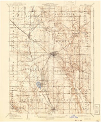
 1960 Oberlin1961 Print · USGSThe educational hub of Oberlin and the quarries of South Amherst are captured here in the early sixties. Genealogists and local historians can trace family plots in Westwood Cemetery or locate landmarks like the Wellhead Airport and Sacred Heart Ch.
 - 1960 Map of Wellington, 1961 Print
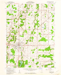 1960 Wellington1961 Print · USGSWellington stood as a vital rail hub in the early sixties, where the intersection of major lines defined the local economy. Researchers can trace the legacy of the Connecticut Western Reserve through landmarks like Greenwood Cem, Westwood Sch, and the grounds of Findley State Park.3 unique versions available
 - 1960 Map of Lorain, 1961 Print
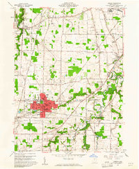
 1960 Lorain1961 Print · USGSLorain and its surrounding industrial suburbs thrived along the Lake Erie shore during the early sixties. Genealogists and historians can trace the foundations of local neighborhoods through dozens of listed schools and churches like St Marys Sch or find family landmarks at Elmwood Cemetery and Penfield Junction.
 - 1960 Map of Nova, 1961 Print
 1960 Nova1961 Print · USGSAs the mid-century agricultural landscape of Ashland County remained firmly tied to the rails, the villages of Nova and Rochester thrived. Genealogists can trace family plots at Universalist Cem or Rochester Cem and follow the historic Orphanage Gore boundary.3 unique versions available
 - 1960 Map of Brighton, 1961 Print
 1960 Brighton1961 Print · USGSLorain County farming and rail transport are captured here at the start of the 1960s. Researchers can trace historic family-named routes and rail lines through rural settlements like Brighton, Rochester, and the small crossroads of White Fox.3 unique versions available
 - 1960 Map of Lagrange, 1963 Print
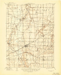
 1960 Lagrange1963 Print · USGSSouthern Lorain County was a landscape of rail crossings and oil derricks in the early sixties. Researchers can trace family history at Knowles Cem, locate the Preston Oil Field, and follow the New York Central through Lagrange.2 unique versions available
Showing maps 1-25 of 127
Top cities of Lorain County
- Lorain historical maps
- Elyria historical maps
- North Ridgeville historical maps
- Avon historical maps
- Avon Lake historical maps
- Amherst historical maps
See more
Frequently asked questions
- What are the different types of historical maps available for Lorain County?
- What is the oldest map of Lorain County?
- Where can I purchase historical maps of Lorain County for my home or office?
- Where can I download high-res historical maps of Lorain County?
- Are there historical topographic maps available for Lorain County?
- Is there historical aerial imagery available for Lorain County?
- Where are historical maps of Lorain County sourced from?