Old Maps of North Ridgeville, Ohio for Hiking & Exploration
Hike through history with 43 historic maps of North Ridgeville. Explore old trails, ghost towns, and forgotten backroads — perfect for outdoor adventurers and local explorers.
- Rediscover forgotten places: Map out old mining camps, roads, and footpaths that no longer exist on modern maps.
- Layer with modern tools: Combine with LiDAR or satellite views to plan hikes through historical terrain.
- Made for exploration: Popular among hikers, overlanders, and local history lovers.
Use these maps to find adventure and explore the hidden past of North Ridgeville.
North Ridgeville, OH maps
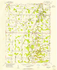
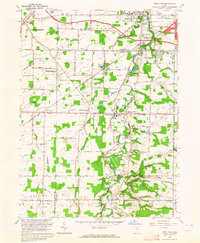
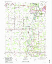
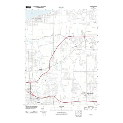
(43)- 1901 Map of Oberlin, 1952 Print
 1901 Oberlin1952 Print · USGSLorain County at the turn of the century shows a bustling corridor of electric interurbans and industrial sandstone quarries. Researchers can trace early railroad junctions at Elyria and Grafton, or locate lakeside settlements like Beach Park and Lake Breeze.3 unique versions available
 - 1902 Map of Berea, 1958 Print
 1902 Berea1958 Print · USGSCuyahoga and Lorain counties appear here at the turn of the century, when electric railways and steam lines were transforming small villages into bustling suburbs. Genealogists and local historians can trace family-named landmarks and early rail junctions in Berea, Olmsted Falls, and the lakeside community of Clifton Park.2 unique versions available
 - 1903 Map of Oberlin, 1943 Print
 1903 Oberlin1943 Print · USGSLorain County at the turn of the century is a hub of industrial growth and rail transit between the Lake Erie shore and the interior. Trace the complex web of electric lines and steam railroads connecting Lorain, Elyria, and Oberlin, or locate old stone Quarry sites near North Amherst and Grafton.
 - 1904 Map of Berea
 1904 Berea1904 Print · USGSWestern Cuyahoga and northern Lorain counties are seen here at the start of the century as electric railways began connecting rural towns to the city. Trace the early streets of Olmsted Falls, the winding Rocky River, and vanished stops like Hardscrabble and Copopa.7 unique versions available
 - 1950 Map of Cleveland
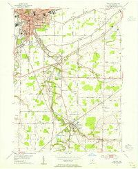
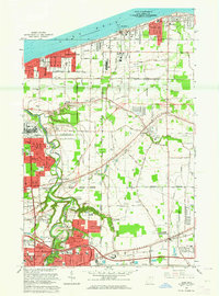
 1950 Cleveland1950 Print · USGSCovers North Ridgeville, including Cleveland, Akron, and other nearby areas
 - 1953 Map of West View, 1955 Print
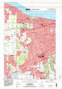
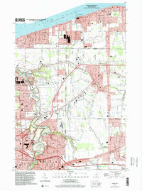
 1953 West View1955 Print · USGSLorain and Cuyahoga counties are shown here in the mid-1950s, a landscape defined by small farming hamlets and active railroads. Researchers can trace historic family lands near Hardscrabble, locate old burials at St Marys Cem, and follow the path of the New York Central through West View.
 - 1953 Map of Grafton, 1955 Print
 1953 Grafton1955 Print · USGSMid-century Lorain County reveals a landscape shaped by glacial ridges and the growing suburbs of Elyria. Genealogists can locate family sites near Butternut Ridge Cem or trace rural landmarks like the Grafton State Farm and the WEOL Radio Towers.
 - 1953 Map of Avon, 1955 Print
 1953 Avon1955 Print · USGSCoastal Lorain County in the mid-fifties reveals a landscape of growing lakefront towns and historic ridgeline roads. Genealogists and local historians can trace the foundations of Avon Lake, the rural reaches of Shawville, and parish sites like St Teresa Ch.
 - 1953 Map of North Olmsted, 1955 Print
 1953 North Olmsted1955 Print · USGSCoastal Cuyahoga and Lorain Counties are captured in the mid-1950s as suburban growth reaches the old ridge roads. Genealogists can trace family plots at Sunset Memorial Park Cemetery or locate local landmarks like Avon Airport and Olmsted Falls.
 - 1956 Map of Cleveland, 1967 Print
 1956 Cleveland1967 Print · USGSNortheast Ohio and Western Pennsylvania are shown at their industrial height during the mid-fifties, from the steel mills to the lakeshore. Researchers can trace the massive Ravenna Arsenal, the Ohio Turnpike, and vanished rail sidings of the B & O RR.3 unique versions available
 - 1956 Map of Toledo, 1968 Print
 1956 Toledo1968 Print · USGSNorthwest Ohio and the Lake Erie shoreline are shown in detail during the late fifties, showcasing a landscape of heavy industry, railroads, and island communities. Genealogists and historians can trace rail networks like the Chesapeake & Ohio RR or locate landmarks such as the Erie Proving Ground and Kelleys Island.4 unique versions available
 - 1961 Map of Toledo
 1961 Toledo1961 Print · USGSThe western basin of Lake Erie and the industrial heart of Northern Ohio are captured here during the post-war era. Researchers can trace historical rail lines like the New York Central or locate landmarks like the Erie Ordnance Depot and Pelee Island.
 - 1962 Map of Cleveland
 1962 Cleveland1962 Print · USGSNortheast Ohio and the Pennsylvania borderlands appear here during the industrial peak of the early sixties. Genealogists and historians can trace the expansive rail lines of the Nickel Plate Road and the growth of suburbs from Parma to Lyndhurst.
 - 1963 Map of West View, 1964 Print
 1963 West View1964 Print · USGSNortheast Ohio in the early sixties shows a landscape of transitioning farmland and growing townships at the Cuyahoga and Lorain county line. Researchers can trace the path of the New York Central railroad through Columbia Station or find family history at St Marys Cem and Myrtle Hill Cemetery.3 unique versions available
 - 1963 Map of Avon, 1964 Print
 1963 Avon1964 Print · USGSCoastal Lorain County is captured here during a decade of rapid suburban growth between the lakefront and the industrial centers. Researchers can trace the development of Sheffield Lake and Avon Lake, or locate family landmarks like St Teresa Cem and Weiss Field.3 unique versions available
 - 1963 Map of Grafton, 1964 Print
 1963 Grafton1964 Print · USGSLorain County shows a blend of industrial growth and rural character in the early sixties as suburban neighborhoods began to expand. Genealogists can locate family sites near Ridgelawn Cem or trace the early development of Brentwood Lake and Eaton Estates.4 unique versions available
 - 1963 Map of North Olmsted, 1964 Print
 1963 North Olmsted1964 Print · USGSCoastal life meets suburban expansion in the early sixties as communities like Bay Village and Westlake grow along the lakefront. Researchers can locate vanished landmarks like Bosworth Airport or trace family sites at Maple Ridge Cem and Evergreen Cem.4 unique versions available
 - 1986 Map of Lorain
 1986 Lorain1986 Print · USGSThe Lake Erie shoreline and North Central Ohio interior are shown in detail during the mid-eighties, from the industrial docks of Lorain to the peninsulas of Sandusky. Researchers can trace historic transport routes like the Baltimore and Ohio Railroad or locate significant landmarks like Oberlin College and Cedar Point.2 unique versions available
 - 1986 Map of Cleveland South
 1986 Cleveland South1986 Print · USGSNortheast Ohio in the mid-eighties shows the expanding reach of the Akron and Cleveland suburbs into the surrounding countryside. Trace the industrial rail networks of the Erie Lackawanna RR or find local landmarks like Kent State University and the Ravenna Arsenal.
 - 1994 Map of Cleveland South
 1994 Cleveland South1994 Print · USGSThe metropolitan corridor between Akron and Cleveland is shown here in the mid-nineties during a period of significant suburban growth. Researchers can trace the path of the Ohio Turnpike or explore expansive recreation lands like West Branch State Park.
 - 1994 Map of West View, 1997 Print
 1994 West View1997 Print · USGSThe Lorain and Cuyahoga county line comes to life in the 1990s as suburban growth meets the traditional Western Reserve landscape. Genealogists and historians can trace family locations near Hardscrabble, St Marys Cem, and the old rail corridor of the Conrail line.
 - 1994 Map of North Olmsted, 2000 Print
 1994 North Olmsted2000 Print · USGSThe western Cleveland suburbs are shown here in the mid-nineties as they matured into dense residential communities. Genealogists can trace local roots through numerous sites like Butternut Ridge Cemetery, Holy Trinity School, and Evergreen Cemetery.
 - 1994 Map of Avon, 2000 Print
 1994 Avon2000 Print · USGSCoastal Lorain County at the close of the twentieth century shows a landscape defined by Great Lakes industry and rapid suburban growth. Trace family roots and local history at St Teresa Cem or the numerous local schools like St Marys Sch and Brookside High Sch.
 - 2010 Map of West View, 2010 Print
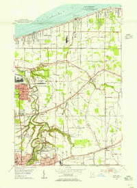
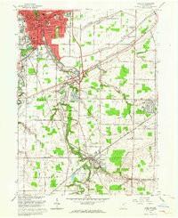
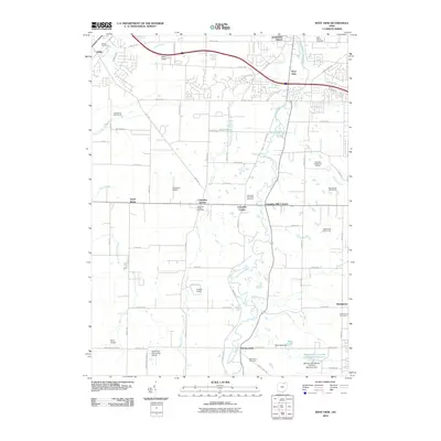 2010 West View2010 Print · USGSCovers North Ridgeville, including Strongsville, Berea, and other nearby areas
 - 2010 Map of Avon, 2010 Print
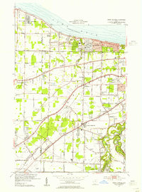
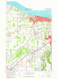
 2010 Avon2010 Print · USGSCovers North Ridgeville, including Lorain, Elyria, and other nearby areas
Showing maps 1-25 of 43
Top cities near North Ridgeville
- Cleveland historical maps
- Lorain historical maps
- Elyria historical maps
- Lakewood historical maps
- Strongsville historical maps
- Brunswick historical maps
See more
Top neighborhoods of North Ridgeville
- Pine Ridge Trailer Park historical maps
- Fields historical maps
- Stone Creek historical maps
- Estates at Hampton Place historical maps
- West Point historical maps
- Hampton Place historical maps
See more
Frequently asked questions
- What are the different types of historical maps available for North Ridgeville?
- What is the oldest map of North Ridgeville?
- Where can I purchase historical maps of North Ridgeville for my home or office?
- Where can I download high-res historical maps of North Ridgeville?
- Are there historical topographic maps available for North Ridgeville?
- Is there historical aerial imagery available for North Ridgeville?
- Where are historical maps of North Ridgeville sourced from?