2020s Maps of Somerford Township, Ohio
Explore 4 historic maps of Somerford Township from the 2020s. These maps offer a rare glimpse into what life looked like during the 2020s — showing old roads, neighborhoods, homes, and landmarks that have changed or disappeared over time.
Whether you're researching your family's past, planning a metal detecting trip, or studying how Somerford Township's landscape evolved across the 2020s, these high-resolution maps are a powerful tool for exploring the history of this region.
- Focus on a specific era: All maps on this page are from the 2020s, giving you a focused view of this time period.
- See what’s changed: Compare century-old streets, trails, and buildings to today's modern landscape using overlays and satellite layers.
- Research with precision: Use these maps for genealogy, historical research, land use analysis, or educational projects.
- View, download, or print: Maps are fully viewable online in high resolution, and can be downloaded or printed for your own records.
Start exploring Somerford Township's history through authentic maps from the 2020s. This is your window into the past.
Somerford Township, OH maps
(4)- 2023 Map of Plumwood, 2023 Print
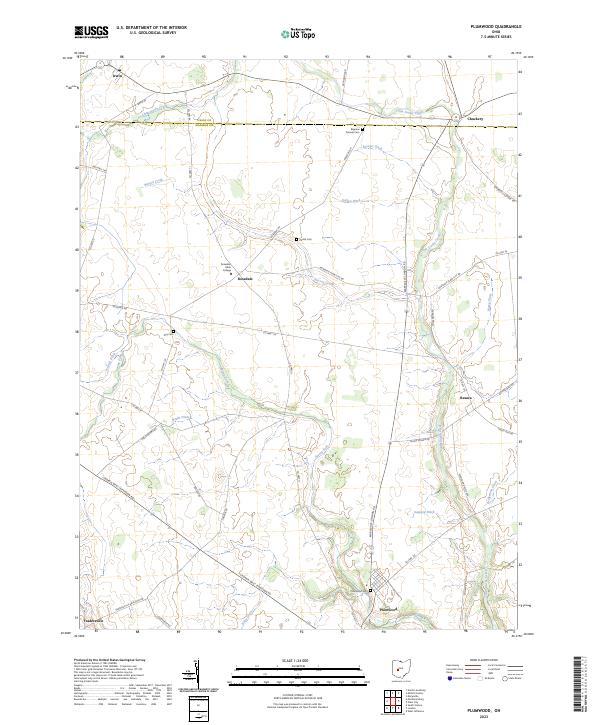 2023 Plumwood2023 Print · USGSMadison and Union counties are shown here as they appear today, featuring a landscape of productive farmland and small rural crossroads. Genealogists can trace family footprints across Bigelow Pioneer Cem, the Rosedale settlement, and Plumwood Cem.
 - 2023 Map of London, 2023 Print
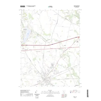 2023 London2023 Print · USGSThe Madison County seat and its surrounding farming townships are captured in this modern survey of the central Ohio landscape. Genealogists and local historians can locate numerous rural burial grounds such as Arbuckle Cem and Upper Gwynne Farm Cem alongside landmarks like the Madison County Airport.
 - 2023 Map of South Vienna, 2023 Print
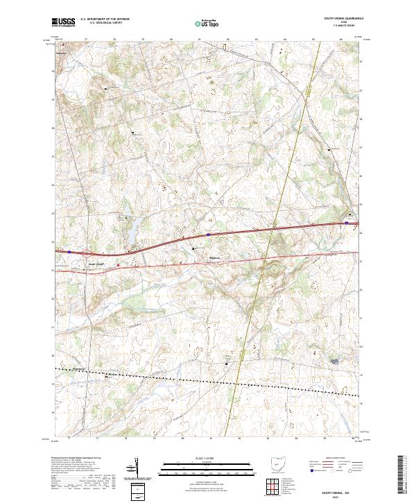 2023 South Vienna2023 Print · USGSSouth Vienna and the surrounding Clark County farmstead country appear here in the early twenty-first century as the National Pike corridor continues to shape local geography. Researchers can trace family history through numerous rural burial grounds like Mcconkey Cem, Wilson Chapel Cem, and Statler Cem.
 - 2023 Map of Mechanicsburg, 2023 Print
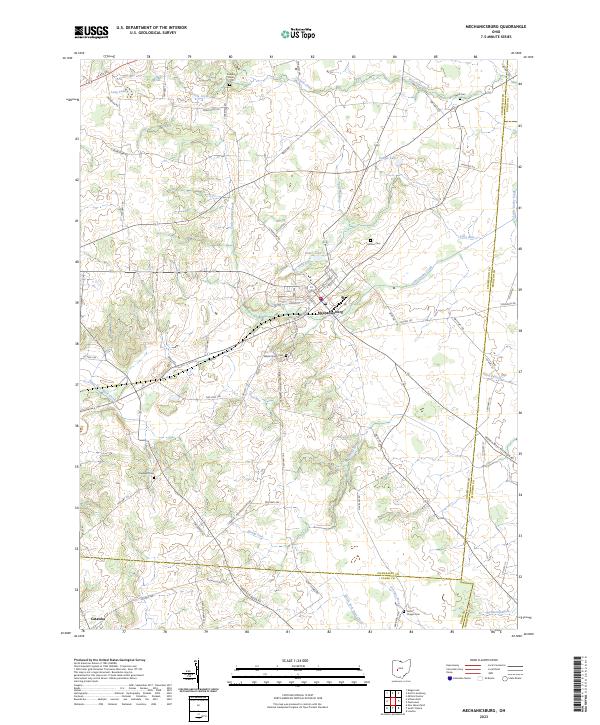 2023 Mechanicsburg2023 Print · USGSMechanicsburg and the surrounding Ohio farmlands are captured in this recent study of the area's enduring rural character. Genealogists can locate family landmarks such as Maple Grove Cem, Hopewell Cem, and Nation Chapel Cem.
End of results
Showing maps 1-4 of 4
Top cities near Somerford Township
- Springfield historical maps
- Marysville historical maps
- Urbana historical maps
- London historical maps
- Plain City historical maps
- West Jefferson historical maps
See more
Top neighborhoods of Somerford Township
- Summerford historical maps
- Tradersville historical maps
- Choctaw Lake historical maps
- Choctaw Lake Subdivision historical maps
Frequently asked questions
- What are the different types of historical maps available for Somerford Township?
- What is the oldest map of Somerford Township?
- Where can I purchase historical maps of Somerford Township for my home or office?
- Where can I download high-res historical maps of Somerford Township?
- Are there historical topographic maps available for Somerford Township?
- Is there historical aerial imagery available for Somerford Township?
- Where are historical maps of Somerford Township sourced from?