Old Maps of Canfield, Ohio for Metal Detecting
Plan your next treasure hunt with 22 historic maps of Canfield. Find old homesites, ghost towns, trails, and gathering spots that may be lost to time — perfect for identifying promising metal detecting locations.
- Locate forgotten sites: Uncover places like long-lost settlements, abandoned rail lines, or gathering spots.
- Plan better hunts: Use map overlays combined with LiDAR or satellite views to narrow in on historically rich areas.
- Made for detectorists: Thousands of hobbyists use these maps to discover relics, coins, and hidden history.
Use these historic maps to boost your research and find new opportunities beneath the surface of Canfield.
Canfield, OH maps
(22)- 1906 Map of Youngstown, 1958 Print
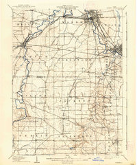
 1906 Youngstown1958 Print · USGSThe Mahoning Valley's industrial heartland is caught at its early twentieth-century peak, showing the massive rail and steel infrastructure at the state border. Researchers can trace the lineage of local neighborhoods and schools like Hell Street School, Idora Park, and Tibbetts Corners.
 - 1908 Map of Youngstown, 1937 Print
 1908 Youngstown1937 Print · USGSThe Mahoning Valley at the height of its industrial boom is defined by a massive concentration of rail lines and riverfront steel towns. Genealogists and historians can trace the footprint of early neighborhood schools like Bell School, find the original layout of Idora Park, and locate vanished rail stops along the ERIE RAILROAD.2 unique versions available
 - 1908 Map of Warren, 1937 Print
 1908 Warren1937 Print · USGSTrumbull and Mahoning counties at the turn of the century show a landscape defined by the heavy rail corridors of the Mahoning River valley. Genealogists can trace family footprints near Russell School, the Infirmary, and early settlements like Mineral Ridge.2 unique versions available
 - 1950 Map of Cleveland
 1950 Cleveland1950 Print · USGSCovers Canfield, including Cleveland, Akron, and other nearby areas
 - 1951 Map of Youngstown, 1953 Print
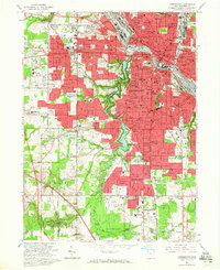
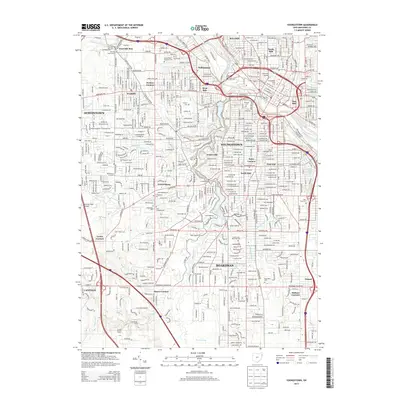
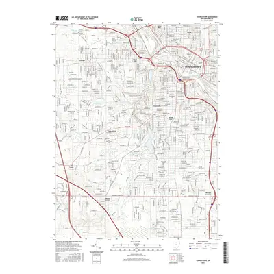
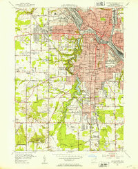 1951 Youngstown1953 Print · USGSYoungstown at the peak of its mid-century industrial era reveals a city defined by its river-valley railroads and sprawling park systems. Researchers can trace neighborhood history through landmarks like Idora Park, Youngstown College, and the sprawling Mill Creek Park.
 - 1952 Map of Canfield, 1953 Print
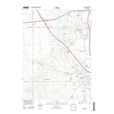
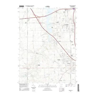
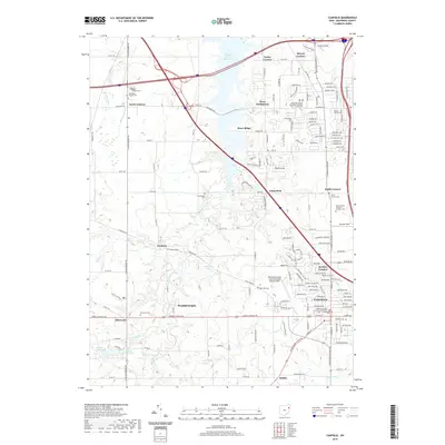
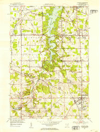 1952 Canfield1953 Print · USGSMahoning County is captured here in the early fifties as the post-war landscape began to shift around the expansive Meander Creek Reservoir. Researchers can locate family landmarks like the Dean Hill Cem, North Jackson Station, and the County Fairgrounds.
 - 1956 Map of Cleveland, 1967 Print
 1956 Cleveland1967 Print · USGSNortheast Ohio and Western Pennsylvania are shown at their industrial height during the mid-fifties, from the steel mills to the lakeshore. Researchers can trace the massive Ravenna Arsenal, the Ohio Turnpike, and vanished rail sidings of the B & O RR.3 unique versions available
 - 1962 Map of Cleveland
 1962 Cleveland1962 Print · USGSNortheast Ohio and the Pennsylvania borderlands appear here during the industrial peak of the early sixties. Genealogists and historians can trace the expansive rail lines of the Nickel Plate Road and the growth of suburbs from Parma to Lyndhurst.
 - 1963 Map of Canfield, 1964 Print
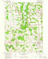 1963 Canfield1964 Print · USGSMahoning County in the early sixties reveals a landscape balancing its agricultural roots with suburban growth. Genealogists and local historians can locate long-standing landmarks like St Pauls Monastery, the County Fairgrounds, and the Old North Cem.4 unique versions available
 - 1963 Map of Youngstown, 1965 Print
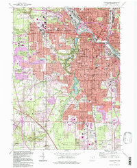
 1963 Youngstown1965 Print · USGSYoungstown was a thriving industrial hub in the mid-sixties, caught here at the peak of its rail-and-canal era. Researchers can trace family roots through numerous parish schools, major cemeteries like Calvary Cemetery, and the campus of Youngstown College.5 unique versions available
 - 1986 Map of Youngstown, 1988 Print
 1986 Youngstown1988 Print · USGSThe industrial corridor of the Mahoning Valley and the collegiate towns of Western Pennsylvania are captured here in the mid-eighties. Researchers can trace the rail lines of the Conrail network or locate historical sites like Churchill and Crown Hill Cem.2 unique versions available
 - 1994 Map of Youngstown, 1997 Print
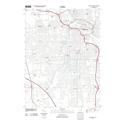
 1994 Youngstown1997 Print · USGSYoungstown and Boardman are captured in the mid-nineties, showing the city's dense urban core and its expanding suburban neighborhoods. Researchers can locate dozens of local landmarks like Youngstown State University, Mill Creek Park, and Calvary Cemetery.
 - 2010 Map of Youngstown, 2010 Print
 2010 Youngstown2010 Print · USGSCovers Canfield, including Youngstown, Boardman, and other nearby areas
 - 2010 Map of Canfield, 2010 Print
 2010 Canfield2010 Print · USGSCovers Canfield, including Austintown, Ellsworth, and other nearby areas
 - 2013 Map of Canfield, 2013 Print
 2013 Canfield2013 Print · USGSCovers Canfield, including Austintown, Ellsworth, and other nearby areas
 - 2013 Map of Youngstown, 2013 Print
 2013 Youngstown2013 Print · USGSCovers Canfield, including Youngstown, Boardman, and other nearby areas
 - 2016 Map of Youngstown, 2016 Print
 2016 Youngstown2016 Print · USGSCovers Canfield, including Youngstown, Boardman, and other nearby areas
 - 2016 Map of Canfield, 2016 Print
 2016 Canfield2016 Print · USGSCovers Canfield, including Austintown, Ellsworth, and other nearby areas
 - 2019 Map of Canfield, 2019 Print
 2019 Canfield2019 Print · USGSCovers Canfield, including Austintown, Ellsworth, and other nearby areas
 - 2019 Map of Youngstown, 2019 Print
 2019 Youngstown2019 Print · USGSCovers Canfield, including Youngstown, Boardman, and other nearby areas
 - 2023 Map of Canfield, 2023 Print
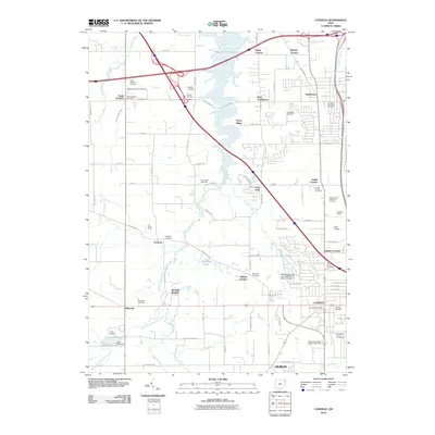
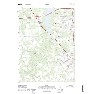 2023 Canfield2023 Print · USGSMahoning County has transformed into a major residential and institutional corridor in this contemporary survey. Researchers can locate numerous family burial sites and civic centers like Old North Cem and Mahoning County Courthouse Number Five - Canfield.
 - 2023 Map of Youngstown, 2023 Print
 2023 Youngstown2023 Print · USGSModern-day Mahoning County is shown here in extensive detail, documenting the urban core and suburban expansion. Researchers can find numerous landmarks like Oak Hill Cem, Youngstown State University, and Lake Cohasset.
End of results
Showing maps 1-22 of 22
Top cities near Canfield
- Youngstown historical maps
- Boardman historical maps
- Warren historical maps
- Austintown historical maps
- Weathersfield Township historical maps
- Howland Township historical maps
See more
Top neighborhoods of Canfield
- Crestwood Heights historical maps
- Highland Meadows historical maps
- Kings Lake Estates historical maps
- Laurel Hills historical maps
- Russo Lakhani Woods historical maps
- Stonebridge historical maps
See more
Frequently asked questions
- What are the different types of historical maps available for Canfield?
- What is the oldest map of Canfield?
- Where can I purchase historical maps of Canfield for my home or office?
- Where can I download high-res historical maps of Canfield?
- Are there historical topographic maps available for Canfield?
- Is there historical aerial imagery available for Canfield?
- Where are historical maps of Canfield sourced from?