Old Maps of Mahoning County, Ohio for Genealogy
Trace your family roots with 133 historic maps of Mahoning County. These high-res maps reveal old neighborhoods, homesites, landmarks, and streets — helping you uncover where your ancestors lived and how the area evolved over time.
- Explore historic neighborhoods: Identify where your relatives may have lived in the 1800s or 1900s.
- Compare maps over time: Trace the changes in streets, buildings, and landmarks for multi-generational research.
- Perfect for genealogy & ancestry research: Used by family historians and researchers to map out lineage and migration.
These maps are an incredible resource for exploring your personal connection to Mahoning County's past.
Mahoning County, OH maps
(133)- 1906 Map of Youngstown, 1958 Print
 1906 Youngstown1958 Print · USGSThe Mahoning Valley's industrial heartland is caught at its early twentieth-century peak, showing the massive rail and steel infrastructure at the state border. Researchers can trace the lineage of local neighborhoods and schools like Hell Street School, Idora Park, and Tibbetts Corners.
 - 1906 Map of Ravenna, 1961 Print
 1906 Ravenna1961 Print · USGSPortage County at the turn of the century was a network of rail-side hamlets and one-room schoolhouses. Genealogists can trace family roots through specific stops like New Milford Rootstown Sta and rural landmarks such as Whippoorwill School.
 - 1907 Map of Columbiana, 1958 Print
 1907 Columbiana1958 Print · USGSColumbiana County at the turn of the century was a bustling corridor of coal, rail, and community life. Genealogists can trace family names at Subrosa School and Mt Zion Church, or locate defunct stops on the Pennsylvania System.
 - 1908 Map of Youngstown, 1937 Print
 1908 Youngstown1937 Print · USGSThe Mahoning Valley at the height of its industrial boom is defined by a massive concentration of rail lines and riverfront steel towns. Genealogists and historians can trace the footprint of early neighborhood schools like Bell School, find the original layout of Idora Park, and locate vanished rail stops along the ERIE RAILROAD.2 unique versions available
 - 1908 Map of Warren, 1937 Print
 1908 Warren1937 Print · USGSTrumbull and Mahoning counties at the turn of the century show a landscape defined by the heavy rail corridors of the Mahoning River valley. Genealogists can trace family footprints near Russell School, the Infirmary, and early settlements like Mineral Ridge.2 unique versions available
 - 1908 Map of Ravenna, 1946 Print
 1908 Ravenna1946 Print · USGSPortage County at the dawn of the twentieth century was a vital crossroads of major rail lines and rural townships. Genealogists can trace family footprints across several rural schools like Evergreen School and vanished depots such as Palmyra Sta or Freedom Station.2 unique versions available
 - 1909 Map of Alliance
 1909 Alliance1909 Print · USGSAlliance and its surrounding industrial townships are captured in detail just after the turn of the century as the rail network reached its peak. Genealogists can trace family roots through numerous rural schools like Linden Hall School and vanished stations such as Freeburg Sta.4 unique versions available
 - 1909 Map of Lisbon, 1937 Print
 1909 Lisbon1937 Print · USGSColumbiana and Mahoning Counties flourished at the intersection of rail and agriculture in the early 1900s. Genealogists can trace family roots through numerous small hamlets and local landmarks like Franklin Square, St Jacobs Church, and New Garden.2 unique versions available
 - 1909 Map of Columbiana, 1937 Print
 1909 Columbiana1937 Print · USGSThe Ohio-Pennsylvania borderlands are captured here during the peak of the rail era, showing a landscape defined by industry and rural education. Researchers can trace the path of the Pennsylvania System through East Palestine or locate local landmarks like Coalmines and the Subrosa School.2 unique versions available
 - 1950 Map of Cleveland
 1950 Cleveland1950 Print · USGSCovers Mahoning County, including Cleveland, Akron, and other nearby areas
 - 1951 Map of Canton
 1951 Canton1951 Print · USGSThe industrial heartland of Ohio and Pennsylvania reached its mid-century peak during this era of heavy rail and river transit. Genealogists and historians can trace the development of steel towns like Aliquippa and Weirton alongside the Ohio River and major lines of the Pennsylvania RR.
 - 1951 Map of Columbiana, 1953 Print
 1951 Columbiana1953 Print · USGSThe Mahoning and Columbiana county line in the early fifties shows a landscape of rail-connected towns and rural cemeteries. Genealogists can trace family names at Zion Hill Ch Cem or Easterly Cem while exploring the rail routes of the ERIE RAILROAD.
 - 1951 Map of Campbell, 1953 Print
 1951 Campbell1953 Print · USGSThe Mahoning River valley in the early fifties shows a dense industrial corridor of rails and riverside towns on the Ohio-Pennsylvania line. Genealogists can trace family landmarks like White Sch, St Johns Cem, and Holy Rosary Cem.
 - 1951 Map of New Middletown, 1953 Print
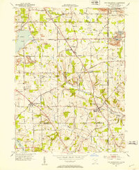 1951 New Middletown1953 Print · USGSEastern Ohio at the dawn of the fifties shows a rural landscape adapting to new interstate travel. Researchers can trace ancestral locations at Bethel Cem, Springfield High Sch, and the emerging corridor of the Ohio Turnpike.
 - 1951 Map of Youngstown, 1953 Print
 1951 Youngstown1953 Print · USGSYoungstown at the peak of its mid-century industrial era reveals a city defined by its river-valley railroads and sprawling park systems. Researchers can trace neighborhood history through landmarks like Idora Park, Youngstown College, and the sprawling Mill Creek Park.
 - 1952 Map of Lake Milton, 1953 Print
 1952 Lake Milton1953 Print · USGSMahoning County in the early fifties shows a landscape of growing reservoirs and deep-rooted rural junctions. Researchers can trace family sites near Berlin Center, locate the Shilling Mill on the river, or find early lakeside settlements like Craig Beach and Flicks Corners.
 - 1952 Map of Canfield, 1953 Print
 1952 Canfield1953 Print · USGSMahoning County is captured here in the early fifties as the post-war landscape began to shift around the expansive Meander Creek Reservoir. Researchers can locate family landmarks like the Dean Hill Cem, North Jackson Station, and the County Fairgrounds.
 - 1952 Map of Alliance, 1954 Print
 1952 Alliance1954 Print · USGSAlliance and its surrounding industrial townships are captured in the early fifties, showcasing a dense rail and school network. Genealogists can trace family names through several burial sites like Old German Cem and Hartzell Cem, or locate historic homes near Mt Union College.3 unique versions available
 - 1952 Map of Damascus, 1954 Print
 1952 Damascus1954 Print · USGSThe Mahoning and Columbiana county line comes alive in the early fifties, showing the rail-centered growth of Beloit and Damascus. Genealogists can locate family landmarks like the Damascus Cemetery, Township School, and the Wilbur Church at a time when steam and diesel still shared the rails.
 - 1952 Map of Salem, 1954 Print
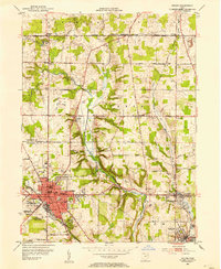 1952 Salem1954 Print · USGSMid-century development in the SALEM area shows a landscape of busy industrial towns and family-named crossroads during the 1950s. Genealogists and historians can trace neighborhood sites like Buckeye Sch, Hope Cem, and the old rail lines serving Washingtonville.
 - 1953 Map of Canton
 1953 Canton1953 Print · USGSThe industrial heartland of Ohio and Pennsylvania is captured at its mid-century peak in this detailed regional survey. Genealogists and historians can trace the vast rail networks of the Pennsylvania RR and find local landmarks like Nimisila Reservoir and Tappan Reservoir.
 - 1954 Map of Sharon West, 1956 Print
 1954 Sharon West1956 Print · USGSThe industrial heart of the Ohio-Pennsylvania border comes alive in the mid-1950s, centered on the bustling rail hubs and river towns. Researchers can trace family history through the neighborhoods of Hubbard, locate the Slope Ch, or study the grounds of Oakwood Cem.
 - 1954 Map of Girard, 1956 Print
 1954 Girard1956 Print · USGSThe Mahoning River valley in the mid-1950s shows an industrial powerhouse at its peak, dominated by a dense rail network. Genealogists and local historians can trace family locations near Girard and McDonald, or locate sites like St Rose Sch and Tod Homestead Cemetery.
 - 1956 Map of Cleveland, 1967 Print
 1956 Cleveland1967 Print · USGSNortheast Ohio and Western Pennsylvania are shown at their industrial height during the mid-fifties, from the steel mills to the lakeshore. Researchers can trace the massive Ravenna Arsenal, the Ohio Turnpike, and vanished rail sidings of the B & O RR.3 unique versions available
 - 1957 Map of Canton, 1971 Print
 1957 Canton1971 Print · USGSThe industrial heartland of eastern Ohio and western Pennsylvania comes alive in this mid-century survey of the Ohio River Valley. Trace the heritage of rail and river commerce through Pittsburgh, the massive steel towns along the Ohio River, and major junctions on the Pennsylvania RR.3 unique versions available
Showing maps 1-25 of 133
Top cities of Mahoning County
- Youngstown historical maps
- Boardman historical maps
- Austintown historical maps
- Struthers historical maps
- Campbell historical maps
- Canfield historical maps
See more
Frequently asked questions
- What are the different types of historical maps available for Mahoning County?
- What is the oldest map of Mahoning County?
- Where can I purchase historical maps of Mahoning County for my home or office?
- Where can I download high-res historical maps of Mahoning County?
- Are there historical topographic maps available for Mahoning County?
- Is there historical aerial imagery available for Mahoning County?
- Where are historical maps of Mahoning County sourced from?