Old Maps of Piqua, Ohio for Academic Research
Study the evolution of Piqua with 31 high-resolution historic maps. Whether you're teaching, researching, or modeling changes in land use, these maps provide essential visual documentation of urban, environmental, and geographic change.
- Analyze long-term change: Track patterns in development, transportation, and natural features.
- Ideal for environmental or urban studies: Support academic projects with primary historical map data.
- Use in the classroom or lab: Educators and researchers rely on these maps to bring historical context to life.
These maps are a powerful tool for teaching, research, and visualizing how Piqua has changed over the decades.
Piqua, OH maps
(31)- 1911 Map of Covington, 1946 Print
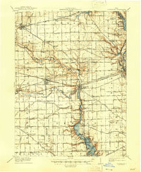 1911 Covington1946 Print · USGSWestern Ohio’s agricultural heartland is mapped here as a web of turnpikes and railroads connects thriving towns. Trace old family sites near Bradford, Gettysburg, and uniquely named rural landmarks like Lickskillet School or Cassels Corners.
 - 1914 Map of Troy, 1931 Print
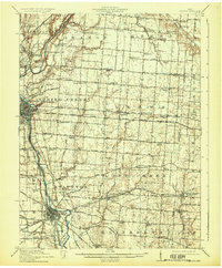 1914 Troy1931 Print · USGSMiami County at the height of the interurban era shows a landscape defined by the Miami River and competing rail lines. Genealogists can locate family landmarks like the County Infirmary or schools such as Sheepskin School and Frogpond School.2 unique versions available
 - 1944 Map of Covington
 1944 Covington1944 Print · USGSWestern Ohio at the end of the Second World War remains a landscape of thriving rural rail towns and country schoolhouses. Researchers can trace the Stillwater River to find Greenville Falls, the Forest Hill Cem, and local landmarks like Tadpole Sch and Ludlow Falls.
 - 1944 Map of Troy
 1944 Troy1944 Print · USGSMiami County during the mid-forties reveals a landscape of industrial river towns and an incredibly dense network of rural schools. Researchers can trace the path of the Miami and Erie Canal and locate family-named landmarks like Rhodhammel Sch and Staunton.
 - 1953 Map of Muncie, 1966 Print
 1953 Muncie1966 Print · USGSIndiana and Ohio borderlands thrive in the early fifties, showing a landscape defined by manufacturing cities and an intensive railroad network. Genealogists can trace family roots across the Indiana-Ohio line through Muncie, Celina, and Portland via the Pennsylvania railroad.5 unique versions available
 - 1956 Map of Muncie
 1956 Muncie1956 Print · USGSEastern Indiana and western Ohio are shown at a peak of rail-driven industry in the mid-fifties. Genealogists and rail historians can trace the paths of the Pennsylvania RR through Muncie or locate landmarks like Lake Saint Marys (Grand Lake Reservoir) and Frances Slocum State Forest.
 - 1961 Map of Piqua West, 1962 Print
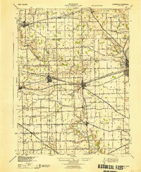
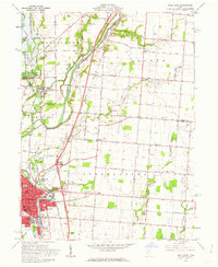
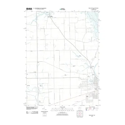
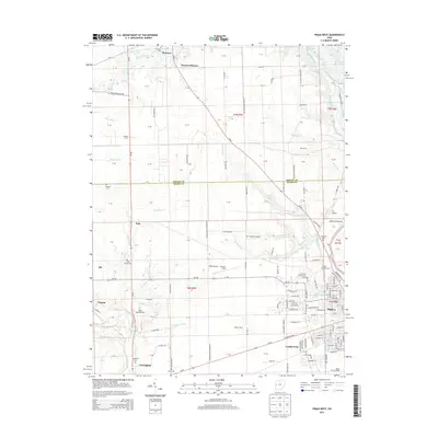
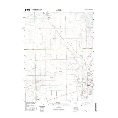
 1961 Piqua West1962 Print · USGSWestern Miami County is captured here in the early sixties as the suburbs of Piqua expanded toward Newberry and Washington townships. Researchers can trace family history through sites like Forest Hill Cemetery, St Teresas Ch, and the rural Mount Jefferson crossroads.4 unique versions available
 - 1961 Map of Piqua East, 1962 Print
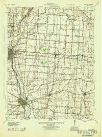
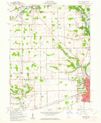
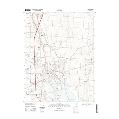
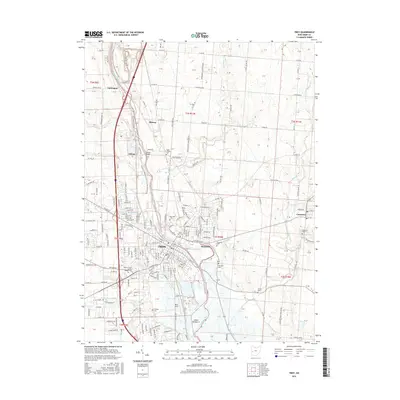
 1961 Piqua East1962 Print · USGSMiami County during the early sixties shows the industrial hub of Piqua at a crossroads of rail and river commerce. Genealogists and local historians can trace the Miami and Erie Canal path or locate family sites at Garby Cem No 1 and Kirkwood.4 unique versions available
 - 1961 Map of Troy, 1962 Print
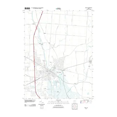
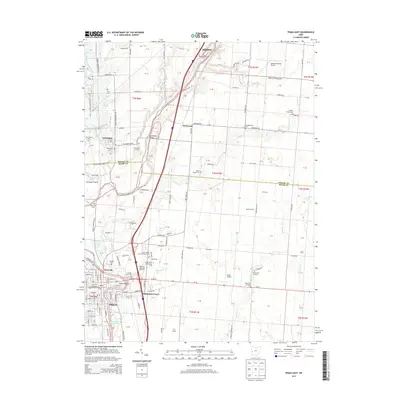
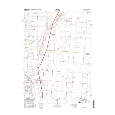
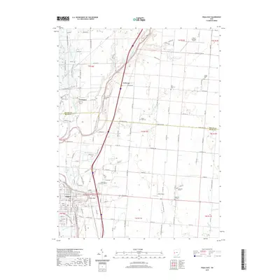
 1961 Troy1962 Print · USGSThe Miami River valley shows significant post-war growth around Troy in the early sixties. Genealogists can trace family landmarks at Riverside Cemetery and Knoop Cem or the rural Staunton Sch.5 unique versions available
 - 1961 Map of Pleasant Hill, 1962 Print
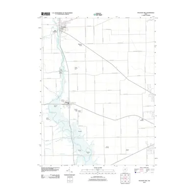
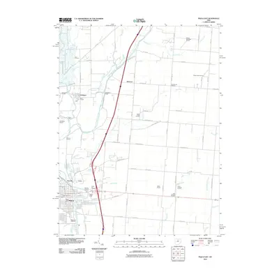
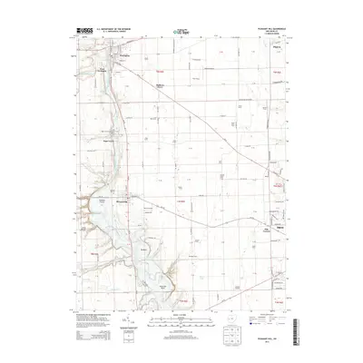
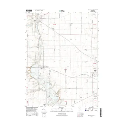
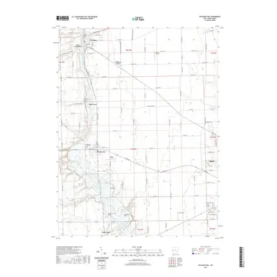
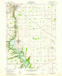 1961 Pleasant Hill1962 Print · USGSMiami County at the start of the sixties reveals a landscape of thriving river towns and established family farms. Researchers can trace the ancestral connections between Pleasant Hill and Covington or locate specific sites like the Concord Township Sch and Old Union Cem.2 unique versions available
 - 1986 Map of Piqua
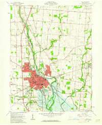
 1986 Piqua1986 Print · USGSThe western Ohio and eastern Indiana borderlands appear here in the mid-1980s, showcasing a landscape of river-valley industry and fertile plains. Researchers can trace historic rail lines like Conrail and Norfolk and Western through towns like Greenville and Winchester.3 unique versions available
 - 2010 Map of Piqua West, 2010 Print
 2010 Piqua West2010 Print · USGSCovers Piqua, including Covington, Polo, and other nearby areas
 - 2010 Map of Pleasant Hill, 2010 Print
 2010 Pleasant Hill2010 Print · USGSCovers Piqua, including Troy, Covington, and other nearby areas
 - 2010 Map of Troy, 2010 Print
 2010 Troy2010 Print · USGSCovers Piqua, including Troy, Staunton, and other nearby areas
 - 2010 Map of Piqua East, 2010 Print
 2010 Piqua East2010 Print · USGSCovers Piqua, including Lockington, Rossville, and other nearby areas
 - 2013 Map of Troy, 2013 Print
 2013 Troy2013 Print · USGSCovers Piqua, including Troy, Staunton, and other nearby areas
 - 2013 Map of Pleasant Hill, 2013 Print
 2013 Pleasant Hill2013 Print · USGSCovers Piqua, including Troy, Covington, and other nearby areas
 - 2013 Map of Piqua West, 2013 Print
 2013 Piqua West2013 Print · USGSCovers Piqua, including Covington, Polo, and other nearby areas
 - 2013 Map of Piqua East, 2013 Print
 2013 Piqua East2013 Print · USGSCovers Piqua, including Lockington, Rossville, and other nearby areas
 - 2016 Map of Piqua West, 2016 Print
 2016 Piqua West2016 Print · USGSCovers Piqua, including Covington, Polo, and other nearby areas
 - 2016 Map of Troy, 2016 Print
 2016 Troy2016 Print · USGSCovers Piqua, including Troy, Staunton, and other nearby areas
 - 2016 Map of Piqua East, 2016 Print
 2016 Piqua East2016 Print · USGSCovers Piqua, including Lockington, Rossville, and other nearby areas
 - 2016 Map of Pleasant Hill, 2016 Print
 2016 Pleasant Hill2016 Print · USGSCovers Piqua, including Troy, Covington, and other nearby areas
 - 2019 Map of Pleasant Hill, 2019 Print
 2019 Pleasant Hill2019 Print · USGSCovers Piqua, including Troy, Covington, and other nearby areas
 - 2019 Map of Piqua East, 2019 Print
 2019 Piqua East2019 Print · USGSCovers Piqua, including Lockington, Rossville, and other nearby areas
Showing maps 1-25 of 31
Top cities near Piqua
- Troy historical maps
- Sidney historical maps
- Tipp City historical maps
- New Carlisle historical maps
- West Milton historical maps
- Versailles historical maps
See more
Top neighborhoods of Piqua
Frequently asked questions
- What are the different types of historical maps available for Piqua?
- What is the oldest map of Piqua?
- Where can I purchase historical maps of Piqua for my home or office?
- Where can I download high-res historical maps of Piqua?
- Are there historical topographic maps available for Piqua?
- Is there historical aerial imagery available for Piqua?
- Where are historical maps of Piqua sourced from?