1900s (20th Century) Maps of Downtown Chesterhill Historic District, Chesterhill
Explore 9 historic maps of Downtown Chesterhill Historic District from the 1900s (20th Century). These maps offer a rare glimpse into what life looked like during the 1900s — showing old roads, neighborhoods, homes, and landmarks that have changed or disappeared over time.
Whether you're researching your family's past, planning a metal detecting trip, or studying how Downtown Chesterhill Historic District's landscape evolved across the 1900s, these high-resolution maps are a powerful tool for exploring the history of this region.
- Focus on a specific era: All maps on this page are from the 1900s, giving you a focused view of this time period.
- See what’s changed: Compare century-old streets, trails, and buildings to today's modern landscape using overlays and satellite layers.
- Research with precision: Use these maps for genealogy, historical research, land use analysis, or educational projects.
- View, download, or print: Maps are fully viewable online in high resolution, and can be downloaded or printed for your own records.
Start exploring Downtown Chesterhill Historic District's history through authentic maps from the 1900s. This is your window into the past.
Downtown Chesterhill Historic District, Chesterhill maps
(9)- 1904 Map of Chesterhill, 1957 Print
 1904 Chesterhill1957 Print · USGSSoutheast Ohio's rugged hill country is captured here during the peak of its rail-and-river economy in the early twentieth century. Researchers can locate vanished rural post offices and community landmarks like Calvary P O, Bethany Church, and Patten Mills.
 - 1906 Map of Chesterhill, 1943 Print
 1906 Chesterhill1943 Print · USGSSoutheastern Ohio at the start of the century reveals a landscape of coal-mining hamlets and river valley rail lines. Genealogists and researchers can trace family landmarks like Mills School, Patten Mills, and the scattered post offices of Calvary PO and Federal.
 - 1949 Map of Clarksburg
 1949 Clarksburg1949 Print · USGSThe upper Ohio River valley and the industrial heart of West Virginia come into focus during this post-war period. Genealogists and researchers can trace the rail corridors of the Baltimore and Ohio and locate centers like Fairmont, Grafton, and Waynesburg.
 - 1956 Map of Clarksburg, 1966 Print
 1956 Clarksburg1966 Print · USGSThe Ohio River valley and the industrial heart of West Virginia are seen here in the mid-1950s as rail and river commerce thrived. Researchers can trace historic transport lines like the Baltimore and Ohio RR and locate ancestral homes in Clarksburg, Moundsville, or Parkersburg.2 unique versions available
 - 1961 Map of Clarksburg
 1961 Clarksburg1961 Print · USGSThe mid-century industrial and river landscapes of West Virginia and Ohio are detailed here, centered on the Ohio River. Researchers can trace the Baltimore and Ohio rail lines connecting towns like Parkersburg, Clarksburg, and Monongah.
 - 1961 Map of Chesterhill, 1962 Print
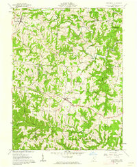 1961 Chesterhill1962 Print · USGSMorgan and Washington Counties are shown here in the early 1960s, a landscape of ridge-top farms and valley settlements along the West Branch Wolf Creek. Genealogists and local historians can trace family roots through numerous sites like Chesterhill, Patten Mills, and the Quaker Cem.4 unique versions available
 - 1981 Map of Parkersburg, 1984 Print
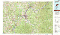 1981 Parkersburg1984 Print · USGSThe Ohio River valley at the start of the 1980s reveals a landscape shaped by river commerce and the rail networks of the Baltimore and Ohio RR. Genealogists and historians can trace the development of riverfront communities like Parkersburg, Marietta, and Williamstown, alongside rural landmarks like Blennerhassett Island and Elizabeth.
 - 1988 Map of Clarksburg, 1989 Print
 1988 Clarksburg1989 Print · USGSThe central Appalachians are documented in detail during the late eighties, showing the industrial and river-based economies of West Virginia, Ohio, and Pennsylvania. Researchers can trace historic rail routes like the B & O RR and locate river towns from St Marys to Parkersburg.
 - 1994 Map of Chesterhill, 1998 Print
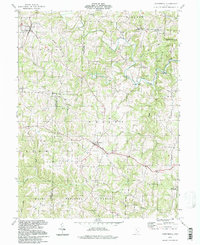 1994 Chesterhill1998 Print · USGSThe rural highlands of Morgan and Washington counties are captured here in the late twentieth century. Genealogists can trace small-town life through Patten Mills, Plantsville, and numerous country churches like Wesleyan Ch.
End of results
Showing maps 1-9 of 9
Frequently asked questions
- What are the different types of historical maps available for Downtown Chesterhill Historic District?
- What is the oldest map of Downtown Chesterhill Historic District?
- Where can I purchase historical maps of Downtown Chesterhill Historic District for my home or office?
- Where can I download high-res historical maps of Downtown Chesterhill Historic District?
- Are there historical topographic maps available for Downtown Chesterhill Historic District?
- Is there historical aerial imagery available for Downtown Chesterhill Historic District?
- Where are historical maps of Downtown Chesterhill Historic District sourced from?