1960s Maps of Muskingum County, Ohio
Explore 27 historic maps of Muskingum County from the 1960s. These maps offer a rare glimpse into what life looked like during the 1960s — showing old roads, neighborhoods, homes, and landmarks that have changed or disappeared over time.
Whether you're researching your family's past, planning a metal detecting trip, or studying how Muskingum County's landscape evolved across the 1960s, these high-resolution maps are a powerful tool for exploring the history of this region.
- Focus on a specific era: All maps on this page are from the 1960s, giving you a focused view of this time period.
- See what’s changed: Compare century-old streets, trails, and buildings to today's modern landscape using overlays and satellite layers.
- Research with precision: Use these maps for genealogy, historical research, land use analysis, or educational projects.
- View, download, or print: Maps are fully viewable online in high resolution, and can be downloaded or printed for your own records.
Start exploring Muskingum County's history through authentic maps from the 1960s. This is your window into the past.
Muskingum County, OH maps
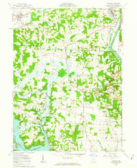
(27)- 1961 Map of Columbus
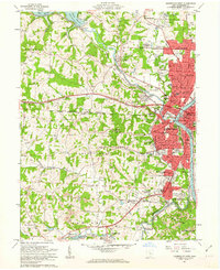
 1961 Columbus1961 Print · USGSCentral and Southern Ohio are captured here in the early sixties, as the region's industrial rail hubs and military bases reached their peak. Genealogists and historians can trace the transition from urban Columbus to rural townships along the Scioto River, locating Lockbourne USAF and old junctions like Washington Court House.
 - 1961 Map of Clarksburg
 1961 Clarksburg1961 Print · USGSThe mid-century industrial and river landscapes of West Virginia and Ohio are detailed here, centered on the Ohio River. Researchers can trace the Baltimore and Ohio rail lines connecting towns like Parkersburg, Clarksburg, and Monongah.
 - 1961 Map of Zanesville West, 1962 Print
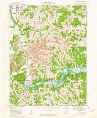
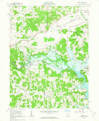
 1961 Zanesville West1962 Print · USGSZanesville and its river valleys are captured here in the early sixties as the city expanded alongside its industrial and rail hubs. Researchers can trace local lineage through numerous burial grounds like United Jewish Cem or explore the New York Central rail lines and early Strip Mine sites.4 unique versions available
 - 1961 Map of Fultonham, 1963 Print
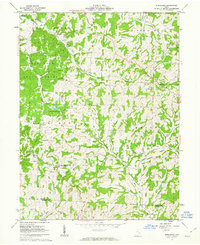
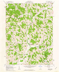
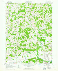
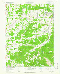 1961 Fultonham1963 Print · USGSMuskingum and Perry Counties are shown here in the early 1960s as mining and rail transport reshaped the rural landscape. Trace local heritage at Fultonham (Uniontown), find family names at Zion Ch Cem, or follow the path of the New York Central railroad.3 unique versions available
 - 1961 Map of Philo, 1963 Print
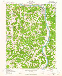 1961 Philo1963 Print · USGSThe Muskingum River valley comes alive in the early sixties as a hub of rail transport and resource extraction. Genealogists can locate family burial sites like Irish Ridge Cem or trace the old Baltimore and Ohio Railroad through Philo and Duncan Falls.4 unique versions available
 - 1961 Map of Crooksville, 1963 Print
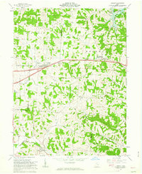
 1961 Crooksville1963 Print · USGSSoutheastern Ohio at the start of the sixties is captured here as a bustling industrial landscape of rail lines and extraction sites. You can trace the development of the Pennsylvania railroad through Roseville or locate family roots near Rose Hill Cem and Ebenezer Ch.5 unique versions available
 - 1961 Map of Ruraldale, 1963 Print
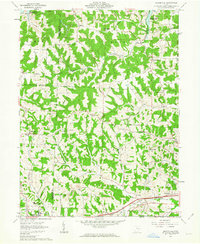
 1961 Ruraldale1963 Print · USGSMuskingum and Morgan counties are shown in the early sixties, a time when small rural settlements like Ruraldale and Museville were deeply tied to the land. Genealogists and historians can trace family locations through numerous landmarks, including Bethlehem Cem, Sugar Grove Chapel, and the Blue Rock Lookout Tower.4 unique versions available
 - 1961 Map of Cumberland, 1963 Print
 1961 Cumberland1963 Print · USGSSoutheastern Ohio's hill country is captured here during the early sixties, showing a landscape defined by rail transport and surface mining. Trace the Baltimore and Ohio tracks through Cumberland or locate family sites like Brookfield Cem and Ark Springs Ch.4 unique versions available
 - 1961 Map of Norwich, 1963 Print
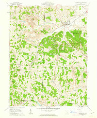
 1961 Norwich1963 Print · USGSMuskingum County in the early sixties shows a rural landscape of scattered hamlets and church-centered townships. Genealogists and local historians can trace family locations through Rock Spring Cem, the village of Norwich, and the old Smith Mill site.5 unique versions available
 - 1961 Map of New Concord, 1963 Print
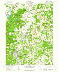
 1961 New Concord1963 Print · USGSMuskingum County and the village of New Concord are captured in the early sixties as local industry and campus life expanded. Researchers can trace family roots at Zion Cem or locate former rural landmarks like the Westland Sch and Rix Mills.4 unique versions available
 - 1961 Map of Zanesville East, 1963 Print
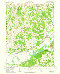
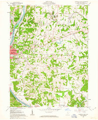 1961 Zanesville East1963 Print · USGSMuskingum County at the start of the sixties reveals a landscape of river-valley industry and expanding coal works. Genealogists and historians can trace rail-side neighborhoods near North Zanesville or locate rural landmarks like Rural Chapel and the Paul Mine.5 unique versions available
 - 1962 Map of Columbus
 1962 Columbus1962 Print · USGSCentral Ohio during the early sixties reveals a transition from the industrial corridors of Columbus to the forested ridges of the south. Genealogists and historians can trace the rail networks of the Baltimore & Ohio RR and find local landmarks like Washington Court House and Camp Sherman Military Reservation.
 - 1962 Map of Marion
 1962 Marion1962 Print · USGSCentral Ohio during the post-war era showcases a dense network of railroad towns and emerging interstate highways. Genealogists can trace family roots in smaller settlements like Houcktown and Marseilles or locate landmarks near Indian Lake.
 - 1962 Map of Canton
 1962 Canton1962 Print · USGSThe industrial heartland of Eastern Ohio and Western Pennsylvania thrives in the early sixties as steel mills and rail lines dominate the river valleys. Genealogists and historians can trace local landmarks like McKinley National Memorial, Malone College, and industrial sites such as Republic Steel Corp.2 unique versions available
 - 1962 Map of Perryton, 1963 Print
 1962 Perryton1963 Print · USGSLicking and Coshocton counties are shown in the early sixties as a rural landscape of winding creek valleys and dispersed hamlets. Researchers can trace family history at Perry Chapel, locate the Union Sch, or find the old Covered Bridge and Ashcraft Ford.3 unique versions available
 - 1962 Map of Plainfield, 1963 Print
 1962 Plainfield1963 Print · USGSCoshocton and Guernsey counties are shown here in the early 1960s as the Wills Creek Reservoir reshaped the valley. Genealogists and local historians can trace small settlements like Linton Mills and Birds Run alongside numerous family cemeteries.4 unique versions available
 - 1962 Map of Gratiot, 1963 Print
 1962 Gratiot1963 Print · USGSLicking and Muskingum counties come together during the early 1960s, a landscape defined by the high ground of Flint Ridge and small crossroads towns. Researchers can locate family landmarks like the Poplar Fork Cem or trace the route of the New York Central past a historic Covered Bridge.3 unique versions available
 - 1962 Map of Wills Creek, 1963 Print
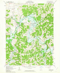
 1962 Wills Creek1963 Print · USGSCoshocton and Muskingum counties are shown in the early 1960s as the regional economy shifted between river valley agriculture and heavy industrial mining. Researchers can trace rural life through Marquand Mills, the Wills Creek Dam, and numerous sites like Zion Ch Cem.4 unique versions available
 - 1962 Map of Toboso, 1963 Print
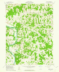
 1962 Toboso1963 Print · USGSMuskingum County at the start of the 1960s reveals a landscape defined by the river and the rail. Genealogists and historians can trace family locations near Stone Ch and Irville, or follow the path of the Baltimore and Ohio Railroad through the Licking Gorge.4 unique versions available
 - 1962 Map of Bloomfield, 1963 Print
 1962 Bloomfield1963 Print · USGSEastern Ohio’s ridgelines and creek valleys are captured here in the early sixties, showing the expansion of New Concord and the local energy economy. Researchers can locate family landmarks like Hawthorne Cem, the Ford Cem, and the historic Lebanon Ch.4 unique versions available
 - 1962 Map of Conesville, 1963 Print
 1962 Conesville1963 Print · USGSThe Muskingum River valley comes to life in this early 1960s survey, showing the intensive coal mining and rail activity of central Ohio. Genealogists can locate family landmarks like McGee Cem, Titus Cem, and the rural community at New Moscow.4 unique versions available
 - 1962 Map of Adamsville, 1963 Print
 1962 Adamsville1963 Print · USGSMuskingum County's river-and-rail corridor is captured here in the early sixties, showing the industrial landscape before modern shifts. Genealogists can trace family names through Stoner Cem and Vernon Cem or locate the historic Washington Ch.5 unique versions available
 - 1962 Map of Dresden, 1963 Print
 1962 Dresden1963 Print · USGSThe Muskingum and Licking river valleys are captured here in the early sixties as new water projects and industry reshaped the terrain. Trace local history at Dresden or search for family roots at Irville-Nashport Cem, Nashport Sch, and Shannon.4 unique versions available
 - 1962 Map of Trinway, 1963 Print
 1962 Trinway1963 Print · USGSThe Muskingum River valley and its complex rail junctions define this corner of Ohio in the early sixties. Genealogists can trace family landmarks like Mt Zion Cem, Broomstick Cem, and the old church at Wakatomika.4 unique versions available
 - 1962 Map of Otsego, 1963 Print
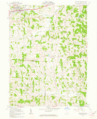
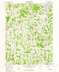 1962 Otsego1963 Print · USGSMuskingum County's rural townships are documented here in the early sixties, showing the intersection of reservoir waters and oil industry. Genealogists can trace family landmarks like Fairview Ch, Grange Hall, and the village of Otsego.2 unique versions available
Showing maps 1-25 of 27
Top cities of Muskingum County
- Zanesville historical maps
- Hopewell historical maps
- New Concord historical maps
- South Zanesville historical maps
- Dresden historical maps
- Brush Creek historical maps
See more
Frequently asked questions
- What are the different types of historical maps available for Muskingum County?
- What is the oldest map of Muskingum County?
- Where can I purchase historical maps of Muskingum County for my home or office?
- Where can I download high-res historical maps of Muskingum County?
- Are there historical topographic maps available for Muskingum County?
- Is there historical aerial imagery available for Muskingum County?
- Where are historical maps of Muskingum County sourced from?